
 United Kingdom
 France
 Germany
 Netherlands
 Sweden
 USA
USA
 Italy
Italy
 Spain
Spain
More From Contributor


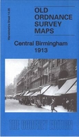
Birmingham South 1913
Birmingham South in 1913 in a fascinating series of reproductions of old Ordnance Survey plans in the Alan Godfrey Editions, ideal for anyone interested in the history of their neighbourhood or family. Two versions have been published for this area, each covering the southern part of Birmingham with much of Balsall Heath, the western part of Sparkbrook and the eastern part of Edgbaston. Coverage stretches from Gough Road eastward to Sampson Road and from Wrentham Street southward to Edward Road. Features include Calthorpe Park, Bristol Road, tramways and depot, Midland Railway with Camp Hill station, Camp Hill Goods station, Holy Trinity church, Grammar School, Highgate Park, St Luke`s church, Belgrave Works, Church of St Mary & St Ambrose, River Rea, St Alban`s church,
etc. Each map has a selection of extracts from a 1913 street directory. About the Alan Godfrey Editions of the 25” OS Series:Selected towns in Great Britain and Ireland are covered by maps showing the extent of urban development in the last decades of the 19th and early 20th century. The plans have been taken from the Ordnance Survey mapping and reprinted at about 15 inches to one mile (1:4, 340). On the reverse most maps have historical notes and many also include extracts from contemporary directories. Most maps cover about one mile (1.6kms) north/south, one and a half miles (2.4kms) across; adjoining sheets can be combined to provide wider coverage.FOR MORE INFORMATION AND A COMPLETE LIST OF ALL AVAILABLE TITLES PLEASE CLICK ON THE SERIES LINK.
etc. Each map has a selection of extracts from a 1913 street directory. About the Alan Godfrey Editions of the 25” OS Series:Selected towns in Great Britain and Ireland are covered by maps showing the extent of urban development in the last decades of the 19th and early 20th century. The plans have been taken from the Ordnance Survey mapping and reprinted at about 15 inches to one mile (1:4, 340). On the reverse most maps have historical notes and many also include extracts from contemporary directories. Most maps cover about one mile (1.6kms) north/south, one and a half miles (2.4kms) across; adjoining sheets can be combined to provide wider coverage.FOR MORE INFORMATION AND A COMPLETE LIST OF ALL AVAILABLE TITLES PLEASE CLICK ON THE SERIES LINK.

Product Description
Reviews/Comments
Add New
Intelligent Comparison
Archived Product

Birmingham North 1913 Stanfords
£3.50
Archived Product

Birmingham South 1888 Stanfords
£3.50
Archived Product
Billingham South 1939 Stanfords
£3.50
Archived Product
Birmingham South 1888 Stanfords
£2.95
Archived Product
Birmingham East 1901 Stanfords
£3.50
Archived Product

Birmingham West 1914 Stanfords
£3.50
Archived Product
Birmingham Central 1913 Stanfords
£3.50
Archived Product
Birmingham Saltley 1902 Stanfords
£3.50
Vouchers
No voucher codes found.
Do you know a voucher code for this product or supplier? Add it to Insights for others to use.
Do you know a voucher code for this product or supplier? Add it to Insights for others to use.
 Denmark