
 United Kingdom
 France
 Germany
 Netherlands
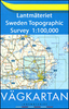
 Sweden
 USA
USA
 Italy
Italy
 Spain
Spain
More From Contributor


Benin
Road map of the country with insets showing street plans of Cotonou and Porto-Novo. Relief shading and 80m contour intervals provide information about the topography and different colours are used to indicate types of terrain. Roads and tracks are shown with distances in kilometres and petrol stations. National park boundaries, accommodation, and other useful features for tourists are indicated. A chart provides distances between 34 locations and another inset shows the administrative division of the country. The legend is in French only.

Product Description
Reviews/Comments
Add New
Intelligent Comparison
Archived Product
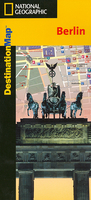
Berlin Stanfords
£7.95
Archived Product
Berlin Stanfords
£4.99
Archived Product
Berlin Stanfords
£6.99
Archived Product
Berlin Stanfords
£10.39
Archived Product
Berlin Stanfords
£4.99
Archived Product
Berlin Stanfords
£6.99
Archived Product
Berlin Stanfords
£24.95
Archived Product

Berlin Stanfords
£20.00
Vouchers
No voucher codes found.
Do you know a voucher code for this product or supplier? Add it to Insights for others to use.
Do you know a voucher code for this product or supplier? Add it to Insights for others to use.
 Denmark