
 United Kingdom
 France
 Germany
 Netherlands
 Sweden
 USA
USA
 Italy
Italy
 Spain
Spain
More From Contributor


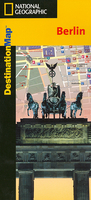
Berlin
Clear colourful street plan of central Berlin, highlighting places of interest. The plan indicates one-way streets and car parks, U- and S-Bahn stations, selected hotels, etc. An enlargement shows the area around the Under den Linden in greater detail. The plan is indexed and also includes a diagram of the U- and S-Bahn networks, plans of the Tegel and Schnefeld airports, a street plan of Potsdam with the Sanssouci palace, and a road map of the environs of the city. Travel tips are included, providing general information for visitors. The map is laminated in durable plastic.

Product Description
Reviews/Comments
Add New
Vouchers
No voucher codes found.
Do you know a voucher code for this product or supplier? Add it to Insights for others to use.
Do you know a voucher code for this product or supplier? Add it to Insights for others to use.
 Denmark