
 United Kingdom
 France
 Germany
 Netherlands
 Sweden
 USA
USA
 Italy
Italy
 Spain
Spain
More From Contributor
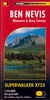

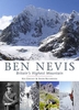
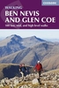
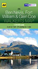

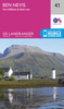

Ben Nevis Summit Map
The summit of Ben Nevis on a handy size, light, waterproof and tear-resistant map at 1:12, 500 from Harvey Map Services, ideal for mountaineering in poor weather conditions. An overprint highlights the bad visibility descent route along the grid bearings of 231º and 282º.Each map in the Harvey’s Summit Map series, only 41x30cm when opened and 10x20cm when folded, provides an excellent picture of the terrain through contours at 15m intervals with additional colouring and graphics to show scree, boulder fields, scattered rocks or boulders, and major crags, plus farmland or moorland as well as open or dense woodland and new plantations.Where appropriate, right of way paths are highlighted, and symbols indicate mountain rescue post or kits, youth hostels and campsites, car
parks and information points. All the maps have the lines of the British National Grid at 100m intervals.To see the other titles in this series please click on the series link.
parks and information points. All the maps have the lines of the British National Grid at 100m intervals.To see the other titles in this series please click on the series link.

Product Description
Reviews/Comments
Add New
Intelligent Comparison
Archived Product

Beinn Alligin Summit Map Stanfords
£5.95
Vouchers
No voucher codes found.
Do you know a voucher code for this product or supplier? Add it to Insights for others to use.
Do you know a voucher code for this product or supplier? Add it to Insights for others to use.
 Denmark