More From Contributor

£14.95
Ben Nevis & Glen Coe is Ronald Turnbull’s Cicerone guide to the best walking opportunities in Lochaber & its two mighty peaks. The guide covers Lochaber’s summits as well as mid-level walks & gentle strolls through empty glens & tent or bothy treks through remote scenic landscapes. The area from Ben Nevis southwards towards Glen Coe offers some of the finest mountain walking in the UK & the authors explore an array of diverse routes throughout the region. The guide is structured in 10 main parts
- Fort William & Glen Nevis, Ben Nevis & the Aonachs, Grey Corries & Spean Bridge, Mamores, Kinlochleven, Glen Coe, Bidean nam Bian, Glen Etive, Black Mount & Ben Cruachan & Oban
- encompassing a total of 100 walks. There is also a section on the longer routes in the region
- the West Highland Way, Through Routes & the Three Ridges. Each walk has a general overview & an Information Box with details of starting & finish points, distance, ascent, approximate walking time, maximum altitude & the terrain. A informative introduction provides practical guidance on walking conditions, when to go, weather & snow conditions, safety in the mountains, recommended maps & compass & GPS. Detailed route descriptions are accompanied by Ordnance Survey extracts mapping the route in addition to colour photographs illustrating some of the highlights of the mountains.


...
Archived Product
£16.95
Experienced climber Alan Kimber’s Cicerone guide to Winter Climbs – Ben Nevis & Glen Coe – is the definitive introduction to exploring some of Scotland’s leading winter climbing. The book covers all that is best on Ben Nevis, as well as Carn Dearg, Aonachs Mor & Beag, Bidean nam Bian & its related summits, Buachaille Etive Mor & the outlying peaks in Glen Coe. Now in its sixth edition, this book is a proven & reliable guide. The guide is organized into four sections on Ben Nevis, Glen Coe & their two surrounding areas & provides a wealth of climbing opportunities for different standards of climber. Each chapter has diagrams showing the general topographical area of the mountains concerned & provides information on the most accessible places for ascents & descents. Labelled diagrams also indicate the path that each route takes in relation to each other. An extensive introduction provides important information on Weather & Avalanches, Equipment & Safety Precautions, Rescue Facilities & Amenities in the area. Detailed climbing route descriptions are accompanied by detailed line drawings mapping each route & also h&-drawn cliff diagrams; in addition to colour photographs illustrating some of the breathtaking highlights of the highest climbs. ...
Archived Product
£12.95
Ben Nevis with the Mamores & Grey Corries ranges at 1:25, 000 on a double-sided, waterproof & tear-resistant map from Harvey Map Services in their Superwalker series, with the peak area also shown in greater detail at 1:12, 500. The map divides the area north/south, with a good overlap between the sides, extending from Fort William past Loch Treig to Chno Deang, plus south to Loch Leven & the Blackwater Reservoir. The enlargement highlights the bad visibility descent route including instructions. The main map at 25K also highlights recommended mountain bike trails.PLEASE NOTE: this title is also available as a pocket-size Ultramap with its scale reduced to 1:40, 000
- to see the list of titles available in this series please click on the series link. Maps in Harvey’s Superwalker series have contours at 15m intervals, with additional graphics for various types of terrain (crags, large boulders, scattered rocks) & colouring for different kinds of land use or vegetation (pastures, bogs, forests or woodl&, etc). The maps show local hiking paths, indicating where appropriate long-distance routes, & boundaries of national parks or other protected areas. Scottish titles also indicate Munro, Corbett & Graham hills. Some maps in addition highlight local cycle routes. A range of symbols mark various facilities for walkers including youth or independent hostels, campsites & caravan sites, information points, etc. Each map has a 1-km British or Irish national grid.
...
Archived Product
£9.95
Ben Nevis with the Mamores & Grey Corries ranges at 1:40, 000 on a waterproof & tear-resistant, pocket-size Ultramap from Harvey Map Services with the same cartography as their Superwalker map of this area. The peak of Ben Nevis is also shown in greater detail at 1:20, 000. The map divides the area north/south, with a good overlap between the sides, extending from Fort William past Loch Treig to Chno Deang, plus south to Loch Leven & the Blackwater Reservoir. The enlargement highlights the bad visibility descent route including instructions. The main map at 40K also shows recommended mountain bike trails.PLEASE NOTE: this title is also available as a Superwalker map at 1:25, 000
- to see the list of titles available in this series please click on the series link. Maps in Harvey’s Superwalker series have contours at 15m intervals, with additional graphics for various types of terrain (crags, large boulders, scattered rocks) & colouring for different kinds of land use or vegetation (pastures, bogs, forests or woodl&, etc). The maps show local hiking paths, indicating where appropriate long-distance routes, & boundaries of national parks or other protected areas. Scottish titles also indicate Munro, Corbett & Graham hills. Some maps in addition highlight local cycle routes. A range of symbols mark various facilities for walkers including youth or independent hostels, campsites & caravan sites, information points, etc. Each map has a 1-km British or Irish national grid.
...
Archived Product
£27.50
This 2nd edition of ” Ben Nevis: Britain`s Highest Mountain” brings the history of Ben Nevis right up to date from the 1st edition, by adding the period from 1986 to 2008. This is a highly illustrated & painstakingly researched history of a mountain whose global status far outstrips its modest altitude; a story of climbers, poets, geologists, map makers & pioneering meteorologists. For more than 100 years, mountaineers have honed their skills & equipment on its flanks & ridges & applied them to dazzling effect in the Alps & Greater Ranges. Today, climbing on Ben Nevis is more popular than ever & the mountain`s international reputation continues to grow, as its cliffs offer up some of the most challenging traditional summer & winter climbs in the world. This title offers fully updated history of Britain`s most famous mountain from 1585
- 2008. It is highly illustrated with more than 400 (mostly colour) photographs, diagrams & maps. It features significant new research & historical photographs, &

Includes::
chapters on: Ben Nevis Observatory, Ben Nevis Distillery, Ben Nevis Aluminium Smelter, Ben Nevis Hill Race, Environment & Conservation, Gaelic Place Names, Geology & Mapping.


...
Archived Product
£19.95
About this series: Specialist climbers' guides, each title consisting of descriptions of climbs in the mountains of Scotl&. Climbs are graded in terms of difficulty.

Includes::
ascent diagrams of ridges & peaks. Compact format with vinyl covers for durability.

...
Archived Product
£5.95
The summit of Ben Nevis on a handy size, light, waterproof & tear-resistant map at 1:12, 500 from Harvey Map Services, ideal for mountaineering in poor weather conditions. An overprint highlights the bad visibility descent route along the grid bearings of 231º & 282º. Each map in the Harvey’s Summit Map series, only 41x 30cm when opened & 10x 20cm when folded, provides an excellent picture of the terrain through contours at 15m intervals with additional colouring & graphics to show scree, boulder fields, scattered rocks or boulders, & major crags, plus farmland or moorland as well as open or dense woodland & new plantations. Where appropriate, right of way paths are highlighted, & symbols indicate mountain rescue post or kits, youth hostels & campsites, car parks & information points. All the maps have the lines of the British National Grid at 100m intervals. To see the other titles in this series please click on the series link. ...
Archived Product
£7.99
Ben Nevis, Fort William & Glen Coe at 1:25, 000 in a series of Walker’s Maps published by the AA with the cartography from the Ordnance Survey’s Explorer series. The map is double-sided & coverage

Includes::
Spean Bridge, Roybridge, Kinlochell, Corpach, Kinlochleven, Onich, Corran, Kentallen, Loch Eil, Loch Linnhe, Ardgour, Loch Leven, Blackwater Reservoir, part of the West Highland Way, etc. Maps in the AA Walker’s series are identical to the OS Explorer maps & provide plenty of recreational & tourist information, indicating in England & Wales the traditional public rights of way paths, including bridleways & byways restricted or open to motorized traffic. Also shown are other routes with public access, including permissive footpaths & bridleways. For Scotl&, where different access rights apply, the maps provide an additional note explaining the regulations. Special marking indicates National Trails & Recreational Routes & for cyclists the maps show traffic-free routes & the National Cycle Network. A wide range of symbols highlights locations of special tourist interest: camping & caravanning sites, youth hostels, information offices & visitors’ centres, parking & picnicking places, historic buildings (indicating where appropriate National Trust, English Heritage, Historic Scotland or Cadw), sites for various recreational pursuits, country pubs, public toilets, etc. The maps provide detailed presentation of the topography with contours at 5 or 10m intervals, numerous spot heights & colouring and/or graphics for different types of vegetation. Additional colouring shows access l&, including areas managed by the National Trust, Forestry Commission & Woodland Trust. All the standard information expected of high quality survey mapping at this scale is included: finely graded road network, railway lines with stations, cuttings or embankments, individual isolated buildings, etc. For GPS users the British National Grid is drawn at 1km intervals.

...
Archived Product
£14.99
Waterproof & tear-resistant OS Active version of map No. 41 from the Ordnance Survey’s Landranger series at 1:50, 000, with contoured & GPS compatible topographic mapping plus tourist information.MOBILE DOWNLOADS: As well as the physical edition of the map, each Landranger title now

Includes::
a code for downloading after purchase its digital version onto your smartphone or tablet for viewing on the OS smartphone app.OS LANDRANGER SERIES: to see the list of all the titles in the OS Landranger series, both paper & waterproof versions, please click on the series link. Maps in the Landranger series provide plenty of recreational & tourist information, indicating the traditional public right of way paths (except in Scotland where different laws apply), including bridleways & byways restricted or open to motorized traffic. National Trails & selected other long-distance paths are marked, as well as on-road & traffic-free cycle routes with their National/ Regional Cycle Network numbers. National Trust/ National Trust for Scotland & Forestry Commission land is clearly marked, indicating open or restricted access. A range of symbols highlights camping & caravanning sites, youth hostels, tourist information offices & visitors’ centres, parking & picnicking places, World Heritage sites, sport & recreational facilities, etc. The maps provide detailed presentation of topography with contours at 10m intervals, numerous spot heights & additional colouring and/or graphics for different types of woodlands, orchards or parkl&, rock features including scree & cliffs, water features inland & along the sea shore with marshl&, dunes, s&, mud, shingle & the high water mark. All the standard information expected of survey mapping at this scale is included: finely graded road network, railway lines with stations, cuttings, embankments, etc; individual isolated buildings; archaeological & historical sites, etc. For GPS users the British National Grid is shown at 1km intervals, with latitude & longitude given by margin ticks at 1` & cross hairs on the map at 5`. Each map covers an area of 40 x 40km, (approx. 25 x 25 miles).

...
Archived Product
£8.99
Paper version of map No. 41 from the Ordnance Survey’s Landranger series at 1:50, 000, with contoured & GPS compatible topographic mapping plus tourist information.MOBILE DOWNLOADS: As well as the physical edition of the map, each Landranger title now

Includes::
a code for downloading after purchase its digital version onto your smartphone or tablet for viewing on the OS smartphone app.OS LANDRANGER SERIES: to see the list of all the titles in the OS Landranger series, both paper & waterproof versions, please click on the series link. Maps in the Landranger series provide plenty of recreational & tourist information, indicating the traditional public right of way paths (except in Scotland where different laws apply), including bridleways & byways restricted or open to motorized traffic. National Trails & selected other long-distance paths are marked, as well as on-road & traffic-free cycle routes with their National/ Regional Cycle Network numbers. National Trust/ National Trust for Scotland & Forestry Commission land is clearly marked, indicating open or restricted access. A range of symbols highlights camping & caravanning sites, youth hostels, tourist information offices & visitors’ centres, parking & picnicking places, World Heritage sites, sport & recreational facilities, etc. The maps provide detailed presentation of topography with contours at 10m intervals, numerous spot heights & additional colouring and/or graphics for different types of woodlands, orchards or parkl&, rock features including scree & cliffs, water features inland & along the sea shore with marshl&, dunes, s&, mud, shingle & the high water mark. All the standard information expected of survey mapping at this scale is included: finely graded road network, railway lines with stations, cuttings, embankments, etc; individual isolated buildings; archaeological & historical sites, etc. For GPS users the British National Grid is shown at 1km intervals, with latitude & longitude given by margin ticks at 1` & cross hairs on the map at 5`. Each map covers an area of 40 x 40km, (approx. 25 x 25 miles).

...
Archived Product

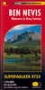
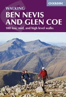
Ben Nevis And Glencoe: 100 Low, Mid, And High Level Walks

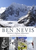
This guidebook details 100 walking routes around Ben Nevis and Glen Coe, centred in 10 areas including Fort William and Glen Nevis, the Aonachs, the Mamores, Kinlochleven, Glen Coe, Glen Etive, Black Mount and Ben Cruachan. Routes are graded according to difficulty, and range between short, easy strolls and long, challenging walks with overnight bothy stays. The region`s 44 Munro summits are covered, including 2 easy scrambles and the formidable traverse of Aonach Eagach`s iconic jagged ridge. Alongside step-by-step route descriptions and mapping, the guide presents practical advice on transport, access, safety and where to stay plus background information on the area`s fascinating geology. Many of the routes reflect the author`s belief that the best rewards often lie off the
popular tourist trails. Yet the highlights are all there: Buachaille Etive Mor, Aonach Eagach, the Mamores, the Grey Corries, Bidean nam Bian, Ben Starav, Carn Mor Dearg and of course, the mighty Ben Nevis. The book - like Glen Coe itself - encourages exploration and includes a helpful `summit summary` to show different options and assist with route-planning.
RIP - This product is no longer available on our network. It was last seen on 25.09.2019

This page now acts as a permanent archive for this product. Add more information using the comments box below to ensure it can still be found by future generations.

Use our search facility to see if it is available from an alternative contributor.
  • Availability: Out Of Stock
  • Supplier: Stanfords
  • SKU: 9781852848712
Availability: In Stock
£14.95

Product Description

This guidebook details 100 walking routes around Ben Nevis & Glen Coe, centred in 10 areas including Fort William & Glen Nevis, the Aonachs, the Mamores, Kinlochleven, Glen Coe, Glen Etive, Black Mount & Ben Cruachan. Routes are graded according to difficulty, & range between short, easy strolls & long, challenging walks with overnight bothy stays. The region`s 44 Munro summits are covered, including 2 easy scrambles & the formidable traverse of Aonach Eagach`s iconic jagged ridge. Alongside step-by-step route descriptions & mapping, the guide presents practical advice on transport, access, safety & where to stay plus background information on the area`s fascinating geology. Many of the routes reflect the author`s belief that the best rewards often lie off the popular tourist trails. Yet the highlights are all there: Buachaille Etive Mor, Aonach Eagach, the Mamores, the Grey Corries, Bidean nam Bian, Ben Starav, Carn Mor Dearg & of course, the mighty Ben Nevis. The book
- like Glen Coe itself
- encourages exploration &

Includes::
a helpful `summit summary` to show different options & assist with route-planning.

Reviews/Comments

Add New

Intelligent Comparison

Oooops!
We couldn't find anything!
Perhaps this product's unique.... Or perhaps we are still looking for comparisons!
Click to bump this page and we'll hurry up.

Price History

Vouchers

No voucher codes found.
Do you know a voucher code for this product or supplier? Add it to Insights for others to use.

Facebook

Jargon Buster

Black - A colour which does not emit any colour of the spectrum. Black absorbs all frequencies of the spectrum.
Grey - A colour often associated with old age (going grey)
Safety - prevents damage being caused.
Practical - Weather a task is easy to carry out and realistically succeed.
Popular - Something that is admired and liked by many people.
Transport - Something that carries people or goods.

Supplier Information

Stanfords
Stanfords was established in 1853 and opened their iconic Covent Garden flagship store in 1901. They have become the top retailer of maps, travel books and accessories in the UK and arguably offer the largest selection of maps and travel books worldwide. Famous names such as Captain Robert Falcon Scott, Ranulph Fiennes and Michael Palin have purchased from Stanfords. They now have a shop in Bristol and both stores together with other venues operate a calendar of events including talks, book signings and exhibitions. As a specialist map retailer, the map selection is comprehensive and includes road maps, street maps and walking maps from worldwide destinations, as well as a selection of world atlases and wall maps. Books include travel guides and travel literature. Stanfords also stock globes, from miniatures made of blue marble to magnificent floor-standing globes. The website features a selection of interesting articles on travel topics.
Page Updated: 2023-11-12 20:15:36

Community Generated Product Tags

Oh No! The productWIKI community hasn't generated any tags for this product yet!
Menu