
 United Kingdom
 France
 Germany
 Netherlands
 Sweden
 USA
USA
 Italy
Italy
 Spain
Spain
More From Contributor


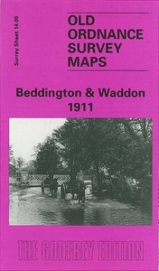
Beddington And Waddon 1911
Beddington and Waddon in 1911 in a fascinating series of reproductions of old Ordnance Survey plans in the Alan Godfrey Editions, ideal for anyone interested in the history of their neighbourhood or family. The map covers the area west of Croydon which includes Beddington village and Waddon, stretching from Beddington Park eastward to Vicarage Road, Waddon. Features include St Mary`s church, Beddington House, cemetery, Royal Female Orphan Asylum, River Wandle, Waddon Mills with Waddon Marsh New Siding, Wandle Mills, Croydon Sewage Works, part of Wandle Park, Waddon Lodge, Paragon Works, Waddon Court (whose 18th century occupant, John Parker, rode around the village each morning accompanied by a monkey dressed in fine clothes), Croydon Gas Works. There are street
directories for Beddington Lane, Bute Road, Church Lane, Croydon Road, Demesne Road, Guy Road, Wandle Road; plus a railway timetable for the Croydon-Wimbledon line in 1908.About the Alan Godfrey Editions of the 25” OS Series:Selected towns in Great Britain and Ireland are covered by maps showing the extent of urban development in the last decades of the 19th and early 20th century. The plans have been taken from the Ordnance Survey mapping and reprinted at about 15 inches to one mile (1:4, 340). On the reverse most maps have historical notes and many also include extracts from contemporary directories. Most maps cover about one mile (1.6kms) north/south, one and a half miles (2.4kms) across; adjoining sheets can be combined to provide wider coverage.FOR MORE INFORMATION AND A
COMPLETE LIST OF ALL AVAILABLE TITLES PLEASE CLICK ON THE SERIES LINK.

Product Description
Reviews/Comments
Add New
Intelligent Comparison
Archived Product
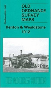
Kenton And Wealdstone 1912 Stanfords
£3.50
Archived Product
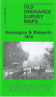
Kennington And Walworth 1914 Stanfords
£3.50
Vouchers
No voucher codes found.
Do you know a voucher code for this product or supplier? Add it to Insights for others to use.
Do you know a voucher code for this product or supplier? Add it to Insights for others to use.
 Denmark