
 United Kingdom
 France
 Germany
 Netherlands
 Sweden
 USA
USA
 Italy
Italy
 Spain
Spain
More From Contributor


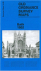


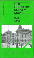
Bath 1883 (Colour Edition)
Bath in 1883 in a fascinating series of reproductions of old Ordnance Survey plans in the Alan Godfrey Editions, ideal for anyone interested in the history of their neighbourhood or family. Two versions of this map are published, showing how the area changed across the years. Coverage stretches from The Circus southward to Bloomfield Avenue, and from Twerton Cemetery eastward to Archway Street, Dolemeads. Features include East Twerton, Locksbrook, South Twerton, several cemeteries, Somerset Certified Industrial Home, Green Park station with railway approaches, Crescent Gardens, River Avon, Bath Spa station, Beechen Cliff, Abbey church, Henrietta Park, Queen Square. The Royal Crescent is split by the top margin. Each map includes various street directory entries: on the 1883
map from Kelly`s 1902 directory including The Circus, Gay Street, High Street, Milsom Street, New King Street, Queen Square and Southgate Street. The 1883 version is from the beautiful hand-coloured 1st Edition.About the Alan Godfrey Editions of the 25” OS SeriesSelected towns in Great Britain and Ireland are covered by maps showing the extent of urban development in the last decades of the 19th and early 20th century. The plans have been taken from the Ordnance Survey mapping and reprinted at about 15 inches to one mile (1:4, 340). On the reverse most maps have historical notes and many also include extracts from contemporary directories. Most maps cover about one mile (1.6kms) north/south, one and a half miles (2.4kms) across; adjoining sheets can be combined to provide wider
coverage.FOR MORE INFORMATION AND A COMPLETE LIST OF ALL AVAILABLE TITLES PLEASE CLICK ON THE SERIES LINK.
 "Pin It")
Product Description
Reviews/Comments
Add New
Intelligent Comparison
Archived Product
Exeter 1888 (Colour Edition) Stanfords
£3.50
Archived Product
Bilston 1884 (Coloured Edition) Stanfords
£4.50
Archived Product
Paisley 1858 (Colour Edition) Stanfords
£2.95
Archived Product
Newton Heath 1889 (Colour Edition) Stanfords
£2.95
Archived Product

Halifax North 1889 (Colour Edition) Stanfords
£2.95
Archived Product
Dudley 1882 (Colour Edition) Stanfords
£2.95
Archived Product
Hull East 1890 (Colour Edition) Stanfords
£4.50
Archived Product
Burslem 1877 (Colour Edition) Stanfords
£4.50
Vouchers
No voucher codes found.
Do you know a voucher code for this product or supplier? Add it to Insights for others to use.
Do you know a voucher code for this product or supplier? Add it to Insights for others to use.
 Denmark