
 United Kingdom
 France
 Germany
 Netherlands
 Sweden
 USA
USA
 Italy
Italy
 Spain
Spain
More From Contributor


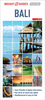


Bali Flexi Map
Bali on a laminated, tear-resistant Insight Flexi Map with an indexed map of the island and Nusa Penida, an enlargement for south Bali, street plans of Kuta, Ubud and Sanur - all also indexed, plus extensive tourist information.On one side is a map of the Bali with Nusa Penida, highlighting numerous places of interest, including beaches, sport and recreational facilities, youth hostels and selected hotels, temples, museums, etc. Topography is shown by relief shading with spot heights. National Parks and other protected areas are marked. Road network includes local country roads and selected tracks, and gives distances on main routes. Also marked are ferry routes to Nusa Penida and Lombok. The map has no geographical coordinates and is indexed for places and points of
interest.On the reverse is an enlargement at 1:150, 000 showing in greater detail the southern tip of Bali. Also provided are indexed street plans of Kuta, Ubud and Sanur, all highlighting numerous hotels, public buildings and places of interest.A special feature of the Insight Flexi series are panels with additional tourist information: 16 main sights, neatly grouped into sections covering Major Attractions and Top Beaches, are given brief descriptions and are prominently highlighted on the relevant maps. Further panels provide information on Getting Around and Facts for Visitors, including tourist information offices, public holidays, opening times, media, money, tipping, telecommunications and monthly climate charts.
interest.On the reverse is an enlargement at 1:150, 000 showing in greater detail the southern tip of Bali. Also provided are indexed street plans of Kuta, Ubud and Sanur, all highlighting numerous hotels, public buildings and places of interest.A special feature of the Insight Flexi series are panels with additional tourist information: 16 main sights, neatly grouped into sections covering Major Attractions and Top Beaches, are given brief descriptions and are prominently highlighted on the relevant maps. Further panels provide information on Getting Around and Facts for Visitors, including tourist information offices, public holidays, opening times, media, money, tipping, telecommunications and monthly climate charts.
Product Description
Reviews/Comments
Add New
Intelligent Comparison
Archived Product
Baltimore Flexi Map Stanfords
£5.99
Archived Product
Dubai Flexi Map Stanfords
£4.99
Archived Product
Valencia Flexi Map Stanfords
£4.99
Archived Product
Taipei Flexi Map Stanfords
£4.99
Archived Product
Bahamas Flexi Map Stanfords
£4.99
Archived Product
Bangkok Flexi Map Stanfords
£4.99
Archived Product
Madeira Flexi Map Stanfords
£4.99
Archived Product
California Flexi Map Stanfords
£4.99
Vouchers
No voucher codes found.
Do you know a voucher code for this product or supplier? Add it to Insights for others to use.
Do you know a voucher code for this product or supplier? Add it to Insights for others to use.
 Denmark