
 United Kingdom
 France
 Germany
 Netherlands
 Sweden
 USA
USA
 Italy
Italy
 Spain
Spain
More From Contributor


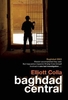


Baghdad
A clear street plan covering an area of about 7 x 7 miles. Main roads are named and railways are included. The old city is highlighted and a variety of the city's features are indicated, eg. places of worship, museums, parks, antiquities, monuments, hotels, markets, public offices. Lines of latitude and longitude are drawn at 1' intervals.Small inset maps show the environs of Baghdad at 1:1, 750, 000 and Iraq & neighbours at 1:6, 000, 000.The index includes streets, quarters of the city and sites of interest eg. mosques, churches, markets, notable buildings.
Product Description
Reviews/Comments
Add New
Intelligent Comparison
Archived Product
Baghdad Stanfords
£8.95
Archived Product

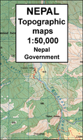
Baghdad Stanfords
£12.99
Archived Product
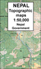
Bahundada Stanfords
£9.99
Archived Product

Bad Dad Stanfords
£12.99
Archived Product

Bad Dad Stanfords
£9.99
Vouchers
No voucher codes found.
Do you know a voucher code for this product or supplier? Add it to Insights for others to use.
Do you know a voucher code for this product or supplier? Add it to Insights for others to use.
 Denmark