More From Contributor

£12.99
Bad Tölz
- Isarwinkel area of the German Alps at 1:35, 000 from Kümmerly+ Frey in a series GPS compatible, double-sided maps
...
Archived Product
£11.50
Bad Tölz
- Lenggries & the Surrounding Area, map no. 50-52, in a series of special contoured & GP-compatible recreational maps
...
Archived Product
£9.50
One of the titles in a series of double-sided topographic maps with hiking routes & tourist information. Cartography is identical to the standard topographic survey of Germany, with contours at 10m intervals. Extensive overprint highlights numerous local footpaths & long-distance hiking routes, indicating waymarking. Cycling routes, mountain bike centres & trails, & cross-country ski routes are also marked. Extensive range of symbols highlight sport & leisure facilities, various types of accommodation, places of interest, tourist railways, etc. Boundaries of national parks & nature reserves are marked. The maps have a 2km UTM grid. Map legend

Includes::
English. The maps also have lists of contact details of various organizations & facilities within the region, plus brief descriptions in German only.

...
Archived Product
£11.50
Maps in this series feature extensive overprint highlighting local & long-distance footpaths & cycle routes, including King Ludwig Way or different variants of the Way of St James, indicating their waymarking. Symbols highlight different types of accommodation (campsites, youth hostels, refuges, etc), sport & recreational facilities, various places of interest, etc. The maps have a 1-km UTM grid. Map legend & all the text are in German only. To see other titles in this series please click on the series link. ...
Archived Product
£12.99
Map No. 1050, Zurzach, in the topographic survey of Switzerland at 1:25, 000 from Bundesamt für Landestopographie (swisstopo), covering the whole country on 247 small format sheets, with special larger maps published for popular regions including some titles now available in hiking versions. Highly regarded for their superb use of graphic relief & hill shading, the maps give an almost 3-D picture of Switzerland`s mountainous terrain. Contours are at 10 m intervals, with 20m intervals in the mountainous areas. All the maps have a 1-km grid for Swiss national coordinates (datum CH 1903). * Small format sheets (Nos. 1011
- 1374)* Map legend in the language of the area covered by the map. Additional margin ticks show latitude & longitude in steps of 2`. The area covered by each map is 17 x 12 km (11 x 7 miles approx). * Special larger sheets (Nos. from 2501 onwards) – STANDARD editions:* No map legend is included but a separate leaflet can be provided instead. The area covered by each map is 25 x 17 km (15 x 11 miles approx).* Special larger sheets (Nos. from 2501 onwards) – HIKING editions:* An overprint highlights hiking, mountain & alpine paths, including regional & national long-distance trails. The maps also show bus routes with bus stops, plus inns in remote locations. The area covered by each map is 25 x 17 km (15 x 11 miles approx).
...
Archived Product
£9.95
The town of Badami, the nearby villages of Aihole & Pattadakal, & the pilgrimage site of Mahakuta in the Malptabha valley of central in Karnataka described in an illustrated guide prepared in cooperation with the Deccan Heritage Foundation. Informative text is combined with colour photos of the temples & the rock-cut shrines. The guidebook

Includes::
site plans plus a glossary of Indian historical figures, gods associated with the site & other related terms.

...
Archived Product
£9.99
Badaussee
- Totes Gebirge
- Bad Mitterndorf
- Tauplitz area of central Austria presented at 1:50, 000 in a series of contoured


...
Archived Product
£9.95
One of the titles in the topographic survey of Switzerland at 1:50, 000, covering the whole country on 78 small format sheets (Nos. 205
- 297), with special larger maps published for popular tourist destinations. Highly regarded for their superb use of graphic relief & hill shading, the maps give an almost 3-D picture of Switzerland's mountainous terrain. Contours are at 20m intervals. Small format sheets:- Map legend in the language of the area covered by the map.- 1km grid for Swiss national coordinates (datum CH 1903
- Bessel) plus margin ticks showing latitude & longitude in steps of 5'.- Area covered is 35 x 24 km / 21 x 15 miles approx. Special larger sheets:
- No map legend included but a separate leaflet can be provided instead.- 1km grid for Swiss national coordinates (datum CH 1903
- Bessel).- Area covered is 50 x 35 km / 31 x 22 miles approx. Alternatives on our website from Swiss topographic survey:
- Switzerland: Swiss Survey 50K Hiking Editions of Topographic Maps series. Editions with an overprint highlighting local footpaths & bus routes with bus stops
- the whole country is covered on small format sheets, with special larger maps also available for selected areas.- Switzerland: Swiss Survey 25K Topographic Maps series. Standard editions without an overprint
- the whole country is covered on small format sheets, each one covering a quarter of the corresponding 1:50, 000 map, plus a selection of special larger sheets for popular areas.


...
Archived Product
£12.99
Map No. 1070, Baden, in the topographic survey of Switzerland at 1:25, 000 from Bundesamt für Landestopographie (swisstopo), covering the whole country on 247 small format sheets, with special larger maps published for popular regions including some titles now available in hiking versions. Highly regarded for their superb use of graphic relief & hill shading, the maps give an almost 3-D picture of Switzerland`s mountainous terrain. Contours are at 10 m intervals, with 20m intervals in the mountainous areas. All the maps have a 1-km grid for Swiss national coordinates (datum CH 1903). * Small format sheets (Nos. 1011
- 1374)* Map legend in the language of the area covered by the map. Additional margin ticks show latitude & longitude in steps of 2`. The area covered by each map is 17 x 12 km (11 x 7 miles approx). * Special larger sheets (Nos. from 2501 onwards) – STANDARD editions:* No map legend is included but a separate leaflet can be provided instead. The area covered by each map is 25 x 17 km (15 x 11 miles approx).* Special larger sheets (Nos. from 2501 onwards) – HIKING editions:* An overprint highlights hiking, mountain & alpine paths, including regional & national long-distance trails. The maps also show bus routes with bus stops, plus inns in remote locations. The area covered by each map is 25 x 17 km (15 x 11 miles approx).
...
Archived Product
£18.99
Baden area, map No. 215T, at 1:50, 000 in a special hiking edition of the country’s topographic survey, published by Swisstopo in cooperation with the Swiss Hiking Federation. Cartography, identical to the standard version of the survey, is highly regarded for its superb use of graphic relief & hill shading to provide an almost 3-D picture of Switzerland`s mountainous terrain. Contours are at 20m intervals. An overprint highlights routes maintained by the SHF, distinguishing between hiking routes, mountain routes requiring proper footwear, & alpine routes where equipment is needed. Paths which are part of the national or regional network of long-distance hiking routes are specially marked & in the more recent editions are annotated with their official numbers. The maps show mountain huts, refuges & in remote areas also inns, plus roads with bus service & the positions of bus stops. All the maps have a 1-km grid of the Swiss national coordinates. For a list of all the titles in this series, please click on the series link. ...
Archived Product

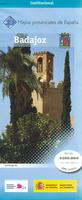
Badajoz Province 200K CNIG Map No. 7

Contoured, GPS-compatible, indexed road map at 1:200, 000 from CNIG - Spain’s civilian survey organization, with exceptionally informative presentation of the landscape and highlighting for facilities and places of interest including campsites and paradors.Maps in CNIG’s 200K Provincial Series provide an excellent picture the topography through contours at 100m intervals enhanced by relief shading, spot heights and colouring for various types of vegetation, plus show national and natural parks. Road network, graded into seven types, includes minor local roads and tracks often not shown on other road maps. Railways indicate high speed, double and single track lines. In each title all the information continues outside the provincial boundary, with contours but without the relief
shading and vegetation colouring. Unless indicated to the contrary in the title’s individual description, all the maps now have a range of icons prominently highlighting various places of interest: cultural and historical heritage, paradors and campsites, sport and recreational facilities, etc. The maps have a 20km UTM grid, plus latitude and longitude margin ticks at 15` intervals, and an index of place names on the reverse. Map legend is in Spanish only. COVERAGE OF SPAIN BY 1:50, 000 TOPOGRAPHIC SURVEY: these provincial maps can also help with choosing more detailed coverage of mainland Spain in the topographic survey of the country at 1:50, 000 – the maps are overprinted with a grid showing the exact coverage of each 50K sheet (in coastal areas some sheets have been combined,
as indicated on the grids shown on our website for series SI00000832).To see the list of titles in the CNIG 200K Provincial Series please click on the series link.
RIP - This product is no longer available on our network. It was last seen on 25.09.2019

This page now acts as a permanent archive for this product. Add more information using the comments box below to ensure it can still be found by future generations.

Use our search facility to see if it is available from an alternative contributor.
  • Availability: Out Of Stock
  • Supplier: Stanfords
  • SKU: 9788441622852
Availability: In Stock
£9.99

Product Description

Contoured, GPS-compatible, indexed road map at 1:200, 000 from CNIG
- Spain’s civilian survey organization, with exceptionally informative presentation of the landscape & highlighting for facilities & places of interest including campsites & paradors. Maps in CNIG’s 200K Provincial Series provide an excellent picture the topography through contours at 100m intervals enhanced by relief shading, spot heights & colouring for various types of vegetation, plus show national & natural parks. Road network, graded into seven types,

Includes::
minor local roads & tracks often not shown on other road maps. Railways indicate high speed, double & single track lines. In each title all the information continues outside the provincial boundary, with contours but without the relief shading & vegetation colouring. Unless indicated to the contrary in the title’s individual description, all the maps now have a range of icons prominently highlighting various places of interest: cultural & historical heritage, paradors & campsites, sport & recreational facilities, etc. The maps have a 20km UTM grid, plus latitude & longitude margin ticks at 15` intervals, & an index of place names on the reverse. Map legend is in Spanish only. COVERAGE OF SPAIN BY 1:50, 000 TOPOGRAPHIC SURVEY: these provincial maps can also help with choosing more detailed coverage of mainland Spain in the topographic survey of the country at 1:50, 000 – the maps are overprinted with a grid showing the exact coverage of each 50K sheet (in coastal areas some sheets have been combined, as indicated on the grids shown on our website for series SI00000832). To see the list of titles in the CNIG 200K Provincial Series please click on the series link.

Reviews/Comments

Add New

Intelligent Comparison

Oooops!
We couldn't find anything!
Perhaps this product's unique.... Or perhaps we are still looking for comparisons!
Click to bump this page and we'll hurry up.

Price History

Vouchers

No voucher codes found.
Do you know a voucher code for this product or supplier? Add it to Insights for others to use.

Facebook

Jargon Buster

GPS - Global Positioning System - Global position using satellites
Spain - A country within the EU.
Spanish - The main language spoken in Spain and Latin America.
Railways - A set of tracks that have been laid for the purpose of trains to travel up and down them
speed - A measurement of how fast an object travels between two points
Natural - not manmade
Network - A link and communication between things. Often computers or people.
Road - a manmade lane or a path that is used to speed up travel.
Individual - A single separate item or person.

Supplier Information

Stanfords
Stanfords was established in 1853 and opened their iconic Covent Garden flagship store in 1901. They have become the top retailer of maps, travel books and accessories in the UK and arguably offer the largest selection of maps and travel books worldwide. Famous names such as Captain Robert Falcon Scott, Ranulph Fiennes and Michael Palin have purchased from Stanfords. They now have a shop in Bristol and both stores together with other venues operate a calendar of events including talks, book signings and exhibitions. As a specialist map retailer, the map selection is comprehensive and includes road maps, street maps and walking maps from worldwide destinations, as well as a selection of world atlases and wall maps. Books include travel guides and travel literature. Stanfords also stock globes, from miniatures made of blue marble to magnificent floor-standing globes. The website features a selection of interesting articles on travel topics.
Page Updated: 2023-11-12 20:15:36

Community Generated Product Tags

Oh No! The productWIKI community hasn't generated any tags for this product yet!
Menu