More From Contributor

£11.95
Attractive map of the country, showing physical relief & communication information
- roads, railways, canals. Intermediate driving
...
Archived Product
£22.95
Azerbaijan at 1:500, 000 from the locally based Baki Kartoqrafiya Fabriki on a contoured map showing the country’s road & rail networks, oil & gas pipelines, internal administrative divisions, etc. Topography is shown by contours at 100m intervals with additional relief shading & spot heights. Colouring and/or graphics indicate deserts, swamps & marshl&, different types of forests, etc. Coastal waters have bathymetric contours & show locations of oil/gas rigs. Road network

Includes::
local roads, gives driving distances on main routes & indicates border crossings. On roads across mountain passes altitude & opening months are marked. Railway lines are shown with stations & coastal ferry routes are included. Also marked are oil & gas pipelined. Latitude & longitude lines are drawn at 20’ & 30’ respectively. Map legend is in Azeri only.

...
Archived Product
£6.95
Azerbaijan in the Culture Smart range of pocket-sized guide books; providing detailed information on local customs, culture, etiquette & manners & ensuring that visitors are prepared for a diverse range of social environments. The series covers an extensive number of countries worldwide & are designed both for those working & living abroad, as well as for visitors who do not want to offend, either intentionally or inadvertently. Their aim is to prevent readers from making embarrassing mistakes & feel confident in unfamiliar situations, while preparing them before arrival on what to expect & how to behave. Each guide is arranged thematically, with dedicated individual chapters on land & people, values & attitudes, customs & traditions, making friends, people at home, ‘time-out’, travelling & communicating. There is also a separate chapter for business travelers, with important information on subjects such as business culture, meetings & making appointments. A Further Reading section also offers a list of recommended other history, travel literature & language titles available on the country. ...
Archived Product
£14.99
More than just a travel guide for visitors, the complete residents` guide to Azerbaijan is for residents, ex-pats & tourists alike. About this series: Detailed & illustrated guides providing not only information for visitors but also for those moving to or living in the destination. Written by residents, for residents, these guide books are packed full of full-colour photographs. The guides are divided with information on becoming a resident; relocating & setting up a home; history & culture; exploring the area; nightlife & activities; shopping; eating & drinking; indexed full-colour maps to help you navigate your way. The books are fully-indexed & also include a wealth of contact information including emergency telephone numbers, websites & phone numbers. ...
Archived Product
£33.99
This dictionary & phrasebook

Includes::
a dictionary of over 4, 000 entries, plus an introduction to basic

...
Archived Product
£14.99
Azerbaijan in Trailblazer’s Adventure Travel Guide series; encompassing a range of guides dedicated to adventurous activities in a range of worldwide destinations. The series

Includes::
outdoor activities such as cycling, motorcycling & overland treks through a wide variety of demanding landscapes, including the Himalaya, Morocco’s Atlas Mountains, the Sahara & the Silk Road. Each title in the series provides comprehensive pre-trip advice, including guidance on choosing a bike or mode of transport, route options, when to go, costs & money & health & safety considerations. Extensive route information is provided to guide travellers through the region’s most impressive sites in the most practical way. Strong on both practical content & cultural & historical background, Trailblazer Adventure Travel Guides feature unique h&-drawn GPS maps which show the distances between towns & villages, altitudes, places to eat & accommodation, water sources, fuel stations & points of interest along the way. Dedicated town & city guides are included throughout the guide, with advice for travellers on all budgets of recommended places to stay, places to eat & drink & what to see & do. Appendices also give information on subjects such as emergency medical facilities, basic language, embassies & general advice on adventure travel through the region & area.

...
Archived Product
£14.95
Map No. G-5A in the TPC series: military topographic survey mapping covering the world's land masses & significant islands at 1:500, 000. The maps are useful as general topographical coverage where nothing else is available, although they are designed primarily as flying charts for military aircraft. TPC stands for Tactical Pilotage Chart. Relief is portrayed by a combination of contours (basic interval 500ft, intermediate contours shown where appropriate), elevation tinting & relief shading, plus spot heights. Towns, villages, major roads, railways & airports are shown but please note that many of the smaller settlements are not named & the road information is not necessarily up to date, as compilation & revision dates vary. Some air navigation information also appears on the map, such as radio beacons & restricted flying zones. Each TPC chart has both UTM & latitude/longitude grids overprinted on it, with additional margin ticks. IMPORTANT
- PLEASE NOTE: The series is gradually being withdrawn from sale to the general public & some sheets may no longer be available when ordered by us. Due to the nature of the map projection assembling these sheets to make a larger map is not recommended. in addition, colours used for relief are not constant throughout the series. In some areas of central Africa & South America the maps have blank spaces, reflecting localized deficiencies or inconsistencies in the survey data.
...
Archived Product
£17.99
Azerbaijan`s Soviet & post-Soviet political history has been tumultuous & varied, particularly with regard to the struggle for independence, democracy & sovereignty. Suha Bolukbasi here illustrates how post-Stalin resilience, the tolerance shown toward subtle nationalist expression & Gorbachev`s relaxation of central control from Moscow were all-in-part responsible for the initial emergence of a more liberal atmosphere in Azerbaijan. As a result, issues such as Moscow`s responsibility for environmental degradation, the depletion of Azerbaijan`s oil, & unfavourable terms of trade have all begun to be freely discussed. However, the Azerbaijan-Armenia dispute over Karabagh has had a dramatic impact on the political discourse. The dispute has become not only an international conflict, but one which involves the lives of more than one million refugees. This book shows how Azerbaijan`s recent political history
- both domestic & international
- has influenced the development of the country & the history of the surrounding region.

...
Archived Product
£10.00
Azilal
- M` Goun region in a series of GPS compatible maps at 1:160, 000 published by EWP & West Col Productions & covering Morocco’s
...
Archived Product
£17.99
Topographic survey of Portugal at 1:50, 000 from the Instituto Geográfico do Exército, the country’s military survey organisation. The maps have contours at 20m intervals & in addition to the standard features shown on topographic mapping at this scale also indicate various types of terrain or vegetation (s&, terraces, rocks, woodlands, vineyards, etc). Each sheet covers an area of 32 x 20km (20 x 12.5 miles approx). The maps have a 1-km UTM grid plus latitude & longitude coordinates for the map corners. Map legend & a glossary of terms used on the maps include English.EDITION DATES: most titles in this series date from 1990s or later. To see all the titles in this series please click on the series link. ...
Archived Product

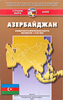
Azerbaijan Reise Know-How

Azerbaijan at 1:400, 000 on a light, waterproof and tear-resistant, double-sided indexed map from Reise-Know-How. The map covers Azerbaijan and its Nakhchivan enclave; the armistice boundary of Nagorno-Karabakh is clearly marked, indicating open or closed border crossings, and where appropriate both Azeri and Armenian names of location are shown. Coverage includes eastern Armenia and south-eastern Georgia with Tbilisi. Topography is presented by altitude colouring with spot heights and names of mountain ranges, peaks, passes, etc, plus boundaries of national parks and other protected areas. Road network includes selected unsurfaced local roads and tracks, and indicates driving distances on main routes. Railway lines are included and local airfields are marked. Internal
administrative boundaries are presented with names of the provinces. Symbols highlight various places of interest, including locations with tourist accommodation, cultural heritage, beaches, etc. Also marked are oil wells and pipelines. Longitude and longitude lines are drawn at 30’ intervals. Map legend includes English.
RIP - This product is no longer available on our network. It was last seen on 25.09.2019

This page now acts as a permanent archive for this product. Add more information using the comments box below to ensure it can still be found by future generations.

Use our search facility to see if it is available from an alternative contributor.
  • External links may include paid for promotion
  • Availability: Out Of Stock
  • Supplier: Stanfords
  • SKU: 9783831773329
Availability: In Stock
£11.50

Product Description

Azerbaijan at 1:400, 000 on a light, waterproof & tear-resistant, double-sided indexed map from Reise-Know-How. The map covers Azerbaijan & its Nakhchivan enclave; the armistice boundary of Nagorno-Karabakh is clearly marked, indicating open or closed border crossings, & where appropriate both Azeri & Armenian names of location are shown. Coverage

Includes::
eastern Armenia & south-eastern Georgia with Tbilisi. Topography is presented by altitude colouring with spot heights & names of mountain ranges, peaks, passes, etc, plus boundaries of national parks & other protected areas. Road network

Includes::
selected unsurfaced local roads & tracks, & indicates driving distances on main routes. Railway lines are included & local airfields are marked. Internal administrative boundaries are presented with names of the provinces. Symbols highlight various places of interest, including locations with tourist accommodation, cultural heritage, beaches, etc. Also marked are oil wells & pipelines. Longitude & longitude lines are drawn at 30’ intervals. Map legend

Includes::
English.

Reviews/Comments

Add New

Intelligent Comparison

Oooops!
We couldn't find anything!
Perhaps this product's unique.... Or perhaps we are still looking for comparisons!
Click to bump this page and we'll hurry up.

Price History

Vouchers

No voucher codes found.
Do you know a voucher code for this product or supplier? Add it to Insights for others to use.

Facebook

Jargon Buster

Oil - A hydrophobic liquid with high carbon and hydrogen content. Has many variations including; cooking oils, petrochemical oils, essential oils.
Waterproof - Resistant to water, usualy specified by depth in metres
Network - A link and communication between things. Often computers or people.
Road - a manmade lane or a path that is used to speed up travel.
Resistant - Something that can repel against something.
Altitude - Something that can be quite high in relation to sea or ground level.
Accommodation - A room in which someone can live in, for example in a hotel

Supplier Information

Stanfords
Stanfords was established in 1853 and opened their iconic Covent Garden flagship store in 1901. They have become the top retailer of maps, travel books and accessories in the UK and arguably offer the largest selection of maps and travel books worldwide. Famous names such as Captain Robert Falcon Scott, Ranulph Fiennes and Michael Palin have purchased from Stanfords. They now have a shop in Bristol and both stores together with other venues operate a calendar of events including talks, book signings and exhibitions. As a specialist map retailer, the map selection is comprehensive and includes road maps, street maps and walking maps from worldwide destinations, as well as a selection of world atlases and wall maps. Books include travel guides and travel literature. Stanfords also stock globes, from miniatures made of blue marble to magnificent floor-standing globes. The website features a selection of interesting articles on travel topics.
Page Updated: 2023-11-12 20:15:36

Community Generated Product Tags

Oh No! The productWIKI community hasn't generated any tags for this product yet!
Menu