
 United Kingdom
 France
 Germany
 Netherlands
 Sweden
 USA
USA
 Italy
Italy
 Spain
Spain
More From Contributor


Walthamstow Marshes 1913
Walthamstow Marches in 1913 in a fascinating series of reproductions of old Ordnance Survey plans in the Alan Godfrey Editions, ideal for anyone interested in the history of their neighbourhood or family. Two versions have been published for this area, from the River Lea and Coppermill Stream eastward to Park Place and Walthamstow Cemetery. The East London Water Works Aqueduct runs north-south across the map, with several railways and junctions: Clapton, Copper Mills, Lea Bridge and Hall Farm Junctions. To the east are the streets of south-west Walthamstow and north-west Leyton - Lea Bridge Road, Markhouse Road, Boundary Road, northward to Lynmouth Road. The industrial tramway to Walthamstow Sewage Works is shown, together with several street tramways. A small section of Upper
Clapton west of the Lea is also covered.About the Alan Godfrey Editions of the 25” OS Series:Selected towns in Great Britain and Ireland are covered by maps showing the extent of urban development in the last decades of the 19th and early 20th century. The plans have been taken from the Ordnance Survey mapping and reprinted at about 15 inches to one mile (1:4, 340). On the reverse most maps have historical notes and many also include extracts from contemporary directories. Most maps cover about one mile (1.6kms) north/south, one and a half miles (2.4kms) across; adjoining sheets can be combined to provide wider coverage.FOR MORE INFORMATION AND A COMPLETE LIST OF ALL AVAILABLE TITLES PLEASE CLICK ON THE SERIES LINK.
Clapton west of the Lea is also covered.About the Alan Godfrey Editions of the 25” OS Series:Selected towns in Great Britain and Ireland are covered by maps showing the extent of urban development in the last decades of the 19th and early 20th century. The plans have been taken from the Ordnance Survey mapping and reprinted at about 15 inches to one mile (1:4, 340). On the reverse most maps have historical notes and many also include extracts from contemporary directories. Most maps cover about one mile (1.6kms) north/south, one and a half miles (2.4kms) across; adjoining sheets can be combined to provide wider coverage.FOR MORE INFORMATION AND A COMPLETE LIST OF ALL AVAILABLE TITLES PLEASE CLICK ON THE SERIES LINK.

Product Description
Reviews/Comments
Add New
Intelligent Comparison
Archived Product

Walthamstow Marshes 1894 Stanfords
£3.50
Archived Product

Walthamstow West 1913 Stanfords
£3.50
Archived Product
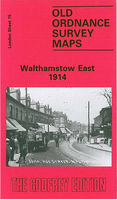
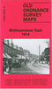
Walthamstow East 1914 Stanfords
£3.50
Archived Product

Walthamstow West 1936 Stanfords
£3.50
Archived Product

Walthamstow East 1939 Stanfords
£3.50
Vouchers
No voucher codes found.
Do you know a voucher code for this product or supplier? Add it to Insights for others to use.
Do you know a voucher code for this product or supplier? Add it to Insights for others to use.
 Denmark