
 United Kingdom
 France
 Germany
 Netherlands
 Sweden
 USA
USA
 Italy
Italy
 Spain
Spain
More From Contributor


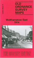
Walthamstow East 1914
Walthamstow East in 1914 in a fascinating series of reproductions of old Ordnance Survey plans in the Alan Godfrey Editions, ideal for anyone interested in the history of their neighbourhood or family. Three versions have been published for this area, with the 1894 map partly colour printed. Coverage extends from Hoe Street eastward to the Forest School, and from Water House and Forst Road southward to Barclay Road and Whipps Cross. Features include railway with Hoe Street and Wood Street stations, tramways, St Peter`s church, Shern Hall, fringes of Epping Forest, Forest School, The Winns or Water House, St Mary`s church, Moneux Almshouses, Walthamstow House, Rising Sun pub, Hagger Farm, St John`s Industrial School, Vestry House, etc. On the reverse of the 1894 version is
a 1855 directory of Walthamstow; the 1939 maps has extracts from a 1922 directory.About the Alan Godfrey Editions of the 25” OS Series:Selected towns in Great Britain and Ireland are covered by maps showing the extent of urban development in the last decades of the 19th and early 20th century. The plans have been taken from the Ordnance Survey mapping and reprinted at about 15 inches to one mile (1:4, 340). On the reverse most maps have historical notes and many also include extracts from contemporary directories. Most maps cover about one mile (1.6kms) north/south, one and a half miles (2.4kms) across; adjoining sheets can be combined to provide wider coverage.FOR MORE INFORMATION AND A COMPLETE LIST OF ALL AVAILABLE TITLES PLEASE CLICK ON THE SERIES LINK.
a 1855 directory of Walthamstow; the 1939 maps has extracts from a 1922 directory.About the Alan Godfrey Editions of the 25” OS Series:Selected towns in Great Britain and Ireland are covered by maps showing the extent of urban development in the last decades of the 19th and early 20th century. The plans have been taken from the Ordnance Survey mapping and reprinted at about 15 inches to one mile (1:4, 340). On the reverse most maps have historical notes and many also include extracts from contemporary directories. Most maps cover about one mile (1.6kms) north/south, one and a half miles (2.4kms) across; adjoining sheets can be combined to provide wider coverage.FOR MORE INFORMATION AND A COMPLETE LIST OF ALL AVAILABLE TITLES PLEASE CLICK ON THE SERIES LINK.

Product Description
Reviews/Comments
Add New
Intelligent Comparison
Archived Product

Walthamstow East 1939 Stanfords
£3.50
Archived Product

Walthamstow West 1913 Stanfords
£3.50
Archived Product
Walthamstow Past Stanfords
£7.95
Archived Product

Walthamstow West 1936 Stanfords
£3.50
Archived Product

Walthamstow Marshes 1894 Stanfords
£3.50
Archived Product

Walthamstow Marshes 1913 Stanfords
£3.50
Vouchers
No voucher codes found.
Do you know a voucher code for this product or supplier? Add it to Insights for others to use.
Do you know a voucher code for this product or supplier? Add it to Insights for others to use.
 Denmark