More From Contributor
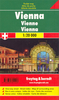
£4.99
Indexed street plan of the city including some of its outer suburbs. Cartography is an enlargement of Freytag & Berndt`s plan at 1:25, 000 & shows public transport but no one-way streets. An inset shows the city centre at a more detailed scale, with main buildings highlighted by small drawings. The plan also

Includes::
a diagram of the metro network & a map with main traffic arteries across Vienna. Map legend

Includes::
English.


...
Archived Product
£4.99
Central Vienna in a series of handy pocket street plans from Freytag & Berndt. Each map is laminated, so waterproof & tear-resistant, & highlights the publishers’ recommendations of five best choices in five categories: shopping, restaurants & cafes, culture, nightlife & sights. On one side is an indexed street plan annotated with colour-coded markers highlighting the publishers’ recommendations, all listed on the reverse of the map with brief notes in several languages. In larger cities the plans cover only the central districts. Also provided are a small road map of the city’s environs, if appropriate a diagram of the metro network, & a Fact Box with phone numbers for tourist offices, car hire & emergency services. Map legend & notes on the recommendations include English. To see other titles in this series please click on the series link. ...
Archived Product
£9.99
Pocket-sized, indexed street atlas, presenting the city on 102 pages. Bus & tram lines are very clearly marked, but one-way streets are not shown. Additional maps show the environs of the city, major traffic arteries, metro & suburban rail network & the city centre at a more detailed scale of 1:15, 000. Map legend

Includes::
English.

...
Archived Product
£15.99
Spiral bound street atlas, presenting the city on 102 map-pages. Bus, U-Bahn, tram & rail lines are clearly marked, & one-way streets are shown. Additional maps show the environs of the city, major traffic arteries & the airport. A plan of the metro, suburban & regional rail networks is on the back cover. The city centre is also presented at a more detailed scale of 1:10, 000. Selected building numbers are marked. Map legend

Includes::
English.

...
Archived Product
£4.50
Streetmap at 1:25, 000 of the central region of the city, from Donaufeld in the north-east to Oberlaa district in the south & Penzing in the west. Detail

Includes::
public buildings & locations of interest, tram & bus routes, railways & metro lines, pedestrian zones, information centres, post offices, hospitals, parks. Map legend

Includes::
English. On the reverse is a small road map of the city & its environs & a plan at 1:8, 500 of the city centre. Street index included. 29 locations of interest are marked on the maps & given brief descriptions.


...
Archived Product
£3.74
Vienna on a laminated, tear-resistant Insight Flexi Map, with a street plans of the city, road maps of its environs & of the north-eastern part of Austria, a diagram of the U- & S-Bahn networks, plus extensive tourist information. The street plan at 1:17, 500 covers the central districts of the city within the outer ring of the boulevards (the G ...
Archived Product
£5.99
Insight Guides Flexi Map Vienna: This easy to use, full-colour, water-proof map is all you need to navigate Vienna. It also


...
Archived Product
£8.95
Very large scale, double-sided street plan of Vienna, fully indexed, printed with extra large typography. All roads are shown, with clear distinctions between dual carriageways, through roads, & secondary roads. Railway lines & stations are marked, as are public buildings, forests/parks, & industrial zones. Points of interest such as sporting facilities, historical sites, zoos, commercial centres are displayed, as well as post offices, hospitals, police stations & cemeteries. The map is grid-referenced & fully indexed in the accompanying booklet. The booklet also contains useful maps of: through-traffic routes; rail networks; & even larger scale city centre enlargements. ...
Archived Product
£8.99
The double-sided city maps include all essential information:- detailed & clear representation of town centre- appealing 3D-display of selected typical buildings- brief description of 16 highlights in 4 languages complemented with attractive pictures- useful additional information for a successful trip (vicinity map, public transport, travel information, climate chart, index of important streets)- up-to-date amendments via QR-Code (airports, local traffic, fairgrounds…). ...
Archived Product
£7.99
The first water-resistant “ Comfort Map“ with direct access to useful additional information from the Internet Vienna in a scale of 1:17, 500 including a detailed presentation of the city centre in a scale of 1:13, 500 presented on a practical map; inclusive of the High 5 Edition app technology for calling up additional travel information & many other benefits:- just the right size
- 9.6 x 16.1 cm
- to fit comfortably into your handbag or trouser pocket- it is water-resistant (laminated/cellophane coating)- can be conveniently folded in any direction thanks to the patented “ Comfort Map” folding design It doesn’t matter what weather it is used in or how often it is folded, the condition of the “CITYMAP Vienna” will not deteriorate. Parks, streets & railway lines are easily recognisable thanks to the clear layout of the map. A separate map of the underground, streets & railway network, & a street index round off the map The “ Interactive Mobile CITYMAP Vienna” – a “paper backup” just in case...... & when used in conjunction with a smartphone, it is a great tool for planning trips. What’s not on the map is in the app By scanning the section of the map you want with the High 5 Edition app, you can get a lot of useful additional information about major attractions in Vienna. The app is based on Augmented Reality technology & is available free of charge from the Apple App store & Google Play store.

...
Archived Product

Vienna Flexi Map

Vienna on a laminated, tear-resistant Insight Flexi Map, with a street plans of the city, road maps of its environs and of the north-eastern part of Austria, a diagram of the U- and S-Bahn networks, plus extensive tourist information.The street plan at 1:17, 500 covers the central districts of the city within the outer ring of the boulevards (the G
RIP - This product is no longer available on our network. It was last seen on 25.09.2019

This page now acts as a permanent archive for this product. Add more information using the comments box below to ensure it can still be found by future generations.

Use our search facility to see if it is available from an alternative contributor.
  • Availability: Out Of Stock
  • Supplier: Stanfords
  • SKU: 9789812822031
Availability: In Stock
£4.99

Product Description

Vienna on a laminated, tear-resistant Insight Flexi Map, with a street plans of the city, road maps of its environs & of the north-eastern part of Austria, a diagram of the U- & S-Bahn networks, plus extensive tourist information. The street plan at 1:17, 500 covers the central districts of the city within the outer ring of the boulevards (the G

Reviews/Comments

Add New

Price History

Vouchers

No voucher codes found.
Do you know a voucher code for this product or supplier? Add it to Insights for others to use.

Facebook

Jargon Buster

Road - a manmade lane or a path that is used to speed up travel.
Resistant - Something that can repel against something.
Laminated - A thin layer of plastic that gives a coating and shine to a material.

Supplier Information

Stanfords
Stanfords was established in 1853 and opened their iconic Covent Garden flagship store in 1901. They have become the top retailer of maps, travel books and accessories in the UK and arguably offer the largest selection of maps and travel books worldwide. Famous names such as Captain Robert Falcon Scott, Ranulph Fiennes and Michael Palin have purchased from Stanfords. They now have a shop in Bristol and both stores together with other venues operate a calendar of events including talks, book signings and exhibitions. As a specialist map retailer, the map selection is comprehensive and includes road maps, street maps and walking maps from worldwide destinations, as well as a selection of world atlases and wall maps. Books include travel guides and travel literature. Stanfords also stock globes, from miniatures made of blue marble to magnificent floor-standing globes. The website features a selection of interesting articles on travel topics.
Page Updated: 2023-11-12 20:15:36

Community Generated Product Tags

Oh No! The productWIKI community hasn't generated any tags for this product yet!
Menu