
 United Kingdom
 France
 Germany
 Netherlands
 Sweden
 USA
USA
 Italy
Italy
 Spain
Spain
More From Contributor


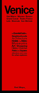
Venice Red Maps
Venice on a tourist street plan from Red Maps presented in a handy concertina format and printed on thick high quality paper, with thematic indexes for sights including museums and churches, hotels, shopping, etc.The main map at 1:6, 150 approx. covers just the most visited parts of the city: from the Santa Lucia railway station across the heart of Venice to the northern part of the Biennale Gardens. The outer parts such as northern Cannaregio with the Ghetto or Giudecca are not included. Main buildings, colour-coded into different types (museums, churches, palaces, hotels, etc), are named and main shopping streets and routes across the city are highlighted. Vaporetto piers indicate which lines stop there.Insets show Murano, Burano and the central part of the Lido. On the
reverse are thematic lists of sights and important buildings, hotels, etc. A special panel provides area-by-area recommendations of (mainly fashion) shops. An index lists neighbourhoods (sestiere), bridges, squares and a selection of major streets.To see other street plans from Red Maps with similar presentation please click on the series link.
reverse are thematic lists of sights and important buildings, hotels, etc. A special panel provides area-by-area recommendations of (mainly fashion) shops. An index lists neighbourhoods (sestiere), bridges, squares and a selection of major streets.To see other street plans from Red Maps with similar presentation please click on the series link.

Product Description
Reviews/Comments
Add New
Intelligent Comparison
Archived Product
Florence Red Maps Stanfords
£9.99
Archived Product
Vienna Red Maps Stanfords
£9.99
Archived Product
Venice Flexi Map Stanfords
£4.99
Archived Product
Venice Flexi Map Stanfords
£4.99
Archived Product
Venice Flexi Map Stanfords
£5.99
Archived Product
Rome Red Maps Stanfords
£9.99
Archived Product

Chicago Red Maps Stanfords
£9.99
Vouchers
No voucher codes found.
Do you know a voucher code for this product or supplier? Add it to Insights for others to use.
Do you know a voucher code for this product or supplier? Add it to Insights for others to use.
 Denmark