More From Contributor

£4.99
This work features a revolutionary new design for pocket-sized travel guides. Open the cover & discover a remarkable new design! 2 popout maps & a comprehensive fully illustrated 64 page guide of Rome. & it works like magic! The map & guide of the city are fully cross-referenced for instant, effortless navigation, making this the easiest guidebook you will ever use. Well-written text covers sights, shopping, entertainment, food, practical information & where to stay. With durable flexibound, stunning laminated covers, the popout cityguide is excellent value for your money for your trip to Rome. ...
Archived Product
£3.99
Rome Pop-Out Map from Compass Maps in a series designed to provide two street plans, the city centre plus a wider area around it, in a handy format to fit neatly all but the smallest pockets, with, as appropriate, transport network diagrams, additional useful maps, etc. Each title ...
Archived Product
£7.95
Rome Province in a series of handy size road maps from Litografia Artistica Cartografica (LAC) with more minor local roads & tracks than can be found on most regional maps. The series is gradually being changed to a new style of digitally derived cartography, so presentation of adjoining titles may vary. All the maps have hill shading to represent the general relief with spot heights for selected peaks, & show a few more local roads & rough tracks than the other road map series. Intermediate road distances are indicated. Regional, provincial & communal borders are marked, & railways, funiculars, airports, sea ferry links & campsites are shown. The legend is in Italian only. The new, digitally produced editions are indexed & have enhanced, more finely drawn cartography: the hill-shading is less bold, motorway service areas are marked, natural parks are highlighted & an expanded range of symbols indicates various landmarks & sites, e.g. antiquities, churches, etc. Two styles of the new cartography are produced, differing only in the colour of the predominant background shading: grey or yellow/green. Some of the new editions include geographical coordinates for the map corners. The index of localities is on the reverse. This title is now published with digital cartography. ...
Archived Product
£12.99
Rome Province at 1:150, 000 in a series of handy size provincial road maps from Litografia Artistica Cartografica (LAC) with more minor local roads & country tracks than can be found on most regional maps from other publishers. This title is now available in a digitally produced edition.LAC’s provincial series is gradually being changed to a new style of digitally derived cartography, so presentation of adjoining titles may vary. All the maps have hill shading to represent the general relief with spot heights for selected peaks, & show a few more local roads & rough tracks than the other road map series. Intermediate road distances are indicated. Regional, provincial & communal borders are marked, & railways, funiculars, airports, sea ferry links & campsites are shown. The legend is in Italian only. The new, digitally produced editions are indexed & have enhanced, more finely drawn cartography: the hill-shading is less bold, motorway service areas are marked, natural parks are highlighted & an expanded range of symbols indicates various landmarks & sites, e.g. antiquities, churches, etc. Two styles of the new cartography are produced, differing only in the colour of the predominant background shading: grey or yellow/green. Some of the new editions include geographical coordinates for the map corners. The index of localities is on the reverse. To see all the titles in this series please click on the series link. ...
Archived Product
£25.00
Ancient Rome reconstructed to its original magnificence. Each site is illustrated as it is & a previous acetate page overlay gives a reconstruction as it was when it was built. The opposite page of text gives statistics, dates, facts about the building or site. Ring bound with Canadian style binding for the spine allows for flat opening & easy manipulation of the overlay page. Double sided gate fold pages Index included ...
Archived Product
£7.99
Rick Steves` Pocket Rome

Includes::
-- Sights: the National Museum, Palatine Hill, Trajan`s Column, Market,

...
Archived Product
£9.99
Rome in the AA Spiral Guides series; comprising a selection of titles exploring a wide range of cities, regions & countries in a handy, spiral loose-leaf format. Fold-out flaps at the front & back of each title give an overview of the main regions covered, with page numbers so visitors can locate their destination easily. Each guide explores the destination geographically by region or area & provides the essential information for the main sites & attractions in addition to a recommended tour of each area by car. An introductory section - ...
Archived Product
£8.99
Rome in the Step by Step series by Insight Guides focuses on providing tailor made walks & tours around the city. The guide features eighteen route recommendations that link up better known sights & take you off of the more beaten track; they are written by local experts who have personally selected places to eat & drink en-route & who offer insider tips on culture, shopping & nightlife. The guide has an array of colour photographs which help bring to life the background & descriptive information provided for destinations & attractions. An overview chapter opens the guide & reviews geography, customs & culture, history, food & drink, shopping, culture & entertainment. Next feature the selected itineraries for walks and/or tours, each of which have a good amount of accompanying information & come with a simple route plan. A user friendly alphabetical directory lists practical information to do with day to day basics & listings of h&-picked hotels & restaurants are provided to suit different budgets & tastes. The publisher ...
Archived Product
£10.99
During its three-thous&-year history Rome has been an imperial metropolis, the capital of a nation & the spiritual core of a great world religion. For writers from antiquity to the present, however, the place holds an alternative significance as a realm of fantasy, aspiration & desire. Captivating & lethal at one & the same moment, its fatal gift of beauty both transfigures & betrays those in thrall to it. Rome Stories explores the city`s fateful impact through the writing of classical historians, a Renaissance sculptor, 18th-century tourists, American, British & French novelists & the authors of modern Rome, each testing & unravelling the city`s ageless paradoxes. Gibbon admires the Last of the Tribunes, Goethe decodes the mysteries of the Carnival & Stendhal`s subversive aristocrats mingle revolution with a little cross-dressing amid their gilt mirrors & frescoed ceilings From Plutarch to Pasolini, from Hawthorne to Wharton, the city of Caesars & popes, of dreamers, chancers & hustlers confronts the questing imagination with its eternally unflinching gaze. ...
Archived Product
£9.99
In ways no guide book can achieve, these twenty absorbing tales by Italian authors ranging from Boccaccio in the Middle Ages to Giacomo Casanova in the eighteenth century, to Pier-Paolo Pasolini in the twentieth & contemporary new writers such as Melania Mazzucco & Igiaba Scego, offer the delight of discovering & exploring one of the world`s most unique cities thorough a wide variety of individual lives & epochs. The tales span seven hundred years but rather than being ordered chronologically, old & new appear alongside one another, reflecting the dual identity of Rome
- thriving, modern metropolis & ancient city centre that is one of the wonders of the world. The tales are wonderfully varied in style, tone, & subject matter. Casanova sets about seducing the hotelier`s daughter only minutes after his arrival, a notorious Spanish prostitute in Renaissance Rome endures a public hiding without flinching, a Danish tourist in her sixties finds an unusual lover, Pope John Paul II uncovers a vast conspiracy against him, a medieval revolutionary demagogue suffers almost the same fate as Mussolini. Each story is illustrated with a black-&-white photograph & there is a map of Rome to help readers locate the important sites which feature in the text. A deep sense of timelessness, of separate destinies entwined across a gulf of centuries, is the cumulative effect of this vivid mosaic of dramatic, comic, & tragic stories set in the Eternal City.
...
Archived Product

Rome Red Maps

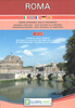
Central Rome on a tourist street plan from Red Maps presented in a handy concertina format and printed on thick high quality paper, with thematic indexes for ancient sites, museums and churches, hotels, shopping, etc.The plan presents central Rome at 1:11, 400 approx, covering the area between the Vatican and the Termini railway station and from just north of the Spanish Steps to the Coliseum. Main buildings, colour-coded into different types (ancient Rome, museums, churches, palaces, hotels, etc), are named and main shopping streets and traffic routes across the city are highlighted. On the reverse a separate panel shows the Flamino district with the sites of the 1960 Olympic Games and the nearby cultural centres. The map has thematic lists of sights and important buildings,
hotels, etc. A special panel provides street-by-street recommendations of (mainly fashion) shops. An index lists squares and a selection of major streets.To see other street plans from Red Maps with similar presentation please click on the series link.
RIP - This product is no longer available on our network. It was last seen on 25.09.2019

This page now acts as a permanent archive for this product. Add more information using the comments box below to ensure it can still be found by future generations.

Use our search facility to see if it is available from an alternative contributor.
  • Availability: Out Of Stock
  • Supplier: Stanfords
  • SKU: 9781892238733
Availability: In Stock
£9.99

Product Description

Central Rome on a tourist street plan from Red Maps presented in a handy concertina format & printed on thick high quality paper, with thematic indexes for ancient sites, museums & churches, hotels, shopping, etc. The plan presents central Rome at 1:11, 400 approx, covering the area between the Vatican & the Termini railway station & from just north of the Spanish Steps to the Coliseum. Main buildings, colour-coded into different types (ancient Rome, museums, churches, palaces, hotels, etc), are named & main shopping streets & traffic routes across the city are highlighted. On the reverse a separate panel shows the Flamino district with the sites of the 1960 Olympic Games & the nearby cultural centres. The map has thematic lists of sights & important buildings, hotels, etc. A special panel provides street-by-street recommendations of (mainly fashion) shops. An index lists squares & a selection of major streets. To see other street plans from Red Maps with similar presentation please click on the series link.

Reviews/Comments

Add New

Price History

Vouchers

No voucher codes found.
Do you know a voucher code for this product or supplier? Add it to Insights for others to use.

Facebook

Jargon Buster

Paper - A thin sheet mainly used for writing. Available in a variety of colours. Made mainly from wood pulp.
Spanish - The main language spoken in Spain and Latin America.
Red - One of the three primary colours
Colour - The categorised spectrum of light visable to humans
Quality - An object that has quality is superior in function and finish than a less quality object.

Supplier Information

Stanfords
Stanfords was established in 1853 and opened their iconic Covent Garden flagship store in 1901. They have become the top retailer of maps, travel books and accessories in the UK and arguably offer the largest selection of maps and travel books worldwide. Famous names such as Captain Robert Falcon Scott, Ranulph Fiennes and Michael Palin have purchased from Stanfords. They now have a shop in Bristol and both stores together with other venues operate a calendar of events including talks, book signings and exhibitions. As a specialist map retailer, the map selection is comprehensive and includes road maps, street maps and walking maps from worldwide destinations, as well as a selection of world atlases and wall maps. Books include travel guides and travel literature. Stanfords also stock globes, from miniatures made of blue marble to magnificent floor-standing globes. The website features a selection of interesting articles on travel topics.
Page Updated: 2023-11-12 20:15:36

Community Generated Product Tags

Oh No! The productWIKI community hasn't generated any tags for this product yet!
Menu