
 United Kingdom
 France
 Germany
 Netherlands
 Sweden
 USA
USA
 Italy
Italy
 Spain
Spain
More From Contributor


Chicago Red Maps
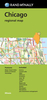
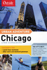
Chicago on a tourist street plan from Red Maps presented in a handy concertina format and printed on thick high quality paper, with thematic indexes for architecture, hotels, restaurants, shopping, etc. The plan covers the city’s central districts, extending along the shore of Lake Michigan from the Lincoln Park in the north to just beyond the McCormick Place Convention Centre, plus inland to Halsted Street. On the reverse two panels provide additional coverage of the Wicker Park/Bucktown district, plus an enlargement showing The Loop in greater detail.The plan names tourist sights and important buildings, entertainment venues, selected hotels and restaurants, etc. Also highlighted are main shopping streets with names of selected individual stores. Subway stations and
connections are very clearly indicated.The plans are accompanied by several lists and recommendations: Chicago’s historic and modern buildings with dates and names of their architects; hotels, restaurants and shops arranged by district; theatres and stadiums/arenas, etc.An index lists only a selection of neighbourhoods and streets.To see other street plans from Red Maps with similar presentation please click on the series link.
connections are very clearly indicated.The plans are accompanied by several lists and recommendations: Chicago’s historic and modern buildings with dates and names of their architects; hotels, restaurants and shops arranged by district; theatres and stadiums/arenas, etc.An index lists only a selection of neighbourhoods and streets.To see other street plans from Red Maps with similar presentation please click on the series link.

Product Description
Reviews/Comments
Add New
Vouchers
No voucher codes found.
Do you know a voucher code for this product or supplier? Add it to Insights for others to use.
Do you know a voucher code for this product or supplier? Add it to Insights for others to use.
 Denmark