
 United Kingdom
 France
 Germany
 Netherlands
 Sweden
 USA
USA
 Italy
Italy
 Spain
Spain
More From Contributor


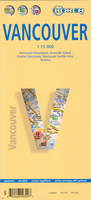
Vancouver Borch
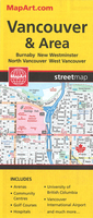
Very clear, indexed, tourist street plan on durable laminated paper showing Downtown Vancouver at 1:15, 000, with more general road map of the greater Vancouver area on the reverse. Street map detail includes one-way streets, notable buildings, shopping malls, pedestrian zones, railway lines and stations, and ferry links. Symbols denote information centres, monuments, places of worship, theatres, sites of interest, car parks, hotels, bus stations, etc.The main map coverage extends from the Vancouver General Hospital in the south Beach to Capilano Highlands in North Vancouver and spans approx. 7km E-W, thus including Stanley Park. A small inset at 1:5, 500 shows Granville Island in greater detail. The Greater Vancouver road map is at 1:125, 000 and shows the main road and
rail communications, municipal divisions and notable sites, covering an area from Delta in the south east to Horseshoe Bay in the north west. A 1:1, 800, 000 road map shows the Seattle / Vancouver region, and there is also a small 1:30, 000 city plan of central Victoria and diagram of Vancouver’s rail and Sea Bus public transport network. Thirty recommended attractions are highlighted on the maps. All the maps are indexed for towns, streets and locations of interest as appropriate to the scale and level of detail, and the multilingual map legend includes English.
rail communications, municipal divisions and notable sites, covering an area from Delta in the south east to Horseshoe Bay in the north west. A 1:1, 800, 000 road map shows the Seattle / Vancouver region, and there is also a small 1:30, 000 city plan of central Victoria and diagram of Vancouver’s rail and Sea Bus public transport network. Thirty recommended attractions are highlighted on the maps. All the maps are indexed for towns, streets and locations of interest as appropriate to the scale and level of detail, and the multilingual map legend includes English.

Product Description
Reviews/Comments
Add New
Intelligent Comparison
Archived Product
Vancouver F&B Stanfords
£9.99
Archived Product
Vancouver Stanfords
£8.95
Archived Product

Vancouver Stanfords
£6.99
Archived Product
Vancouver Stanfords
£10.39
Archived Product
Vancouver Stanfords
£36.95
Archived Product
France Borch Stanfords
£9.99
Archived Product
Venice Borch Stanfords
£8.99
Archived Product
Vancouver & Area Stanfords
£8.99
Vouchers
No voucher codes found.
Do you know a voucher code for this product or supplier? Add it to Insights for others to use.
Do you know a voucher code for this product or supplier? Add it to Insights for others to use.
 Denmark