
 United Kingdom
 France
 Germany
 Netherlands
 Sweden
 USA
USA
 Italy
Italy
 Spain
Spain
More From Contributor


Upholland South 1907
Upholland South in 1907 in a fascinating series of reproductions of old Ordnance Survey plans in the Alan Godfrey Editions, ideal for anyone interested in the history of their neighbourhood or family. The map covers the southern part of Upholland and western part of Orrell. Coverage runs from Orrell station westward to Upholland station, and from the `Abbey Lakes` fishpond southward to Pimbo Lane. Features include L&YR railway from Orrell to Upholland with tunnel, mineral railways, Far Moor area, Tontine area, New Fold area, Lawns Works and tramway, Grammar School, Sandbrook Mill, St James RC church, Upholland Brick Works, Pimbo Lane Brick Works, Pimbo Lane Colliery and tramway, old shafts, etc. On the reverse is a section of the 1927 version, showing the New Fold and Pimbo
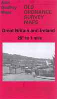
Lane areas at a later stage. Features now include Mountain Mine Colliery. About the Alan Godfrey Editions of the 25” OS Series:Selected towns in Great Britain and Ireland are covered by maps showing the extent of urban development in the last decades of the 19th and early 20th century. The plans have been taken from the Ordnance Survey mapping and reprinted at about 15 inches to one mile (1:4, 340). On the reverse most maps have historical notes and many also include extracts from contemporary directories. Most maps cover about one mile (1.6kms) north/south, one and a half miles (2.4kms) across; adjoining sheets can be combined to provide wider coverage.FOR MORE INFORMATION AND A COMPLETE LIST OF ALL AVAILABLE TITLES PLEASE CLICK ON THE SERIES LINK.
Lane areas at a later stage. Features now include Mountain Mine Colliery. About the Alan Godfrey Editions of the 25” OS Series:Selected towns in Great Britain and Ireland are covered by maps showing the extent of urban development in the last decades of the 19th and early 20th century. The plans have been taken from the Ordnance Survey mapping and reprinted at about 15 inches to one mile (1:4, 340). On the reverse most maps have historical notes and many also include extracts from contemporary directories. Most maps cover about one mile (1.6kms) north/south, one and a half miles (2.4kms) across; adjoining sheets can be combined to provide wider coverage.FOR MORE INFORMATION AND A COMPLETE LIST OF ALL AVAILABLE TITLES PLEASE CLICK ON THE SERIES LINK.

Product Description
Reviews/Comments
Add New
Intelligent Comparison
Archived Product
Upholland 1907 Stanfords
£2.95
Archived Product
Upholland 1907 Stanfords
£3.50
Archived Product

Colne South 1910 Stanfords
£3.50
Vouchers
No voucher codes found.
Do you know a voucher code for this product or supplier? Add it to Insights for others to use.
Do you know a voucher code for this product or supplier? Add it to Insights for others to use.
 Denmark