
 United Kingdom
 France
 Germany
 Netherlands
 Sweden
 USA
USA
 Italy
Italy
 Spain
Spain
More From Contributor


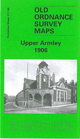
Upper Armley 1906
Upper Armley in 1906 in a fascinating series of reproductions of old Ordnance Survey plans in the Alan Godfrey Editions, ideal for anyone interested in the history of their neighbourhood or family. The map covers part of Armley on the west side of Leeds, extending west to cover the outskirts of Bramley. Coverage stretches from Aston Road Bramley eastward to Armley Lodge Road, and from Burley Wood southward to Town Street Armley. Armley House is near the centre of the map and other features include Far Fold Moor, Armley Park, Armley Moor, Pasture Hill, Armley Grange, Burley Mills, short stretches of the Leeds & Liverpool Canal and Midland Railway, Bramley Workhouse, Armley Cemetery, Greenthorpe, Gamble Hill (south-western corner), Hill Top, Hill Top Tannery, Bramley Town
End, Wyther House, Wyther Lodge, etc. On the reverse are street directory entries for Armley Lodge Road, Armley Ridge Road, Edinburgh Ave/Grove/Place/Road/Terr, Greenock Place/St/Terr, Hope Ave/Grove/Mount/Place, Stanningley Road, Theaker Lane and Town Street.About the Alan Godfrey Editions of the 25” OS Series:Selected towns in Great Britain and Ireland are covered by maps showing the extent of urban development in the last decades of the 19th and early 20th century. The plans have been taken from the Ordnance Survey mapping and reprinted at about 15 inches to one mile (1:4, 340). On the reverse most maps have historical notes and many also include extracts from contemporary directories. Most maps cover about one mile (1.6kms) north/south, one and a half miles (2.4kms) across;
adjoining sheets can be combined to provide wider coverage.FOR MORE INFORMATION AND A COMPLETE LIST OF ALL AVAILABLE TITLES PLEASE CLICK ON THE SERIES LINK.

Product Description
Reviews/Comments
Add New
Intelligent Comparison
Archived Product
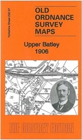
Upper Batley 1906 Stanfords
£3.50
Vouchers
No voucher codes found.
Do you know a voucher code for this product or supplier? Add it to Insights for others to use.
Do you know a voucher code for this product or supplier? Add it to Insights for others to use.
 Denmark