
 United Kingdom
 France
 Germany
 Netherlands
 Sweden
 USA
USA
 Italy
Italy
 Spain
Spain
More From Contributor


Upholland 1907
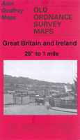
Upholland in 1907 in a fascinating series of reproductions of old Ordnance Survey plans in the Alan Godfrey Editions, ideal for anyone interested in the history of their neighbourhood or family. Selected towns in Great Britain and Ireland are covered by maps showing the extent of urban development in the last decades of the 19th and early 20th century.In this title: the map covers the village of Upholland, originally part of Wigan parish but today in West Lancashire. Coverage stretches from the village centre around St Thomas church, northward to St Joseph's RC College at Walthew Park, and from the Abbey Lakes Hotel westward to the disused Windmill Colliery. This is largely a rural map but features include the village centre (now a Conservation area), Hall Green, Upholland Corn Mill,
Holland House, Holland Windmill, Newgate etc. On the reverse is a 1918 directory of Upholland and Orrell. About the Alan Godfrey Editions of the 25
Holland House, Holland Windmill, Newgate etc. On the reverse is a 1918 directory of Upholland and Orrell. About the Alan Godfrey Editions of the 25
Product Description
Reviews/Comments
Add New
Intelligent Comparison
Archived Product
Upholland 1907 Stanfords
£3.50
Archived Product

Upholland South 1907 Stanfords
£3.50
Archived Product

Elland 1905 Stanfords
£3.50
Vouchers
No voucher codes found.
Do you know a voucher code for this product or supplier? Add it to Insights for others to use.
Do you know a voucher code for this product or supplier? Add it to Insights for others to use.
 Denmark