
 United Kingdom
 France
 Germany
 Netherlands
 Sweden
 USA
USA
 Italy
Italy
 Spain
Spain
More From Contributor


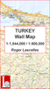

Turkey Tourist Map
Turkey Tourist Map at 1:2, 000, 000 from Mepmedya includes main transport routes (major roads and railways), and photographs and descriptions of many places of interest. *Map legend in English, Turkish and German.* Motorways, dual carriageways and secondary roads are shown, as are major railway lines, airports, some regional ferry routes and major harbours. Border crossing points are shown.Provinces are delineated and provincial capitals and many smaller towns are marked, with an indication of their administrative importance.Relief shading defines the terrain, mountain ranges are named and spot heights are shown for major peaks. The main lakes, rivers and dams of the country are marked and named.The mapping is annotated with numerous places of interest. These range from ancient
ruins, castles and historic sites, to national parks, resorts and ski centres. The most important sites are numbered, with descriptions and photography appearing beneath the map and on the reverse.Includes Cyprus.
ruins, castles and historic sites, to national parks, resorts and ski centres. The most important sites are numbered, with descriptions and photography appearing beneath the map and on the reverse.Includes Cyprus.

Product Description
Reviews/Comments
Add New
Intelligent Comparison
Archived Product
Orkney Tourist Map Stanfords
£3.99
Archived Product
Orkney Tourist Map Stanfords
£4.99
Archived Product

Durban Pocket Tourist Map Stanfords
£6.50
Archived Product

Wales Tourist Map Stanfords
£3.99
Archived Product

Hebron Tourist Map Stanfords
£12.95
Archived Product
Australia Tourist Map Stanfords
£10.95
Archived Product
Turkey Flexi Map Stanfords
£4.99
Archived Product
Zürich Tourist Map Stanfords
£12.99
Vouchers
No voucher codes found.
Do you know a voucher code for this product or supplier? Add it to Insights for others to use.
Do you know a voucher code for this product or supplier? Add it to Insights for others to use.
 Denmark