
 United Kingdom
 France
 Germany
 Netherlands
 Sweden
 USA
USA
 Italy
Italy
 Spain
Spain
More From Contributor

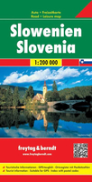
Slovenia
Slovenia with Istria at 1:300, 000 on an indexed road map from Kartografija in Ljubljana, prominently highlighting picturesque locations. The main map includes the northern part of Istria, with the whole of the peninsula shown on the reverse at the same scale. Coverage includes much of Carinthia and north-western Croatia with Zagreb.Topography is shown by light, pleasant altitude colouring, with relief shading and plenty of names of mountain chains, peaks and other geographical features. Road network includes selected small local roads and tracks, and indicates toll routes, steep gradients, seasonal closures, roads not recommended for caravans, etc, as well as locations of fuel supplies. Driving distances are shown on main and secondary routes. Railway and ferry lines are
included and local airports are marked.Pictureque locations are prominently highlighted and symbols indicate various places of interest including campsites. Latitude and longitude lines are drawn at 15
included and local airports are marked.Pictureque locations are prominently highlighted and symbols indicate various places of interest including campsites. Latitude and longitude lines are drawn at 15
Product Description
Reviews/Comments
Add New
Intelligent Comparison
Archived Product
Slovenia Stanfords
£9.95
Archived Product
Slovenia Stanfords
£9.50
Archived Product
Slovenia Stanfords
£11.99
Archived Product
Slovenia Stanfords
£11.19
Archived Product
Slovenia Stanfords
£12.99
Archived Product
Slovenia F&B Stanfords
£10.99
Archived Product
Slovakia Stanfords
£17.99
Archived Product
Slovakia Stanfords
£9.99
Vouchers
No voucher codes found.
Do you know a voucher code for this product or supplier? Add it to Insights for others to use.
Do you know a voucher code for this product or supplier? Add it to Insights for others to use.
 Denmark