
 United Kingdom
 France
 Germany
 Netherlands
 Sweden
 USA
USA
 Italy
Italy
 Spain
Spain
More From Contributor


Slovenia F&B
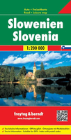
Slovenia at 1:200, 000 from Freytag & Berndt, on a detailed, indexed road map presenting the whole country on one side of the map as an alternative to the publisher’s double-sided version at 1:150, 000. Coverage includes the south-eastern corner of Austria with the Carinthian lakes around Klagenfurt and Villach.Topography is shown by relief shading, with spot heights and plenty of names of peaks, valleys, etc. National parks and protected areas are marked. Road network includes minor roads and cart tracks, and indicates driving distances on most local routes, roads closed to motorized traffic or not recommended for caravans, seasonal closures on mountain roads, steep gradients, toll sections, motorway services, etc. Special tourist routes and scenic roads are highlighted.
Railway lines are shown with stations and local airports are marked. Picturesque towns and villages are highlighted. Symbols mark other places of interest and facilities, including campsites and youth hostels, golf course, museums, etc. The map also highlights the course of long-distance hiking routes across the northern part of the country. Latitude and longitude lines are drawn at intervals of 10’. The index is in a separate booklet attached to the map cover.*Map legend include English.*The same cartography, enlarged to 1:150, 000 for clearer presentation, is also used in F&B’s “Top 10 Tips” double-side map of Slovenia, with additional tourist information and street plans.
Railway lines are shown with stations and local airports are marked. Picturesque towns and villages are highlighted. Symbols mark other places of interest and facilities, including campsites and youth hostels, golf course, museums, etc. The map also highlights the course of long-distance hiking routes across the northern part of the country. Latitude and longitude lines are drawn at intervals of 10’. The index is in a separate booklet attached to the map cover.*Map legend include English.*The same cartography, enlarged to 1:150, 000 for clearer presentation, is also used in F&B’s “Top 10 Tips” double-side map of Slovenia, with additional tourist information and street plans.

Product Description
Reviews/Comments
Add New
Vouchers
No voucher codes found.
Do you know a voucher code for this product or supplier? Add it to Insights for others to use.
Do you know a voucher code for this product or supplier? Add it to Insights for others to use.
 Denmark