More From Contributor
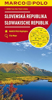
£32.78

Colloquial Slovak is easy to use & is specially written by experienced teachers for self-study or class use. The course offers

...
Archived Product
£5.99
The Michelin National road map of the Slovak Republic at 1:500, 000 scale is ideal for route planning & touring. The map gives comprehensive coverage of national road networks showing all major motorways, dual carriageways, national & regional main roads & most single-lane roads. The map is divided by grid showing latitude & logitude. Distances between major locations are marked along roads, with total distance & several intermediate distances shown. A quick-reference chart of distances & driving times between major locations is also included. The map also

Includes::
a grid-referenced index of principal place names. Clear, easy-to read cartography shows roads in reds, yellows & white with black outlines. Major topography is indicated with relief shading. Woodland & forest is marked with green shading. Built-up urban areas are clearly marked in yellow. Airports, ferries, railways are also marked. National & administrative divisions are marked, as are administrative district seats. Areas of special interest, such as churches & museums, are also displayed. City plan plans & regional enlargements:- Bratislava at 1:100, 000 scale.

...
Archived Product
£9.50
Indexed, waterproof & tear-resistant road map of Slovakia with topographic & tourist information, published by Reise Know-How as part of their highly acclaimed World Mapping Project. The map is double-sided to provide the best balance between a good scale & a convenient size sheet. Road & rail networks are easy to see on a clear base which presents topography by altitude colouring with contours, spot heights, mountain passes & names of mountain ranges. Road network

Includes::
selected unsurfaced local roads, highlights scenic routes & shows driving distances on main roads. Roads closed to motorized traffic are prominently marked. National parks & protected areas are marked & symbols highlight various places of interest: picturesque towns & villages, campsites & youth hostels, UNESCO world heritage sites, archaeological remains & museums, viewpoints, spas & hot springs, etc. Coverage of the border areas of Poland

Includes::
the foothills of the Tatra Mountains & several national & regional parks. The map has a latitude & longitude grid at intervals of 15


...
Archived Product
£17.99
Illustrated with colour photographs & maps, this guide presents Slovakia's attractions & landmarks region-by-region. For each region, useful telephone numbers & addresses are listed for information offices & recommended hotels, restaurants, museums & galleries. Introductory chapters cover general themes of geography, history, culture, population, nature & economy, & there is a brief A-Z reference section on essential & diverse practical matters eg. transport, traffic rules, food, opening hours, money, state holidays etc. Slovakian publication in English. ...
Archived Product
£7.50
Slovakia on an indexed road map at 1:500, 000 from the Budapest-based Cartographia, prominently highlighting interesting locations & national parks, plus an enlargement showing Tatra Mountain in greater detail & a street plan of central Bratislava. Coverage extends north to Kraków to cover the Polish side of the Tatras & their foothills. Road network, graded into six types, indicates driving distances on main & secondary road, plus highlights scenic routes & has gradient markings. Railway lines are included & local airports are marked. Locations worth visiting, both towns or villages & natural sites, are prominently highlighted. Symbols indicate other places of interest, including campsites. Topography is shown by relief shading with names of mountain ranges & peak heights, plus boundaries of national parks. The map has latitude & longitude lines at 30’ intervals. The index is on the reverse. An enlargement at 1:100, 000 shows in greater detail the High Tatra region, highlighting numerous waymarked hiking trails. Coverage extends north to Zakopane to include the eastern part of the Polish Tatrzanski National Park. Also included is a small street plan of central Bratislava. ...
Archived Product
£9.99
This map combines the map of Slovakia (1:430, 000) with a separate map of Hungary (1:540, 000) on the other side, in the belief that the two countries constitute an excellent joint travel experience. Both maps provide excellent detail for roads & urban areas, & for points of interest, parks, rail lines, & historic sites. ...
Archived Product
£9.95
Slovakia on a large, double-sided indexed map from Mair Dumont, with five street plans & special features to aid route planning & navigation: a fold-out flap in the jacket gives an overview of the whole area covered by the map plus the adjoining regions & highlights popular locations, with the grid reference system in the margins making it easier to find places on the main map. A set of seven peel-on/peel-off stickers, removable without damaging the map surface, is provided for making selected locations more prominent when navigating. The country is divided east/west, with the western side extending to Brno to include eastern Moravia. The map boldly stresses main roads & motorways in strong colours & selected towns in large letters, but also shows minor roads & villages in considerable detail. Road information

Includes::
toll roads, traffic restrictions & seasonal closures, gradient marking for steep roads, scenic roads & special tourist routes, etc. Motorway services clearly indicate types of facilities available there. Railway network is shown with stations &

Includes::
tourist lines Picturesque towns or villages & sites worth visiting, including areas with interesting landscape, are given star rating, & other tourist information

Includes::
campsites & youth hostels, landmarks, recreational facilities etc. National parks & other protected areas are highlighted. Topography is shown by relief shading with spot heights & colouring for wooded areas. The map shows plenty of names of geographical

Features:
mountain & hill ranges, valleys, peaks & passes, etc. Latitude & longitude grid is drawn at intervals of 10'. Map legend & all information include English. The index is in a separate booklet attached to the map cover & lists all locations with their postcodes. The booklet also contains central Bratislava, Banska Bystrica, Ko


...
Archived Product
£6.95
Slovakia in the Culture Smart range of pocket-sized guide books; providing detailed information on local customs, culture, etiquette & manners & ensuring that visitors are prepared for a diverse range of social environments. The series covers an extensive number of countries worldwide & are designed both for those working & living abroad, as well as for visitors who do not want to offend, either intentionally or inadvertently. Their aim is to prevent readers from making embarrassing mistakes & feel confident in unfamiliar situations, while preparing them before arrival on what to expect & how to behave. Each guide is arranged thematically, with dedicated individual chapters on land & people, values & attitudes, customs & traditions, making friends, people at home, ‘time-out’, travelling & communicating. There is also a separate chapter for business travelers, with important information on subjects such as business culture, meetings & making appointments. A Further Reading section also offers a list of recommended other history, travel literature & language titles available on the country. ...
Archived Product
£10.99
Detailed, double-sided road map of Slovakia, with index booklet. Clearly shows the national road network & selected provincial & local roads, with each class of road clearly indicated & road numbers shown. Intermediate driving distances between locations are shown in kilometres alongside the road, motorway filling stations are shown & motorway junctions are indicated. Topography is shown with relief shading & some spot heights, & colour shading is used to indicate land types such as forests or marshl&. International & provincial boundaries are clearly marked, as are National Parks, nature reserves & restricted military areas. Symbols indicate various sights & locations of tourist interest, such as churches, leisure & sports destinations, panoramas & viewing points, monuments & historic sites. Some hotels & campsites are marked. Railway lines, airports, ports & marinas are also shown. A grid divides the map at 10’ increments, & is also grid-referenced for the accompanying index booklet.* Multilingual map legend

Includes::
English.*

...
Archived Product

Slovakia

Slovakia on a large, double-sided indexed map from MairDumont, with five street plans and special features to aid route planning and navigation: a fold-out flap in the jacket gives an overview of the whole area covered by the map plus the adjoining regions and highlights popular locations, with the grid reference system in the margins making it easier to find places on the main map. A set of seven peel-on/peel-off stickers, removable without damaging the map surface, is provided for making selected locations more prominent when navigating.The country is divided east/west, with the western side extending to Brno to include eastern Moravia. The map boldly stresses main roads and motorways in strong colours and selected towns in large letters, but also shows minor roads and villages in
considerable detail. Road information includes toll roads, traffic restrictions and seasonal closures, gradient marking for steep roads, scenic roads and special tourist routes, etc. Motorway services clearly indicate types of facilities available there. Railway network is shown with stations and includes tourist linesPicturesque towns or villages and sites worth visiting, including areas with interesting landscape, are given star rating, and other tourist information includes campsites and youth hostels, landmarks, recreational facilities etc. National parks and other protected areas are highlighted. Topography is shown by relief shading with spot heights and colouring for wooded areas. The map shows plenty of names of geographical features: mountain and hill ranges, valleys,
peaks and passes, etc. Latitude and longitude grid is drawn at intervals of 10`. Map legend and all information include English.The index is in a separate booklet attached to the map cover and lists all locations with their postcodes. The booklet also contains central Bratislava, Banska Bystrica, Košice, Nitra and Trencin, plus a distance/travelling times table, emergency numbers and main traffic regulations.
RIP - This product is no longer available on our network. It was last seen on 25.09.2019

This page now acts as a permanent archive for this product. Add more information using the comments box below to ensure it can still be found by future generations.

Use our search facility to see if it is available from an alternative contributor.
  • External links may include paid for promotion
  • Availability: Out Of Stock
  • Supplier: Stanfords
  • SKU: 9783829739917
Availability: In Stock
£9.99

Product Description

Slovakia on a large, double-sided indexed map from Mair Dumont, with five street plans & special features to aid route planning & navigation: a fold-out flap in the jacket gives an overview of the whole area covered by the map plus the adjoining regions & highlights popular locations, with the grid reference system in the margins making it easier to find places on the main map. A set of seven peel-on/peel-off stickers, removable without damaging the map surface, is provided for making selected locations more prominent when navigating. The country is divided east/west, with the western side extending to Brno to include eastern Moravia. The map boldly stresses main roads & motorways in strong colours & selected towns in large letters, but also shows minor roads & villages in considerable detail. Road information

Includes::
toll roads, traffic restrictions & seasonal closures, gradient marking for steep roads, scenic roads & special tourist routes, etc. Motorway services clearly indicate types of facilities available there. Railway network is shown with stations &

Includes::
tourist lines Picturesque towns or villages & sites worth visiting, including areas with interesting landscape, are given star rating, & other tourist information

Includes::
campsites & youth hostels, landmarks, recreational facilities etc. National parks & other protected areas are highlighted. Topography is shown by relief shading with spot heights & colouring for wooded areas. The map shows plenty of names of geographical

Features:
mountain & hill ranges, valleys, peaks & passes, etc. Latitude & longitude grid is drawn at intervals of 10`. Map legend & all information include English. The index is in a separate booklet attached to the map cover & lists all locations with their postcodes. The booklet also contains central Bratislava, Banska Bystrica, Košice, Nitra & Trencin, plus a distance/travelling times table, emergency numbers & main traffic regulations.

Reviews/Comments

Add New

Intelligent Comparison

Oooops!
We couldn't find anything!
Perhaps this product's unique.... Or perhaps we are still looking for comparisons!
Click to bump this page and we'll hurry up.

Price History

Vouchers

No voucher codes found.
Do you know a voucher code for this product or supplier? Add it to Insights for others to use.

Facebook

Jargon Buster

Jacket - A type of garment worn on the upper body usualy outdoors. Also know as an anorak or parka
Ice - Frozen water, the solid state of water.
star - A giant ball of plasma held together by gravity.
strong - A descriptive word for an item that has physical strength
Set - a group of items usually related to one another. Some objects cannot function without the complete set of items.
Network - A link and communication between things. Often computers or people.
Large - something that takes up more space than normal.
Road - a manmade lane or a path that is used to speed up travel.
Ice - Frozen water, Ice is cold to the touch and forms when water reaches 0 degrees centigrade.
Popular - Something that is admired and liked by many people.
Reference - To prove evidence with a back up source.

Supplier Information

Stanfords
Stanfords was established in 1853 and opened their iconic Covent Garden flagship store in 1901. They have become the top retailer of maps, travel books and accessories in the UK and arguably offer the largest selection of maps and travel books worldwide. Famous names such as Captain Robert Falcon Scott, Ranulph Fiennes and Michael Palin have purchased from Stanfords. They now have a shop in Bristol and both stores together with other venues operate a calendar of events including talks, book signings and exhibitions. As a specialist map retailer, the map selection is comprehensive and includes road maps, street maps and walking maps from worldwide destinations, as well as a selection of world atlases and wall maps. Books include travel guides and travel literature. Stanfords also stock globes, from miniatures made of blue marble to magnificent floor-standing globes. The website features a selection of interesting articles on travel topics.
Page Updated: 2023-11-12 20:15:36

Community Generated Product Tags

Oh No! The productWIKI community hasn't generated any tags for this product yet!
Menu