
 United Kingdom
 France
 Germany
 Netherlands
 Sweden
 USA
USA
 Italy
Italy
 Spain
Spain
More From Contributor


Sheffield Handsworth 1901
Sheffield Handsworth in 1901 in a fascinating series of reproductions of old Ordnance Survey plans in the Alan Godfrey Editions, ideal for anyone interested in the history of their neighbourhood or family. The map is centred on the village of Handsworth, a few miles east of Sheffield, with St Mary`s church near the centre of the map. Other features here include Bramley Hall, St Joseph`s RC church, cemeteries, Norfolk Hotel, Handsworth Hall, Handsworth Quarries, nurseries. Coverage extends west to Richmond Park, east to Handsworth Grange, Ballifield Hall and (top right corner) Orgreave Hall. Part of Orgreave Colliery is in the north-eastern corner, where there is also a short stretch of the GCR railway. Directories of Orgreave and Handsworth in 1902 are on the reverse.About the
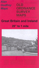
Alan Godfrey Editions of the 25” OS Series:Selected towns in Great Britain and Ireland are covered by maps showing the extent of urban development in the last decades of the 19th and early 20th century. The plans have been taken from the Ordnance Survey mapping and reprinted at about 15 inches to one mile (1:4, 340). On the reverse most maps have historical notes and many also include extracts from contemporary directories. Most maps cover about one mile (1.6kms) north/south, one and a half miles (2.4kms) across; adjoining sheets can be combined to provide wider coverage.FOR MORE INFORMATION AND A COMPLETE LIST OF ALL AVAILABLE TITLES PLEASE CLICK ON THE SERIES LINK.
Alan Godfrey Editions of the 25” OS Series:Selected towns in Great Britain and Ireland are covered by maps showing the extent of urban development in the last decades of the 19th and early 20th century. The plans have been taken from the Ordnance Survey mapping and reprinted at about 15 inches to one mile (1:4, 340). On the reverse most maps have historical notes and many also include extracts from contemporary directories. Most maps cover about one mile (1.6kms) north/south, one and a half miles (2.4kms) across; adjoining sheets can be combined to provide wider coverage.FOR MORE INFORMATION AND A COMPLETE LIST OF ALL AVAILABLE TITLES PLEASE CLICK ON THE SERIES LINK.

Product Description
Reviews/Comments
Add New
Intelligent Comparison
Archived Product
Sheffield North 1903 Stanfords
£3.50
Archived Product

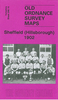
Sheffield Hillsborough 1902 Stanfords
£3.50
Archived Product

Sheffield West 1903 Stanfords
£3.50
Archived Product

Sheffield Park 1903 Stanfords
£3.50
Archived Product
Sheffield And Doncaster 1903 Stanfords
£9.99
Vouchers
No voucher codes found.
Do you know a voucher code for this product or supplier? Add it to Insights for others to use.
Do you know a voucher code for this product or supplier? Add it to Insights for others to use.
 Denmark