
 United Kingdom
 France
 Germany
 Netherlands
 Sweden
 USA
USA
 Italy
Italy
 Spain
Spain
More From Contributor


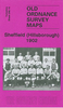

Sheffield Darnall 1903
Sheffield Darnall in 1903 in a fascinating series of reproductions of old Ordnance Survey plans in the Alan Godfrey Editions, ideal for anyone interested in the history of their neighbourhood or family. The map covers the eastern area of Sheffield, including Little Attercliffe and Darnall. Coverage stretches from Ripon Street eastward to High Hazels Park and Handsworth Hill and from Copster Road southward to Corker Bottoms. Features include Nunnery Colliery, Woodbourn Bridge, Darnall Steel Works, Kettle Bridge Brick Works, Aqueduct Brickworks, Darnall Cemetery, Holy Trinity church, St Andrew`s Mission Church, tramways, Victoria Paint Works, etc. The Great Central Railway runs across the map, with Darnall station, Carriage and Wagon Works, Woodbourn Junction, Attercliffe
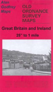
Junction. A small portion of Attercliffe (top left corner) includes Theatre Royal, Pinfold Bridge. A selection of street directory entries is on the reverse, including Bawtry Road, Darnall Road, Industry Road, Main Road and Staniforth Road.About the Alan Godfrey Editions of the 25” OS Series:Selected towns in Great Britain and Ireland are covered by maps showing the extent of urban development in the last decades of the 19th and early 20th century. The plans have been taken from the Ordnance Survey mapping and reprinted at about 15 inches to one mile (1:4, 340). On the reverse most maps have historical notes and many also include extracts from contemporary directories. Most maps cover about one mile (1.6kms) north/south, one and a half miles (2.4kms) across; adjoining sheets can be
combined to provide wider coverage.FOR MORE INFORMATION AND A COMPLETE LIST OF ALL AVAILABLE TITLES PLEASE CLICK ON THE SERIES LINK.

Product Description
Reviews/Comments
Add New
Intelligent Comparison
Archived Product
Sheffield Park 1903 Stanfords
£3.50
Archived Product

Sheffield Central 1903 Stanfords
£3.50
Archived Product
Sheffield North 1903 Stanfords
£3.50
Archived Product

Sheffield Heeley 1903 Stanfords
£3.50
Archived Product

Sheffield West 1903 Stanfords
£3.50
Archived Product

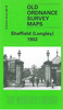
Sheffield Longley 1902 Stanfords
£3.50
Archived Product
Sheffield And Doncaster 1903 Stanfords
£9.99
Archived Product
Sheffield Neepsend 1903 Stanfords
£2.95
Vouchers
No voucher codes found.
Do you know a voucher code for this product or supplier? Add it to Insights for others to use.
Do you know a voucher code for this product or supplier? Add it to Insights for others to use.
 Denmark