
 United Kingdom
 France
 Germany
 Netherlands
 Sweden
 USA
USA
 Italy
Italy
 Spain
Spain
More From Contributor


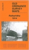

Rotherhithe 1914
Rotherhithe in 1914 in a fascinating series of reproductions of old Ordnance Survey plans in the Alan Godfrey Editions, ideal for anyone interested in the history of their neighbourhood or family. Selected towns in Great Britain and Ireland are covered by maps showing the extent of urban development in the last decades of the 19th and early 20th century.In this title: three versions of this map have been published to show how the area developed across the years. The maps each cover the same area, stretching from Lower Road and Thames Tunnel eastward to Alpha Road, from Rotherhithe Road and the Thames southward to Greenland Dock. The maps cover most of Rotherhithe with its docks, and also the western part of the Isle of Dogs, and a small bit of Wapping. Features include Shadwell Old
Basin, West Ferry Road, Union Docks, Limehouse Basin, the western parts of West India Dock and South Dock; Surrey Commercial Docks including Lavender Pond, Stave Dock, Albion Dock, Canada Dock, Quebec Pond, Russia Dock, Lady Dock, Norway Dock, Greenland Dock; also Surrey Basin, Surrey Canal, Sulphur Works, St Olave's Union Infirmary, tramways, Barnard's Wharf, Durand's Wharf and many other wharves; part of Southwark Park. Churches include St Mary's Rotherhithe, All Saints, St Luke's Alpha Road. Streets include West Ferry Road, Commercial Dock Road, Adam Street, Albion Street, part of Wapping High Street. The maps also include extracts from contemporary directories; the 1868 map has street directory for Millwall and Rotherhithe Street.About the Alan Godfrey Editions
of the 25
Product Description
Reviews/Comments
Add New
Intelligent Comparison
Archived Product

Rotherhithe 1914 Stanfords
£3.50
Archived Product

Rotherhithe 1894 Stanfords
£3.50
Archived Product

Rotherhithe 1868 Stanfords
£3.50
Archived Product

Rotherham 1901 Stanfords
£3.50
Archived Product
Rotherham South 1901 Stanfords
£3.50
Vouchers
No voucher codes found.
Do you know a voucher code for this product or supplier? Add it to Insights for others to use.
Do you know a voucher code for this product or supplier? Add it to Insights for others to use.
 Denmark