
 United Kingdom
 France
 Germany
 Netherlands
 Sweden
 USA
USA
 Italy
Italy
 Spain
Spain
More From Contributor


Rotherham 1901
Rotherham in 1901 in a fascinating series of reproductions of old Ordnance Survey plans in the Alan Godfrey Editions, ideal for anyone interested in the history of their neighbourhood or family. Two versions have been published for this area, stretching from Masbrough Street eastward to Western Road, and from Kenneth Street southward to Reneville Road. Rotherham town centre is covered and features include Central station, Westgate station, Workhouse, Rotherham Old Brewery, cattle market, River Don, Sheffield & South Yorkshire Navigation, hospital, All Saints church, Effingham Works, Rotherham Forge, Clifton Park, cholera burial ground, race course, Clifton House, Market Hall, etc. Both maps have selections from contemporary street directory entries, those for the 1922
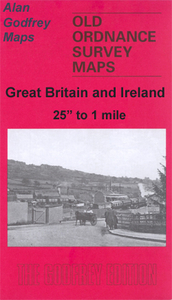
map including College Street, The Crofts, Frederick Street, High Street, Moorgate Street and Wharncliffe Street.About the Alan Godfrey Editions of the 25” OS Series:Selected towns in Great Britain and Ireland are covered by maps showing the extent of urban development in the last decades of the 19th and early 20th century. The plans have been taken from the Ordnance Survey mapping and reprinted at about 15 inches to one mile (1:4, 340). On the reverse most maps have historical notes and many also include extracts from contemporary directories. Most maps cover about one mile (1.6kms) north/south, one and a half miles (2.4kms) across; adjoining sheets can be combined to provide wider coverage.FOR MORE INFORMATION AND A COMPLETE LIST OF ALL AVAILABLE TITLES PLEASE CLICK ON THE SERIES
LINK.

Product Description
Reviews/Comments
Add New
Intelligent Comparison
Archived Product
Rotherham 1922 Stanfords
£3.50
Archived Product
Rotherham South 1901 Stanfords
£3.50
Archived Product
Rotherhithe 1914 Stanfords
£2.95
Archived Product

Rotherhithe 1914 Stanfords
£3.50
Vouchers
No voucher codes found.
Do you know a voucher code for this product or supplier? Add it to Insights for others to use.
Do you know a voucher code for this product or supplier? Add it to Insights for others to use.
 Denmark