
 United Kingdom
 France
 Germany
 Netherlands
 Sweden
 USA
USA
 Italy
Italy
 Spain
Spain
More From Contributor


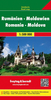
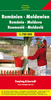

Romania & Moldova ITMB
Romania at 1:850, 000 and Moldova at 1:445, 000 on a double-sided indexed map from ITMB, showing the topography of the two countries by altitude colouring, with street plans of central Bucharest and Chisinau.Each country is presented separately on one side of the map. The map of Moldova is shown with north-east rather than the conventional north at the top of the sheet, so that the country can be presented at a better scale. Topography is shown by altitude colouring with spot heights, plus graphics for swamps, forests, orchards and vineyards.Road network includes selected local roads and tracks; driving distances are marked on main and selected secondary routes. Railway lines are included and local airports are marked. Also shown are internal administrative boundaries with names of
the provinces. A range of symbols highlight various place of interest, including locations with tourist accommodation. The map of Romania has no geographical coordinates; on the Moldova map latitude and longitude are shown as margin ticks at 30’ intervals. Each country has a separate index. Also provided are large, clear street plans of central Bucharest and Chisinau, highlighting various facilities, including selected hotels, and places of interest.
the provinces. A range of symbols highlight various place of interest, including locations with tourist accommodation. The map of Romania has no geographical coordinates; on the Moldova map latitude and longitude are shown as margin ticks at 30’ intervals. Each country has a separate index. Also provided are large, clear street plans of central Bucharest and Chisinau, highlighting various facilities, including selected hotels, and places of interest.

Product Description
Reviews/Comments
Add New
Intelligent Comparison
Archived Product
Romania - Moldova F&B Stanfords
£10.99
Archived Product
Romania - Moldova F&B Stanfords
£10.99
Archived Product
Romania - Moldova Stanfords
£9.50
Archived Product
Romania And Moldova Stanfords
£9.95
Archived Product
Romania And Moldova Stanfords
£4.99
Vouchers
No voucher codes found.
Do you know a voucher code for this product or supplier? Add it to Insights for others to use.
Do you know a voucher code for this product or supplier? Add it to Insights for others to use.
 Denmark