
 United Kingdom
 France
 Germany
 Netherlands
 Sweden
 USA
USA
 Italy
Italy
 Spain
Spain
More From Contributor


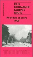
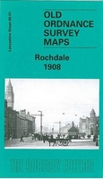
Rochdale South 1908
Rochdale South in 1908 in a fascinating series of reproductions of old Ordnance Survey plans in the Alan Godfrey Editions, ideal for anyone interested in the history of their neighbourhood or family. The map covers the southern part of Rochdale, extending from Rochdale station southward to Balderstone Hall and Buersill, and from Boundary Street eastward to Moss Side Lane. Features include Rochdale station, part of railway works, Lower Lane Iron Works, Rochdale Canal, tramways, Lower Place, Stoneyfield, part of Castleton Wards South and East, and many mills, including Eagle Mill, Green Mill, Dicken Green Mill, Norwich Street Mills, Grove Mills, Era Mill, Victoria Mill, Moss Mill, State Mill and others. Extracts from a street directory are on the reverse, including Hare
Street, King Street East, Oldham Road and Royds Street. About the Alan Godfrey Editions of the 25” OS Series:Selected towns in Great Britain and Ireland are covered by maps showing the extent of urban development in the last decades of the 19th and early 20th century. The plans have been taken from the Ordnance Survey mapping and reprinted at about 15 inches to one mile (1:4, 340). On the reverse most maps have historical notes and many also include extracts from contemporary directories. Most maps cover about one mile (1.6kms) north/south, one and a half miles (2.4kms) across; adjoining sheets can be combined to provide wider coverage.FOR MORE INFORMATION AND A COMPLETE LIST OF ALL AVAILABLE TITLES PLEASE CLICK ON THE SERIES LINK.
Street, King Street East, Oldham Road and Royds Street. About the Alan Godfrey Editions of the 25” OS Series:Selected towns in Great Britain and Ireland are covered by maps showing the extent of urban development in the last decades of the 19th and early 20th century. The plans have been taken from the Ordnance Survey mapping and reprinted at about 15 inches to one mile (1:4, 340). On the reverse most maps have historical notes and many also include extracts from contemporary directories. Most maps cover about one mile (1.6kms) north/south, one and a half miles (2.4kms) across; adjoining sheets can be combined to provide wider coverage.FOR MORE INFORMATION AND A COMPLETE LIST OF ALL AVAILABLE TITLES PLEASE CLICK ON THE SERIES LINK.

Product Description
Reviews/Comments
Add New
Intelligent Comparison
Archived Product
Rochdale 1908 Stanfords
£3.50
Archived Product
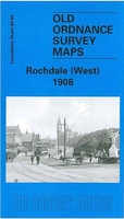
Rochdale West 1908 Stanfords
£2.95
Archived Product
Rochdale West 1908 Stanfords
£3.50
Archived Product
Horwich South 1908 Stanfords
£2.95
Archived Product

Horwich South 1908 Stanfords
£3.50
Archived Product

Colne South 1910 Stanfords
£3.50
Archived Product
Rochdale South West & Sudden 1908 Stanfords
£2.95
Archived Product
Rotherham South 1901 Stanfords
£3.50
Vouchers
No voucher codes found.
Do you know a voucher code for this product or supplier? Add it to Insights for others to use.
Do you know a voucher code for this product or supplier? Add it to Insights for others to use.
 Denmark