
 United Kingdom
 France
 Germany
 Netherlands
 Sweden
 USA
USA
 Italy
Italy
 Spain
Spain
More From Contributor


Portishead North 1930
Portishead North in 1930 in a fascinating series of reproductions of old Ordnance Survey plans in the Alan Godfrey Editions, ideal for anyone interested in the history of their neighbourhood or family. Portishead is covered on three maps. This title covers the northern part of the town, extending from Rockleigh and Kilkenny Bay eastward to Portishead Dock. Features include Woodhill, most of Portishead Dock, Pier, Royal Hotel, Portishead station, Portbury Wharf, engine shed, Marine Lake, Portishead Point, Adelaide Terrace, timber wharf. On the reverse is a list of private residents from a 1920s directory. About the Alan Godfrey Editions of the 25” OS SeriesSelected towns in Great Britain and Ireland are covered by maps showing the extent of urban development in the last
decades of the 19th and early 20th century. The plans have been taken from the Ordnance Survey mapping and reprinted at about 15 inches to one mile (1:4, 340). On the reverse most maps have historical notes and many also include extracts from contemporary directories. Most maps cover about one mile (1.6kms) north/south, one and a half miles (2.4kms) across; adjoining sheets can be combined to provide wider coverage.FOR MORE INFORMATION AND A COMPLETE LIST OF ALL AVAILABLE TITLES PLEASE CLICK ON THE SERIES LINK.
decades of the 19th and early 20th century. The plans have been taken from the Ordnance Survey mapping and reprinted at about 15 inches to one mile (1:4, 340). On the reverse most maps have historical notes and many also include extracts from contemporary directories. Most maps cover about one mile (1.6kms) north/south, one and a half miles (2.4kms) across; adjoining sheets can be combined to provide wider coverage.FOR MORE INFORMATION AND A COMPLETE LIST OF ALL AVAILABLE TITLES PLEASE CLICK ON THE SERIES LINK.

Product Description
Reviews/Comments
Add New
Intelligent Comparison
Archived Product

Portishead West 1930 Stanfords
£3.50
Archived Product

Portishead East 1930 Stanfords
£3.50
Archived Product

Horsham North 1932 Stanfords
£3.50
Archived Product

Northfield North 1903 Stanfords
£3.50
Archived Product
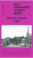
Norwich North 1905 Stanfords
£3.50
Archived Product
Horwich North 1907 Stanfords
£2.95
Archived Product

Horwich North 1907 Stanfords
£3.50
Archived Product

Nottingham North 1913 Stanfords
£3.50
Vouchers
No voucher codes found.
Do you know a voucher code for this product or supplier? Add it to Insights for others to use.
Do you know a voucher code for this product or supplier? Add it to Insights for others to use.
 Denmark