
 United Kingdom
 France
 Germany
 Netherlands
 Sweden
 USA
USA
 Italy
Italy
 Spain
Spain
More From Contributor


Nottingham North 1913
Nottingham North in 1913 in a fascinating series of reproductions of old Ordnance Survey plans in the Alan Godfrey Editions, ideal for anyone interested in the history of their neighbourhood or family. The map covers the north part of Nottingham, including the Carrington area, much of Mapperley and Alexandra Park. Coverage stretches from Exeter Road eastward to The Wells Road, and from St Ann`s Hill northward to Percival Road. Features include Forest House, tramways, Carrington station, Sherwood Hill Works, Forest Recreation Ground, Bellevue Reservoir, St John`s church, Hungerhill Gardens, Stonepit Coppice Gardens, Alexandra Park area, Lunatic Asylum, Mapperley Hall, St Jude`s church, Carrington Market Place, etc. On the reverse are street directory entries for Magdala
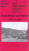
Road, Redcliffe Road, Private Road, Sherwood Rise and Woodborough Road in 1902.About the Alan Godfrey Editions of the 25” OS Series:Selected towns in Great Britain and Ireland are covered by maps showing the extent of urban development in the last decades of the 19th and early 20th century. The plans have been taken from the Ordnance Survey mapping and reprinted at about 15 inches to one mile (1:4, 340). On the reverse most maps have historical notes and many also include extracts from contemporary directories. Most maps cover about one mile (1.6kms) north/south, one and a half miles (2.4kms) across; adjoining sheets can be combined to provide wider coverage.FOR MORE INFORMATION AND A COMPLETE LIST OF ALL AVAILABLE TITLES PLEASE CLICK ON THE SERIES LINK.
Road, Redcliffe Road, Private Road, Sherwood Rise and Woodborough Road in 1902.About the Alan Godfrey Editions of the 25” OS Series:Selected towns in Great Britain and Ireland are covered by maps showing the extent of urban development in the last decades of the 19th and early 20th century. The plans have been taken from the Ordnance Survey mapping and reprinted at about 15 inches to one mile (1:4, 340). On the reverse most maps have historical notes and many also include extracts from contemporary directories. Most maps cover about one mile (1.6kms) north/south, one and a half miles (2.4kms) across; adjoining sheets can be combined to provide wider coverage.FOR MORE INFORMATION AND A COMPLETE LIST OF ALL AVAILABLE TITLES PLEASE CLICK ON THE SERIES LINK.

Product Description
Reviews/Comments
Add New
Intelligent Comparison
Archived Product

Nottingham North West 1913 Stanfords
£3.00
Archived Product

Tottenham North 1936 Stanfords
£3.50
Archived Product

Birmingham North 1913 Stanfords
£3.50
Archived Product

Nottingham South 1899 Stanfords
£3.50
Archived Product

Tottenham North 1894 Stanfords
£3.50
Archived Product
Nottingham Radford 1899 Stanfords
£2.95
Archived Product

Nottingham Radford 1899 Stanfords
£3.50
Archived Product

Horsham North 1932 Stanfords
£3.50
Vouchers
No voucher codes found.
Do you know a voucher code for this product or supplier? Add it to Insights for others to use.
Do you know a voucher code for this product or supplier? Add it to Insights for others to use.
 Denmark