More From Contributor

£14.99
Nottingham Pevsner Architectural Guide, in a series of publications begun with the express aim of providing up-to-date guides to the most significant buildings in every part of the country, suitable for both general reader & specialist. Each volume provides an introductory overview of the architecture of the area, followed by a descriptive gazetteer arranged alphabetically by place. Whilst cathedrals & their furnishings, great country houses & their parks form the grand set pieces, the books demonstrate the enjoyable diversity of architecture in the British Isles in accounts of rural churches & farmsteads, Victorian public buildings & industrial monuments. A continuing programme of publication keeps the series up-to-date with new information on older buildings & recent architecture while maintaining the tradition of Pevsner`s own succinct accounts. Each book has over 100 photographs, mostly specially commissioned, numerous maps & plans, a glossary & indexes. ...
Archived Product
£5.50
Nottingham Premier Street Plan from Geographers' A-Z Map Company designed to cover the city within its administrative boundaries, with a separate comprehensive index booklet listing streets, places & areas, industrial estates, hospitals, selected flats & walkways, service areas, stations & selected places of interest, shown where appropriate with their postcodes. The city is covered at 3 ...
Archived Product
£24.99
Nottingham Premier Wall Map, size 117 x 91cm, encapsulated version, from Geographers' A-Z Map Company designed to cover the city within its administrative boundaries, with a comprehensive index booklet listing streets, places & areas, industrial estates, hospitals, selected flats & walkways, service areas, stations & selected places of interest, shown where appropriate with their postcodes. The city is covered at 3 ...
Archived Product
£6.99
Nottingham Premier Wall Map, size 117 x 91cm, paper version, from Geographers' A-Z Map Company designed to cover the city within its administrative boundaries, with a comprehensive index booklet listing streets, places & areas, industrial estates, hospitals, selected flats & walkways, service areas, stations & selected places of interest, shown where appropriate with their postcodes. The city is covered at 3 ...
Archived Product
£2.95
Nottingham Radford in 1899 in a fascinating series of reproductions of old Ordnance Survey plans in the Alan Godfrey Editions, ideal for anyone interested in the history of their neighbourhood or family. Selected towns in Great Britain & Ireland are covered by maps showing the extent of urban development in the last decades of the 19th & early 20th century. In this title: the map covers the western part of Nottingham around Radford, stretching from Newdigate Street & Tennyson Street westward to Radford Woodhouse, & from Gregory Boulevard southward to Lincoln Circus. Features include Old Radford area, New Radford area, parts of Wollaton & Sherwood Wards, Christ Church, Bloomsgrove Works, Cycle Works, All Souls church, St Michael's church, St Peter's church, Children's Training Institute, tobacco warehouse & factory, Midland Railway with Radford station & junction, Nottingham Canal, Radford Bridge, gas works, tramways etc. On the reverse are street directories for Denman Street, Forster Street, Independent Street & Radford Boulevard. About the Alan Godfrey Editions of the 25 ...
Archived Product
£2.95
Nottingham Sherwood in 1899 in a fascinating series of reproductions of old Ordnance Survey plans in the Alan Godfrey Editions, ideal for anyone interested in the history of their neighbourhood or family. Selected towns in Great Britain & Ireland are covered by maps showing the extent of urban development in the last decades of the 19th & early 20th century. In this title: the map covers the Sherwood area, on the north side of Nottingham. Coverage extends northward to Thackeray's Lane. Features include GNR railway with Sherwood station, Mapperley Brick Works with railway incline, Lace Factory, Woodthorpe Grange, Breck Hill Farm, Woodthorpe House, Bagthorpe Hospital, Workhouse under construction, The Cedars & Woodthorpe Lodge convalescent hospitals, Arno Vale. On the reverse are street directories for Mansfield Road for 1891 & 1902. About the Alan Godfrey Editions of the 25 ...
Archived Product
£3.00
Nottingham Sherwood in 1899 in a fascinating series of reproductions of old Ordnance Survey plans in the Alan Godfrey Editions, ideal for anyone interested in the history of their neighbourhood or family. The map covers the Sherwood area, on the north side of Nottingham. Coverage extends northward to Thackeray`s Lane. Features include GNR railway with Sherwood station, Mapperley Brick Works with railway incline, Lace Factory, Woodthorpe Grange, Breck Hill Farm, Woodthorpe House, Bagthorpe Hospital, Workhouse under construction, The Cedars & Woodthorpe Lodge convalescent hospitals, Arno Vale, etc. On the reverse are street directories for Mansfield Road for 1891 & 1902. About the Alan Godfrey Editions of the 25” OS Series: Selected towns in Great Britain & Ireland are covered by maps showing the extent of urban development in the last decades of the 19th & early 20th century. The plans have been taken from the Ordnance Survey mapping & reprinted at about 15 inches to one mile (1:4, 340). On the reverse most maps have historical notes & many also include extracts from contemporary directories. Most maps cover about one mile (1.6kms) north/south, one & a half miles (2.4kms) across; adjoining sheets can be combined to provide wider coverage.FOR MORE INFORMATION & A COMPLETE LIST OF ALL AVAILABLE TITLES PLEASE CLICK ON THE SERIES LINK. ...
Archived Product
£3.50
Nottingham South in 1899 in a fascinating series of reproductions of old Ordnance Survey plans in the Alan Godfrey Editions, ideal for anyone interested in the history of their neighbourhood or family. The map covers the southern part of Nottingham, stretching from Broad Marsh & Narrow Marsh southward to Trent Bridge cricket ground, & from Holles Crescent eastward to Sneinton Hollows. Features include River Trent, Forest football ground, Trent Bridge, St Christopher`s church, Midland Railway with main station, locomotive sheds, Mansfield Junction, GNR railway with terminus, carriage shed, Sneinton Junction, GCR railway with engine shed, carriage shed, Meadows Cricket Ground, tramways, Nottingham Canal, St George`s church, Nottingham Castle, LNWR railway goods branch with goods shed, East Croft, Hay Market, St Gabriel`s church, Tinkers Leen, bonded stores, St Nicholas church, etc. On the reverse are street directory entries for Arkwright Street, Broad Marsh, Canal Street & Narrow Marsh. * About the Alan Godfrey Editions of the 25” OS Series: Selected towns in Great Britain & Ireland are covered by maps showing the extent of urban development in the last decades of the 19th & early 20th century. The plans have been taken from the Ordnance Survey mapping & reprinted at about 15 inches to one mile (1:4, 340). On the reverse most maps have historical notes & many also include extracts from contemporary directories. Most maps cover about one mile (1.6kms) north/south, one & a half miles (2.4kms) across; adjoining sheets can be combined to provide wider coverage.FOR MORE INFORMATION & A COMPLETE LIST OF ALL AVAILABLE TITLES PLEASE CLICK ON THE SERIES LINK. ...
Archived Product
£5.50
Nottingham, Ilkeston, Long Eaton & West Bridgford Street Atlas from the Geographers` A-Z Map Company in a paperback format slightly smaller than A5. Map scale is 1:15, 850 (4” to a mile), with an enlargement showing the town centre of Nottingham in greater detail at 1:7, 920 (8” to 1 mile). Coverage

Includes::
Arnold, Beeston, Bingham, Burton Joyce, Calverton, Carlton, Cotgrave, Eastwood, Heanor, Hucknall, Keyworth, Kirk Hallam, Ruddington & Stapleford. Current edition of this title was published in 2013. To see other titles in this series of A-Z street atlases of towns & cities please click on the series link. A-Z also publish a series of County Street Atlases
- for a list of titles in that series please search for SI00000917.A-Z street atlases present motorways plus A & B roads highlighted by colouring & shown with route numbers. One way or restricted access streets & car parks are marked, as are in more recently published titles locations of speed cameras. Also shown are selected cycleway routes. Where appropriate, A & B roads are annotated with selected house numbers for easier identification of addresses. Railway lines are shown with stations & level crossings. Colouring indicates different types of buildings: educational, hospitals & healthcare, industrial, leisure & recreational, shopping centres & markets, public buildings, & places of interest. Symbols mark locations of facilities usually indicated on street mapping: post offices, emergency services, public toilets, etc. Also marked are postcode & local authority boundaries. Each page has the lines & coordinates of the British National Grid. The indexes list streets, places & areas, hospitals, industrial estates, blocks of flats on housing estates, railway stations, & selected places o interest; the latter are printed in contrasting colouring to make them easier to find.


...
Archived Product
£14.99
Waterproof & tear-resistant OS Active version of map No. 129 from the Ordnance Survey’s Landranger series at 1:50, 000, with contoured & GPS compatible topographic mapping plus tourist information.MOBILE DOWNLOADS: As well as the physical edition of the map, each Landranger title now

Includes::
a code for downloading after purchase its digital version onto your smartphone or tablet for viewing on the OS smartphone app.OS LANDRANGER SERIES: to see the list of all the titles in the OS Landranger series, both paper & waterproof versions, please click on the series link. Maps in the Landranger series provide plenty of recreational & tourist information, indicating the traditional public right of way paths (except in Scotland where different laws apply), including bridleways & byways restricted or open to motorized traffic. National Trails & selected other long-distance paths are marked, as well as on-road & traffic-free cycle routes with their National/ Regional Cycle Network numbers. National Trust/ National Trust for Scotland & Forestry Commission land is clearly marked, indicating open or restricted access. A range of symbols highlights camping & caravanning sites, youth hostels, tourist information offices & visitors’ centres, parking & picnicking places, World Heritage sites, sport & recreational facilities, etc. The maps provide detailed presentation of topography with contours at 10m intervals, numerous spot heights & additional colouring and/or graphics for different types of woodlands, orchards or parkl&, rock features including scree & cliffs, water features inland & along the sea shore with marshl&, dunes, s&, mud, shingle & the high water mark. All the standard information expected of survey mapping at this scale is included: finely graded road network, railway lines with stations, cuttings, embankments, etc; individual isolated buildings; archaeological & historical sites, etc. For GPS users the British National Grid is shown at 1km intervals, with latitude & longitude given by margin ticks at 1` & cross hairs on the map at 5`. Each map covers an area of 40 x 40km, (approx. 25 x 25 miles).

...
Archived Product

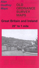
Nottingham Radford 1899

Nottingham Radford in 1899 in a fascinating series of reproductions of old Ordnance Survey plans in the Alan Godfrey Editions, ideal for anyone interested in the history of their neighbourhood or family. The map covers the western part of Nottingham around Radford, stretching from Newdigate Street and Tennyson Street westward to Radford Woodhouse, and from Gregory Boulevard southward to Lincoln Circus. Features include Old Radford area, New Radford area, parts of Wollaton and Sherwood Wards, Christ Church, Bloomsgrove Works, Cycle Works, All Souls church, St Michael`s church, St Peter`s church, Children`s Training Institute, tobacco warehouse and factory, Midland Railway with Radford station and junction, Nottingham Canal, Radford Bridge, gas works, tramways, etc. On the
reverse are street directories for Denman Street, Forster Street, Independent Street and Radford Boulevard. About the Alan Godfrey Editions of the 25” OS Series:Selected towns in Great Britain and Ireland are covered by maps showing the extent of urban development in the last decades of the 19th and early 20th century. The plans have been taken from the Ordnance Survey mapping and reprinted at about 15 inches to one mile (1:4, 340). On the reverse most maps have historical notes and many also include extracts from contemporary directories. Most maps cover about one mile (1.6kms) north/south, one and a half miles (2.4kms) across; adjoining sheets can be combined to provide wider coverage.FOR MORE INFORMATION AND A COMPLETE LIST OF ALL AVAILABLE TITLES PLEASE CLICK ON THE SERIES LINK.
RIP - This product is no longer available on our network. It was last seen on 25.09.2019

This page now acts as a permanent archive for this product. Add more information using the comments box below to ensure it can still be found by future generations.

Use our search facility to see if it is available from an alternative contributor.
  • External links may include paid for promotion
  • Availability: Out Of Stock
  • Supplier: Stanfords
  • SKU: 9781847843593
Availability: In Stock
£3.50

Product Description

Nottingham Radford in 1899 in a fascinating series of reproductions of old Ordnance Survey plans in the Alan Godfrey Editions, ideal for anyone interested in the history of their neighbourhood or family. The map covers the western part of Nottingham around Radford, stretching from Newdigate Street & Tennyson Street westward to Radford Woodhouse, & from Gregory Boulevard southward to Lincoln Circus. Features include Old Radford area, New Radford area, parts of Wollaton & Sherwood Wards, Christ Church, Bloomsgrove Works, Cycle Works, All Souls church, St Michael`s church, St Peter`s church, Children`s Training Institute, tobacco warehouse & factory, Midland Railway with Radford station & junction, Nottingham Canal, Radford Bridge, gas works, tramways, etc. On the reverse are street directories for Denman Street, Forster Street, Independent Street & Radford Boulevard. About the Alan Godfrey Editions of the 25” OS Series: Selected towns in Great Britain & Ireland are covered by maps showing the extent of urban development in the last decades of the 19th & early 20th century. The plans have been taken from the Ordnance Survey mapping & reprinted at about 15 inches to one mile (1:4, 340). On the reverse most maps have historical notes & many also include extracts from contemporary directories. Most maps cover about one mile (1.6kms) north/south, one & a half miles (2.4kms) across; adjoining sheets can be combined to provide wider coverage.FOR MORE INFORMATION & A COMPLETE LIST OF ALL AVAILABLE TITLES PLEASE CLICK ON THE SERIES LINK.

Reviews/Comments

Add New

Intelligent Comparison

Oooops!
We couldn't find anything!
Perhaps this product's unique.... Or perhaps we are still looking for comparisons!
Click to bump this page and we'll hurry up.

Price History

Vouchers

No voucher codes found.
Do you know a voucher code for this product or supplier? Add it to Insights for others to use.

Facebook

Jargon Buster

Contemporary - Modern era design
Contemporary - A design reference to indicate post war modern design
History - Anything that happens in the past. An acedemic subject.
Contemporary - An object that is living in the same time.
Junction - A point where two or more things come together, typically used to describe roads
Children - A young life form within the early stages of physical development,
Ideal - Something that satisfies a perfect criteria.
Family - A group of people that live together made up from parents and children.

Supplier Information

Stanfords
Stanfords was established in 1853 and opened their iconic Covent Garden flagship store in 1901. They have become the top retailer of maps, travel books and accessories in the UK and arguably offer the largest selection of maps and travel books worldwide. Famous names such as Captain Robert Falcon Scott, Ranulph Fiennes and Michael Palin have purchased from Stanfords. They now have a shop in Bristol and both stores together with other venues operate a calendar of events including talks, book signings and exhibitions. As a specialist map retailer, the map selection is comprehensive and includes road maps, street maps and walking maps from worldwide destinations, as well as a selection of world atlases and wall maps. Books include travel guides and travel literature. Stanfords also stock globes, from miniatures made of blue marble to magnificent floor-standing globes. The website features a selection of interesting articles on travel topics.
Page Updated: 2023-11-12 20:15:36

Community Generated Product Tags

Oh No! The productWIKI community hasn't generated any tags for this product yet!
Menu