
 United Kingdom
 France
 Germany
 Netherlands
 Sweden
 USA
USA
 Italy
Italy
 Spain
Spain
More From Contributor


Pelsall South 1901
Pelsall South in 1901 in a fascinating series of reproductions of old Ordnance Survey plans in the Alan Godfrey Editions, ideal for anyone interested in the history of their neighbourhood or family. The map covers much of Pelsall village, stretching from Pelsall post office and Railswood Farm southward to Heath End. Shelfield is in the bottom right corner. Features include Pelsall Common, railway with station and Leigh`s Wood Junction, Heath End Brickworks, St Michael`s church, Pelsall Foundry, Pelsall Hall, Queen`s Hotel, High Heath, Shelfield Lodge, Shelfield House, Goscote Hall, etc. On the reverse are directories for Pelsall and Rushall.About the Alan Godfrey Editions of the 25” OS Series:Selected towns in Great Britain and Ireland are covered by maps showing the extent
of urban development in the last decades of the 19th and early 20th century. The plans have been taken from the Ordnance Survey mapping and reprinted at about 15 inches to one mile (1:4, 340). On the reverse most maps have historical notes and many also include extracts from contemporary directories. Most maps cover about one mile (1.6kms) north/south, one and a half miles (2.4kms) across; adjoining sheets can be combined to provide wider coverage.FOR MORE INFORMATION AND A COMPLETE LIST OF ALL AVAILABLE TITLES PLEASE CLICK ON THE SERIES LINK.
of urban development in the last decades of the 19th and early 20th century. The plans have been taken from the Ordnance Survey mapping and reprinted at about 15 inches to one mile (1:4, 340). On the reverse most maps have historical notes and many also include extracts from contemporary directories. Most maps cover about one mile (1.6kms) north/south, one and a half miles (2.4kms) across; adjoining sheets can be combined to provide wider coverage.FOR MORE INFORMATION AND A COMPLETE LIST OF ALL AVAILABLE TITLES PLEASE CLICK ON THE SERIES LINK.

Product Description
Reviews/Comments
Add New
Intelligent Comparison
Archived Product
Walsall South East 1901 Stanfords
£2.95
Archived Product

Walsall South East 1901 Stanfords
£3.50
Archived Product
Kendall South 1911 Stanfords
£2.95
Archived Product

Kendal South 1911 Stanfords
£3.50
Archived Product
Belfast South 1920 Stanfords
£2.95
Archived Product

Pelsall North 1883 Stanfords
£3.50
Archived Product
Maghull South 1906 Stanfords
£2.95
Archived Product
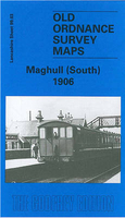
Maghull South 1906 Stanfords
£3.50
Vouchers
No voucher codes found.
Do you know a voucher code for this product or supplier? Add it to Insights for others to use.
Do you know a voucher code for this product or supplier? Add it to Insights for others to use.
 Denmark