
 United Kingdom
 France
 Germany
 Netherlands
 Sweden
 USA
USA
 Italy
Italy
 Spain
Spain
More From Contributor

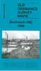

Northwich North East 1908
Northwich North East in 1908 in a fascinating series of reproductions of old Ordnance Survey plans in the Alan Godfrey Editions, ideal for anyone interested in the history of their neighbourhood or family. Selected towns in Great Britain and Ireland are covered by maps showing the extent of urban development in the last decades of the 19th and early 20th century.In this title: the map covers the north-eastern part of Northwich, plus parts of Lostock Gralam and Wincham. Coverage stretches from Brook Street (Northwich) eastward to Wincham Hall and northward to Chapel Street (Wincham). Features include St Helen's church, Northwich; Cheshire Lines Railway with Northwich station, engine shed, mineral railways, sidings; Witton Sewage Farm, Ashton's Salt Works, Ashton's Flashes,
Neumann's Flashes, Manor Croft, Nelson Pumping Station, Lostock Salt Works, Trent & Mersey Canal, Lostock Bleach Works, Lostock Alkali Works, Wincham Mills, Winchambrook Pumping Station, Victoria Salt Works, Wincham Hall, Wincham Brook etc. On the reverse are the Northwich Commercial directory, entries M-Y, plus a railway timetable for the Crewe-Northwich-Greenbank line.About the Alan Godfrey Editions of the 25
Neumann's Flashes, Manor Croft, Nelson Pumping Station, Lostock Salt Works, Trent & Mersey Canal, Lostock Bleach Works, Lostock Alkali Works, Wincham Mills, Winchambrook Pumping Station, Victoria Salt Works, Wincham Hall, Wincham Brook etc. On the reverse are the Northwich Commercial directory, entries M-Y, plus a railway timetable for the Crewe-Northwich-Greenbank line.About the Alan Godfrey Editions of the 25
Product Description
Reviews/Comments
Add New
Intelligent Comparison
Archived Product

Northwich North East 1908 Stanfords
£3.50
Archived Product
Northwich South West 1908 Stanfords
£2.95
Archived Product
Norwich North West 1905 Stanfords
£2.95
Archived Product

Norwich North West 1905 Stanfords
£3.50
Archived Product

Northwich South-West 1908 Stanfords
£3.50
Archived Product
Norwich North 1905 Stanfords
£3.50
Archived Product
Horwich North 1907 Stanfords
£2.95
Archived Product

Horwich North 1907 Stanfords
£3.50
Vouchers
No voucher codes found.
Do you know a voucher code for this product or supplier? Add it to Insights for others to use.
Do you know a voucher code for this product or supplier? Add it to Insights for others to use.
 Denmark