More From Contributor

£11.19
Laminated waterproof edition of a detailed topographic map from the Ordnance Survey Explorer series, covering Winsford & Middlewich. Edition A2; Publication date February 2012 About this series: These highly detailed maps show all the administrative boundaries, settlements as small as isolated farms, the road network down to unfenced roads & country tracks, & field boundaries (hedges & drystone walls) which make navigation across the countryside much easier. Steep gradients on roads are indicated. Various landmarks, e.g. powerlines, archaeological sites, windmills, churches & lighthouses are shown & additional graphics indicate natural terrain features such as cliffs, scree, mud & vegetation variations. The contour interval is 5 metres in the lower parts of the country & 10 metres in the uplands, & spot heights are marked. Each map covers an area of 30 x 20km (i.e. approx. 19 x 12 miles), with some double-sided maps covering more, as indicated in the individual descriptions. The maps are fully GPS compatible, with the National Grid shown at 1km intervals & latitude & longitude indicated by margin ticks at 1'. The Explorer series has replaced the earlier, green-cover Pathfinder maps. The Explorer series is now complete & covers all of Engl&, Wales & Scotl&. Some sheets for popular areas like the National Parks are still branded as Outdoor Leisure (OL) maps, but are now included in this series as the cartography is the same as that in the Explorer Maps. The Explorer maps offer a substantial improvement on the Pathfinder series, with greater use of colour, larger area per map, & stronger emphasis on information for ramblers & tourists. This series is ideal for walking & other outdoor pursuits & each map shows a large amount of information for ramblers & tourists. Public rights of way are shown (except in Scotland), together with other routes with public access: National Trails & Recreational Paths, permitted paths & bridleways, & selected cycle routes. Open access land created under the Countryside & Rights of Way Act 2000 is marked. Tourist information

Includes::
caravan & camp sites, Park & Ride locations, recreation/leisure/sport centres, museums, historic buildings, English Heritage & National Trust sites, rural pubs, etc. The map legend is in English only, except for the tourist information content which is also in French & German.

...
Archived Product
£2.95
Northwich North East in 1908 in a fascinating series of reproductions of old Ordnance Survey plans in the Alan Godfrey Editions, ideal for anyone interested in the history of their neighbourhood or family. Selected towns in Great Britain & Ireland are covered by maps showing the extent of urban development in the last decades of the 19th & early 20th century. In this title: the map covers the north-eastern part of Northwich, plus parts of Lostock Gralam & Wincham. Coverage stretches from Brook Street (Northwich) eastward to Wincham Hall & northward to Chapel Street (Wincham). Features include St Helen's church, Northwich; Cheshire Lines Railway with Northwich station, engine shed, mineral railways, sidings; Witton Sewage Farm, Ashton's Salt Works, Ashton's Flashes, Neumann's Flashes, Manor Croft, Nelson Pumping Station, Lostock Salt Works, Trent & Mersey Canal, Lostock Bleach Works, Lostock Alkali Works, Wincham Mills, Winchambrook Pumping Station, Victoria Salt Works, Wincham Hall, Wincham Brook etc. On the reverse are the Northwich Commercial directory, entries M-Y, plus a railway timetable for the Crewe-Northwich-Greenbank line. About the Alan Godfrey Editions of the 25 ...
Archived Product
£3.50
Northwich North East in 1908 in a fascinating series of reproductions of old Ordnance Survey plans in the Alan Godfrey Editions, ideal for anyone interested in the history of their neighbourhood or family. The map covers the north-eastern part of Northwich, plus parts of Lostock Gralam & Wincham. Coverage stretches from Brook Street (Northwich) eastward to Wincham Hall & northward to Chapel Street (Wincham). Features include St Helen`s church, Northwich; Cheshire Lines Railway with Northwich station, engine shed, mineral railways, sidings; Witton Sewage Farm, Ashton`s Salt Works, Ashton`s Flashes, Neumann`s Flashes, Manor Croft, Nelson Pumping Station, Lostock Salt Works, Trent & Mersey Canal, Lostock Bleach Works, Lostock Alkali Works, Wincham Mills, Winchambrook Pumping Station, Victoria Salt Works, Wincham Hall, Wincham Brook, etc. On the reverse are the Northwich Commercial directory, entries M to Y, plus a railway timetable for the Crewe-Northwich-Greenbank line. About the Alan Godfrey Editions of the 25” OS Series: Selected towns in Great Britain & Ireland are covered by maps showing the extent of urban development in the last decades of the 19th & early 20th century. The plans have been taken from the Ordnance Survey mapping & reprinted at about 15 inches to one mile (1:4, 340). On the reverse most maps have historical notes & many also include extracts from contemporary directories. Most maps cover about one mile (1.6kms) north/south, one & a half miles (2.4kms) across; adjoining sheets can be combined to provide wider coverage.FOR MORE INFORMATION & A COMPLETE LIST OF ALL AVAILABLE TITLES PLEASE CLICK ON THE SERIES LINK. ...
Archived Product
£2.95
Northwich North West & Winnington 1908 in a fascinating series of reproductions of old Ordnance Survey plans in the Alan Godfrey Editions, ideal for anyone interested in the history of their neighbourhood or family. Selected towns in Great Britain & Ireland are covered by maps showing the extent of urban development in the last decades of the 19th & early 20th century. In this title: the map covers Winnington & the north-western part of Northwich. Small portions of Barnton & Anderton are also included in the top left corner. Coverage stretches from Nursery Road (Barnton) eastward to Witton Flashes, & southward to Verdin Park. The Winnington Alkali Works is a major feature on the map. Other features include River Weaver, Anderton Basin, Anderton Salt Works, British Company's Salt Works, Eureka Salt Works, Worboise Works, Trent & Mersey Canal, Northwich & Winnington Sewage Works, Winnington Hall, Winnington Park, football ground, St Luke's church, Verdin Park, Cheshire Lines Railway branch, infirmary, Witton Salt Works, Barons Quay, Bull Ring, Dane Bridge, Yorkshire Buildings, Market Hall, Swine Market Street, Baronsquay Rocksalt Mine, Witton Street etc. On the reverse is a section of the Northwich commercial directory, entries A-L. About the Alan Godfrey Editions of the 25 ...
Archived Product
£3.50
Northwich North West & Winnington 1908 in a fascinating series of reproductions of old Ordnance Survey plans in the Alan Godfrey Editions, ideal for anyone interested in the history of their neighbourhood or family. The map covers Winnington & the north-western part of Northwich. Small portions of Barnton & Anderton are also included in the top left corner. Coverage stretches from Nursery Road (Barnton) eastward to Witton Flashes, & southward to Verdin Park. The Winnington Alkali Works is a major feature on the map. Other features include River Weaver, Anderton Basin, Anderton Salt Works, British Company`s Salt Works, Eureka Salt Works, Worboise Works, Trent & Mersey Canal, Northwich & Winnington Sewage Works, Winnington Hall, Winnington Park, football ground, St Luke`s church, Verdin Park, Cheshire Lines Railway branch, infirmary, Witton Salt Works, Barons Quay, Bull Ring, Dane Bridge, Yorkshire Buildings, Market Hall, Swine Market Street, Baronsquay Rocksalt Mine, Witton Street, etc. On the reverse is a section of the Northwich commercial directory, entries A to L. About the Alan Godfrey Editions of the 25” OS Series: Selected towns in Great Britain & Ireland are covered by maps showing the extent of urban development in the last decades of the 19th & early 20th century. The plans have been taken from the Ordnance Survey mapping & reprinted at about 15 inches to one mile (1:4, 340). On the reverse most maps have historical notes & many also include extracts from contemporary directories. Most maps cover about one mile (1.6kms) north/south, one & a half miles (2.4kms) across; adjoining sheets can be combined to provide wider coverage.FOR MORE INFORMATION & A COMPLETE LIST OF ALL AVAILABLE TITLES PLEASE CLICK ON THE SERIES LINK. ...
Archived Product
£3.50
Northwich South West in 1908 in a fascinating series of reproductions of old Ordnance Survey plans in the Alan Godfrey Editions, ideal for anyone interested in the history of their neighbourhood or family. The map covers the south part of Northwich with a small part of Hartford. Coverage stretches from Hartford Beach eastward to London Road, & from Castle Hill southward to Leftwich Green. Features include Cheshire Lines Railway with Hartford & Greenbank station, River Weaver, Hunt`s Locks, Dobell`s Farm, Weaver Shipbuilding Yard, Northwich Workhouse, Weaver Leather Works, Weaver Foundry, Leftwich Works, Dane Leather Works, Hartford Hill, Holy Trinity church, Moss Farm, Hartford Manor, football ground, etc. On the reverse is a private residents directory. About the Alan Godfrey Editions of the 25” OS Series: Selected towns in Great Britain & Ireland are covered by maps showing the extent of urban development in the last decades of the 19th & early 20th century. The plans have been taken from the Ordnance Survey mapping & reprinted at about 15 inches to one mile (1:4, 340). On the reverse most maps have historical notes & many also include extracts from contemporary directories. Most maps cover about one mile (1.6kms) north/south, one & a half miles (2.4kms) across; adjoining sheets can be combined to provide wider coverage.FOR MORE INFORMATION & A COMPLETE LIST OF ALL AVAILABLE TITLES PLEASE CLICK ON THE SERIES LINK. ...
Archived Product
£3.50
Northwood & Eastbury in 1935 in a fascinating series of reproductions of old Ordnance Survey plans in the Alan Godfrey Editions, ideal for anyone interested in the history of their neighbourhood or family. The map covers the central area of Northwood, including the station, & extends northward into Hertfordshire, where Grove Green & Eastbury are included. It is principally a residential area & features include Eastbury Grange, Bracken Hill, Chateau de Madrid Hotel, St Helen`s School, station & railway, Presbyterian church, Grove Farm, St Martin`s School etc. On the reverse are 1890 & 1933 directories of Northwood. About the Alan Godfrey Editions of the 25” OS Series: Selected towns in Great Britain & Ireland are covered by maps showing the extent of urban development in the last decades of the 19th & early 20th century. The plans have been taken from the Ordnance Survey mapping & reprinted at about 15 inches to one mile (1:4, 340). On the reverse most maps have historical notes & many also include extracts from contemporary directories. Most maps cover about one mile (1.6kms) north/south, one & a half miles (2.4kms) across; adjoining sheets can be combined to provide wider coverage.FOR MORE INFORMATION & A COMPLETE LIST OF ALL AVAILABLE TITLES PLEASE CLICK ON THE SERIES LINK. ...
Archived Product
£3.50
Northwood Hills in 1935 in a fascinating series of reproductions of old Ordnance Survey plans in the Alan Godfrey Editions, ideal for anyone interested in the history of their neighbourhood or family. The map covers the southern part of Northwood, stretching from Maxwell Road & Emmanuel Church southward to St Vincent`s Hospital. Features include Haste Hill area, stretch of railway with Northwood Hills station, Northwood & Pinner War Memorial Hospital, Northwood Farm, etc. On the reverse is a list of private residents from a 1933 directory. About the Alan Godfrey Editions of the 25” OS Series: Selected towns in Great Britain & Ireland are covered by maps showing the extent of urban development in the last decades of the 19th & early 20th century. The plans have been taken from the Ordnance Survey mapping & reprinted at about 15 inches to one mile (1:4, 340). On the reverse most maps have historical notes & many also include extracts from contemporary directories. Most maps cover about one mile (1.6kms) north/south, one & a half miles (2.4kms) across; adjoining sheets can be combined to provide wider coverage.FOR MORE INFORMATION & A COMPLETE LIST OF ALL AVAILABLE TITLES PLEASE CLICK ON THE SERIES LINK. ...
Archived Product
£3.50
Norton in 1896 in a fascinating series of reproductions of old Ordnance Survey plans in the Alan Godfrey Editions, ideal for anyone interested in the history of their neighbourhood or family. SThe map covers the village of Norton, immediately north of Stockton on Tees. Coverage stretches from Junction Road & The Green southward to Hallifield Street. North Road & High Street run north-south up the centre of the map, culminating at The Green with its Hamnbletonian Inn & St Mary`s church. Other features include brewery, Summnerhouse Square, White Swan Inn, Fox Almshouses, & a stretch of the NER Stockton Branch as far as Norton South Junction. On the reverse are extensive extracts from Whelan`s Directory of 1894. About the Alan Godfrey Editions of the 25” OS Series: Selected towns in Great Britain & Ireland are covered by maps showing the extent of urban development in the last decades of the 19th & early 20th century. The plans have been taken from the Ordnance Survey mapping & reprinted at about 15 inches to one mile (1:4, 340). On the reverse most maps have historical notes & many also include extracts from contemporary directories. Most maps cover about one mile (1.6kms) north/south, one & a half miles (2.4kms) across; adjoining sheets can be combined to provide wider coverage.FOR MORE INFORMATION & A COMPLETE LIST OF ALL AVAILABLE TITLES PLEASE CLICK ON THE SERIES LINK. ...
Archived Product
£12.99
` Major Norton gave the order to fire two or three times.. . Their advanced machine gunners could be seen rushing forward & establishing themselves in commanding posts.. . Almost at once the ridge we were occupying was swept by machine gun fire.. .` E.F. Norton lived a life of distinction in the declining years of the British Empire. Born into an accomplished, well-travelled family, he followed his heart & enlisted for a professional career as a soldier. A distinguished military career followed, punctuated with indulgences in his passion for exploration & mountaineering. The British Empire was starting to crumble, & Norton would be called upon more than once to rise to a variety of challenges. Norton`s gift for leadership was first demonstrated via his rapid progression through the ranks in the First World War, which paved the way for future leadership appointments, having earned the confidence & respect of those under his comm&. Events in the Second World War followed suit, when Norton was abruptly assigned the post of acting governor of Hong Kong, entrusted to save the civilian population from imminent Japanese invasion. The 1924 Everest expedition exemplifies the pattern of having had leadership thrust upon him
- in this case when General Charles Bruce was struck down by malaria on the approach march. Leading from the front, Norton set an altitude record for climbing on Everest without supplementary oxygen
- a record only bettered in 1978 when Reinhold Messner & Peter Habeler made the first ascent of Everest without oxygen. Yet tragedy would follow Norton`s achievement, when George Mallory & Andrew Irvine disappeared high on the mountain. In Norton of Everest, Hugh Norton has written sensitively & knowledgably about his father`s remarkable life as mountaineer, soldier, naturalist, artist & family man. As on Everest, the real story is not the death of the gallant, but the heroics of the quiet survivors like E.F. Norton.

...
Archived Product

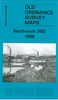
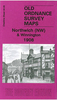
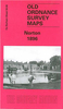
Northwich South West 1908

Northwich South West in 1908 in a fascinating series of reproductions of old Ordnance Survey plans in the Alan Godfrey Editions, ideal for anyone interested in the history of their neighbourhood or family. Selected towns in Great Britain and Ireland are covered by maps showing the extent of urban development in the last decades of the 19th and early 20th century.In this title: the map covers the south part of Northwich, with a small part of Hartford. Coverage stretches from Hartford Beach eastward to London Road, and from Castle Hill southward to Leftwich Green. Features include Cheshire Lines Railway with Hartford & Greenbank station, River Weaver, Hunt's Locks, Dobell's Farm, Weaver Shipbuilding Yard, Northwich Workhouse, Weaver Leather Works, Weaver Foundry, Leftwich Works,
Dane Leather Works, Hartford Hill, Holy Trinity church, Moss Farm, Hartford Manor, football ground etc. On the reverse is a private residents directory. About the Alan Godfrey Editions of the 25
RIP - This product is no longer available on our network. It was last seen on 25.09.2019

This page now acts as a permanent archive for this product. Add more information using the comments box below to ensure it can still be found by future generations.

Use our search facility to see if it is available from an alternative contributor.
  • External links may include paid for promotion
  • Availability: Out Of Stock
  • Supplier: Stanfords
  • SKU: XL188862
Availability: In Stock
£2.95

Product Description

Northwich South West in 1908 in a fascinating series of reproductions of old Ordnance Survey plans in the Alan Godfrey Editions, ideal for anyone interested in the history of their neighbourhood or family. Selected towns in Great Britain & Ireland are covered by maps showing the extent of urban development in the last decades of the 19th & early 20th century. In this title: the map covers the south part of Northwich, with a small part of Hartford. Coverage stretches from Hartford Beach eastward to London Road, & from Castle Hill southward to Leftwich Green. Features include Cheshire Lines Railway with Hartford & Greenbank station, River Weaver, Hunt's Locks, Dobell's Farm, Weaver Shipbuilding Yard, Northwich Workhouse, Weaver Leather Works, Weaver Foundry, Leftwich Works, Dane Leather Works, Hartford Hill, Holy Trinity church, Moss Farm, Hartford Manor, football ground etc. On the reverse is a private residents directory. About the Alan Godfrey Editions of the 25

Reviews/Comments

Add New

Intelligent Comparison

Oooops!
We couldn't find anything!
Perhaps this product's unique.... Or perhaps we are still looking for comparisons!
Click to bump this page and we'll hurry up.

Price History

Vouchers

No voucher codes found.
Do you know a voucher code for this product or supplier? Add it to Insights for others to use.

Facebook

Jargon Buster

Leather - Durable and flexible made from the tanning of an animals raw hide
Football - A sport involving kicking a ball and trying to score a goal
Beach - An area on the coast consisting of a sandy or pebbled area
History - Anything that happens in the past. An acedemic subject.
Leather - Made from animal hides, is a flexible and durable material
Small - something that takes up less space than normal.
Road - a manmade lane or a path that is used to speed up travel.
Ideal - Something that satisfies a perfect criteria.
Family - A group of people that live together made up from parents and children.

Supplier Information

Stanfords
Stanfords was established in 1853 and opened their iconic Covent Garden flagship store in 1901. They have become the top retailer of maps, travel books and accessories in the UK and arguably offer the largest selection of maps and travel books worldwide. Famous names such as Captain Robert Falcon Scott, Ranulph Fiennes and Michael Palin have purchased from Stanfords. They now have a shop in Bristol and both stores together with other venues operate a calendar of events including talks, book signings and exhibitions. As a specialist map retailer, the map selection is comprehensive and includes road maps, street maps and walking maps from worldwide destinations, as well as a selection of world atlases and wall maps. Books include travel guides and travel literature. Stanfords also stock globes, from miniatures made of blue marble to magnificent floor-standing globes. The website features a selection of interesting articles on travel topics.
Page Updated: 2023-11-12 20:15:36

Community Generated Product Tags

Oh No! The productWIKI community hasn't generated any tags for this product yet!
Menu