
 United Kingdom
 France
 Germany
 Netherlands
 Sweden
 USA
USA
 Italy
Italy
 Spain
Spain
More From Contributor


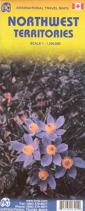
Northwest Territories ITMB
Double-sided map of Northwest Territories, part of a series of maps of Canadian provinces from the Vancouver-based ITMB, with topography presented by altitude colouring rather than by relief shading. The map divides the province east-west, with the northernmost islands shown as a separate inset.Topography is indicated by altitude colouring, spot heights and names of mountain ranges. Swamps, salt flats, sandy areas, waterfalls and rapids are marked. The map also shows the tree line and areas of tundra vegetation. Protected areas and Indian reserves are highlighted.Road network indicates winter, ice and seasonal roads. Names of various highways are shown and locations of local airstrips, sea plane bases and petrol stations are indicated. Symbols highlight lodges and camping sites,
information centres and medical services, skiing areas, etc. The map has a latitude and longitude grid at intervals of 1º and an index of settlements.Also included is street plan of Yellowknife, indicating various facilities in the town. The map is annotated with notes and advice on traveling in NWT, the region’s history, etc.
information centres and medical services, skiing areas, etc. The map has a latitude and longitude grid at intervals of 1º and an index of settlements.Also included is street plan of Yellowknife, indicating various facilities in the town. The map is annotated with notes and advice on traveling in NWT, the region’s history, etc.

Product Description
Reviews/Comments
Add New
Intelligent Comparison
Archived Product
Yukon & Northwest Territories South West ITMB Stanfords
£9.99
Vouchers
No voucher codes found.
Do you know a voucher code for this product or supplier? Add it to Insights for others to use.
Do you know a voucher code for this product or supplier? Add it to Insights for others to use.
 Denmark