More From Contributor
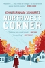
£6.99
Northumberland is England`s most northern county, a magical place filled with ancient castles, golden sand beaches, rolling hills, rugged moorland & friendly little Northumberland towns & villages. This much-awaited addition to the award-nominated series of easy walking guides is an affordable & practical guide to 40 of the best family walks in the region. ...
Archived Product
£9.99
Northumbria & Coast in the AA Leisure Guide series; exploring the walking, cycling & car touring opportunities in a range of British destinations. The guides also provide details of outdoor activities, local events & festivals, shopping, the best pubs & tea-rooms & the must-see attractions in each region. Each title in the series allows readers to find individual sections easily & is designed for practical use on the road. An illustrated Essential Sights introductory section lists some of the region ...
Archived Product
£9.99
Map No. 736 covering at 1:75, 000 the Northville-Placid Trail (NPT) across the Adirondack Park in northern New York State. The title is part of an extensive series in the National Geographic’s Trails Illustrated imprint of GPS compatible, contoured hiking maps of USA’s national & state parks or forests & other popular recreational areas. Cartography is based on the national topographic survey, with additional tourist information. The maps, with most titles now printed on light, waterproof & tear-resistant plastic paper, highlight walking trails along with campsites & other accommodation, picnic sites, areas for various recreational pursuits such as horse riding or skiing, drinking water sources, & many other facilities of interest to the outdoor enthusiast. Cartography is based on information from the USGS (United States Geological Survey
- the country’s national survey organization), revised by the National Geographic Maps in cooperation with the National Park Service, USDA Forest Service, etc. Topography is excellently presented by contours (interval varies according to scale), enhanced by relief shading & colouring/graphics for wood cover, glaciers, etc. All heights are given in feet. The maps have a UTM grid plus latitude & longitude margin ticks & GPS waypoints for selected important locations. Each map is double-sided to give either maximum coverage of the chosen area or additional enlargements of its important sections. Accompanying notes provide useful information on relevant regulations, safety precautions, contact addresses, etc.IMPORTANT
- PLEASE NOTE: the series is very extensive, ranging in scale from 1:400, 000 for the vast national parks of Alaska to 1:25, 000 for local map in several states. We recommend, therefore, viewing the series by state rather than the whole list.

...
Archived Product
£11.99
Northwest Achterhoek on a waterproof, tear-resistant, GPS compatible walking map at 1:25, 000 from Trage Paden, in a series of maps with extensive overprint for long-distance & local walking routes. GPS waypoints & route profiles are available for download from the publisher’s website. Contours used in this map series vary between 2, 5 to 5m according to the terrain, with 5m interval predominantly used for hilly areas. Varied colouring show different types of landscape: woods, vineyards, fields etc. An overprint highlights both the national long-distance walking routes & the shorter local circular trails, each clearly identified by a code and/or an abbreviation of its name. Recommended starting points for walks are designated by a symbol. Cycle lanes are visibly marked with a bike symbol; roads with heavy traffic are clearly indicated. Symbols indicate various facilities, such as railway & bus stations, coffee shops, campsites, country restaurants/bars, sport & leisure facilities. Maps have the lines of the Dutch National Grid for measuring distances & for determining location using GPS device & they are printed on weather resistant & tear-resistant paper. Each map covers an area of Approx. 25 x 26 km & the map legend is in Dutch only. The map is presented in an elegant cardboard case. To see all the titles in this series please click on the series link. ...
Archived Product
£12.99
The Northwest Coast Trail along the coast of southern Washington State & northern Oregon presented on a light, waterproof & tear-resistant map at 1:126, 720 from Adventure Maps, with several enlargements covering various parts of the trail in greater detail. Coverage starts along the northern shore of Willapa Bay (south-west of Tacoma) & ends in Nehalem Bay west of Portl&. Topography is vividly presented by contours at 200 feet, enhanced by relief shading. The Northwest Coast Trail is prominently highlighted & symbols indicate various facilities & places of interest, including campsites. 15 recommended hiking trails & 5 popular biking rides are cross-referenced to lists providing more information. Several sections along the route (as indicated on the main map) are presented in greater detail on enlargements at 1:31, 680. Neither the main map nor the enlargements show any geographical coordinates for GPS. The map also

Includes::
route profiles for the more demanding part of the trail, plus general information about the area.

...
Archived Product
£8.99
Twelve years after a tragic accident & a cover-up that led to prison time, Dwight Arno, now fifty, is a man who has started over without exactly moving on. Living alone in California, haunted yet keeping his head down, Dwight manages a sporting goods store & dates a woman to whom he hasn`t revealed the truth about his past. Then an unexpected arrival throws his carefully neutralized life into turmoil & exposes all that he`s hidden. Sam, Dwight`s estranged college-age son, has shown up without warning, fleeing a devastating incident in his own life. In its way, Sam`s sense of guilt is as crushing as his father`s. As the two men are forced to confront their similar natures & their half-buried hopes for connection, they must also search for redemption & love. In turn, they dramatically transform the lives of the women around them: the ex-wives, mothers, & lovers they have turned to in their desperate attempts to somehow rewrite, outrun, or eradicate the past. Told in the resonant voices of everyday people gripped in the emotional riptide of lived life, ” Northwest Corner” is at once tough & heart-lifting, an urgent, powerful story about family bonds that can never be broken & the wayward roads that lead us back to those we love. ...
Archived Product
£7.99
The Northwest is an amalgamation of dynamic cities & beautiful landscapes. From the historic charm of Chester to walking in the Peak District, this region can`t fail to impress. Footprint Focus provides invaluable information on transport, accommodation, eating & entertainment to ensure that your trip

Includes::
the best of this wonderful region of the UK. Essentials section with useful advice on getting to & around the Northwest. Comprehensive, up-to-date listings of where to eat, sleep & seek adventure.

Includes::
information on tour operators & activities, from cycling in the Isle of Man to listening to music in Manchester. Detailed maps for the Northwest & the main cities in the region. Slim enough to fit in your pocket. With detailed information on all the main sights, plus many lesser-known attractions, Footprint Focus Northwest England (
Includes: Peak District & Isle of Man) provides concise & comprehensive coverage of one of England`s most lively regions.


...
Archived Product
£7.99
The Northwest Highlands is the Scotland of mist-shrouded glens, towering mountain peaks, windswept violet heather hillsides & brooding lochs. Explore this mysterious land with the aid of Footprint Focus, which will guide you to the best of the Northwest Highlands` accommodation, restaurants, tours, & tips on spotting the Loch Ness Monster. Essentials section with useful advice on getting to & around the Northwest Highlands. Comprehensive, up-to-date listings of where to eat, sleep & seek adventure.

Includes::
information on tour operators & activities, from dolphin cruises to mountain hiking. Detailed maps for the Northwest Highlands. Slim enough to fit in your pocket. With detailed information on all the main sights, plus many lesser-known attractions, Footprint Focus Northwest Highlands of Scotland (
Includes: Inverness, Fort William, Glen Coe, Wester Ross & Ullapool) provides concise & comprehensive coverage of Scotland`s most wild & exhilarating region. The content of the Footprintfocus Northwest Highlands of Scotland (
Includes: Inverness, Fort William, Glen Coe & Ullapool) guide has been extracted from the Scotland Highlands & Islands Footprint Handbook.


...
Archived Product
£9.99
Double-sided map of Northwest Territories, part of a series of maps of Canadian provinces from the Vancouver-based ITMB, with topography presented by altitude colouring rather than by relief shading. The map divides the province east-west, with the northernmost islands shown as a separate inset. Topography is indicated by altitude colouring, spot heights & names of mountain ranges. Swamps, salt flats, sandy areas, waterfalls & rapids are marked. The map also shows the tree line & areas of tundra vegetation. Protected areas & Indian reserves are highlighted. Road network indicates winter, ice & seasonal roads. Names of various highways are shown & locations of local airstrips, sea plane bases & petrol stations are indicated. Symbols highlight lodges & camping sites, information centres & medical services, skiing areas, etc. The map has a latitude & longitude grid at intervals of 1º & an index of settlements. Also included is street plan of Yellowknife, indicating various facilities in the town. The map is annotated with notes & advice on traveling in NWT, the region’s history, etc. ...
Archived Product
£14.99
Northwich, Delamere Forest, Winsford & Middlewich area on a detailed topographic & GPS compatible map No. 267, waterproof version, from the Ordnance Survey’s 1:25, 000 Explorer series.MOBILE DOWNLOADS: this title & all the other OS Explorer maps include a code for downloading after purchase the digital version onto your smartphone or tablet for viewing on the OS smartphone app.OS EXPLORER SERIES: to see the list of all the titles in the OS Explorer series, both paper & waterproof versions, please click on the series link. The Explorer series, Ordnance Survey’s most detailed maps recommended for anyone enjoying outdoor activities, provides topographic coverage of Great Britain at 1:25, 000 on GPS compatible maps with hiking trails, cycling routes & extensive tourist information. Each printed map is available either on paper or as a waterproof & tear-resistant OS Active Map, as indicated in its title. Britain’s National Parks & other areas of particular tourist interest are presented on often double-sided OL (Outdoor Leisure) maps, whilst most standard format Explorers cover an area of 30 x 20km (approx. 19 x 12 miles). All three versions (paper, waterproof & digital) are the same & provide plenty of recreational & tourist information, indicating the traditional public right of way paths (except in Scotland where different laws apply), including bridleways & byways. National Trails & other long-distance paths are marked, as well as permissive footpaths or bridleways & on-road or traffic-free cycle routes with, where appropriate, their National/ Regional Cycle Network numbers. Boundaries of access land are clearly marked. A wide range of symbols provides additional tourist information, highlighting camping & caravanning sites, information offices & visitors’ centres, parking & picnicking places, country pubs, sport & recreational facilities including cycle hire locations & mountain biking trails, historic buildings & museums, etc. Exceptionally clear presentation of the landscape is provided by contours at 5m or in the uplands at 10m intervals, with additional spot heights plus colouring and/or graphics for different types of woodlands, orchards, heath, marshl&, scree or boulders, & other topographic features. For GPS users the maps have British National Grid lines at 1km intervals, with latitude & longitude given by margin ticks at 1`. Clearly laid out map legend

Includes::
French & German translations for the tourist information symbols.

...
Archived Product

Northwest Corner

Twelve years after a tragic accident and a cover-up that led to prison time, Dwight Arno, now fifty, is a man who has started over without exactly moving on. Living alone in California, haunted yet keeping his head down, Dwight manages a sporting goods store and dates a woman to whom he hasn't revealed the truth about his past. Then an unexpected arrival throws his carefully neutralized life into turmoil and exposes all that he's hidden. Sam, Dwight's estranged college-age son, has shown up without warning, fleeing a devastating incident in his own life. In its way, Sam's sense of guilt is as crushing as his father's. As the two men are forced to confront their similar natures and their half-buried hopes for connection, they must also search for redemption and love. In turn,
they dramatically transform the lives of the women around them: the ex-wives, mothers, and lovers they have turned to in their desperate attempts to somehow rewrite, outrun, or eradicate the past.Told in the resonant voices of everyday people gripped in the emotional riptide of lived life, Northwest Corner is at once tough and heart-lifting, an urgent, powerful story about family bonds that can never be broken and the wayward roads that lead us back to those we love.
RIP - This product is no longer available on our network. It was last seen on 25.09.2019

This page now acts as a permanent archive for this product. Add more information using the comments box below to ensure it can still be found by future generations.

Use our search facility to see if it is available from an alternative contributor.
  • Availability: Out Of Stock
  • Supplier: Stanfords
  • SKU: 9781780331980
Availability: In Stock
£12.99

Product Description

Twelve years after a tragic accident & a cover-up that led to prison time, Dwight Arno, now fifty, is a man who has started over without exactly moving on. Living alone in California, haunted yet keeping his head down, Dwight manages a sporting goods store & dates a woman to whom he hasn't revealed the truth about his past. Then an unexpected arrival throws his carefully neutralized life into turmoil & exposes all that he's hidden. Sam, Dwight's estranged college-age son, has shown up without warning, fleeing a devastating incident in his own life. In its way, Sam's sense of guilt is as crushing as his father's. As the two men are forced to confront their similar natures & their half-buried hopes for connection, they must also search for redemption & love. In turn, they dramatically transform the lives of the women around them: the ex-wives, mothers, & lovers they have turned to in their desperate attempts to somehow rewrite, outrun, or eradicate the past. Told in the resonant voices of everyday people gripped in the emotional riptide of lived life, Northwest Corner is at once tough & heart-lifting, an urgent, powerful story about family bonds that can never be broken & the wayward roads that lead us back to those we love.

Reviews/Comments

Add New

Intelligent Comparison

Oooops!
We couldn't find anything!
Perhaps this product's unique.... Or perhaps we are still looking for comparisons!
Click to bump this page and we'll hurry up.

Price History

Vouchers

No voucher codes found.
Do you know a voucher code for this product or supplier? Add it to Insights for others to use.

Facebook

Jargon Buster

LED - Light Emitting Diode - a small light source
Heart - An organ that pumps blood around the body. Usually related to love.
Love - Someone who shows deep affection for someone else.
LED - Light Emitting Diode. A bulb that is very efficient at producing light. Often small.
Head - The upper part of a body typically separated by the neck.
Family - A group of people that live together made up from parents and children.

Supplier Information

Stanfords
Stanfords was established in 1853 and opened their iconic Covent Garden flagship store in 1901. They have become the top retailer of maps, travel books and accessories in the UK and arguably offer the largest selection of maps and travel books worldwide. Famous names such as Captain Robert Falcon Scott, Ranulph Fiennes and Michael Palin have purchased from Stanfords. They now have a shop in Bristol and both stores together with other venues operate a calendar of events including talks, book signings and exhibitions. As a specialist map retailer, the map selection is comprehensive and includes road maps, street maps and walking maps from worldwide destinations, as well as a selection of world atlases and wall maps. Books include travel guides and travel literature. Stanfords also stock globes, from miniatures made of blue marble to magnificent floor-standing globes. The website features a selection of interesting articles on travel topics.
Page Updated: 2023-11-12 20:15:36

Community Generated Product Tags

Oh No! The productWIKI community hasn't generated any tags for this product yet!
Menu