
 United Kingdom
 France
 Germany
 Netherlands
 Sweden
 USA
USA
 Italy
Italy
 Spain
Spain
More From Contributor


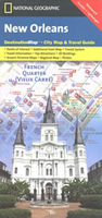
New Orleans Borch
Laminated and waterproof map for visitors to New Orleans, combining a detailed street plan of the downtown area, a street plan of a wider part of the city, a road map of the environs, plus a road map of south-eastern Louisiana, all indexed and highlighting places of interest.The main plan at 1:11, 000 provides detailed coverage of the downtown area including the city centre, the French Quarter and the Garden District. The plan prominently highlights locations of most of the 30 Top Sights in the city selected by the publishers – choices beyond the downtown area are highlighted on the remaining maps. Also marked are numerous hotels, car parks, and various other places of interest. On the reverse is a street plan at 1:30, 000 of a wide part of the city, including the Lakefront
Airport, indicating principal traffic arteries and highlighting sights outside the downtown area. Also provided is a small road map of the city’s environs, plus a larger map of south-eastern Louisiana. All the plans and road maps are indexed, including, as appropriate, lists of quarters, sights, hotels, shopping centres, etc.Also provided is are climate charts, various useful conversion tables, plus a small map of USA with time zones.
Airport, indicating principal traffic arteries and highlighting sights outside the downtown area. Also provided is a small road map of the city’s environs, plus a larger map of south-eastern Louisiana. All the plans and road maps are indexed, including, as appropriate, lists of quarters, sights, hotels, shopping centres, etc.Also provided is are climate charts, various useful conversion tables, plus a small map of USA with time zones.

Product Description
Reviews/Comments
Add New
Intelligent Comparison
Archived Product

New Orleans Noir Stanfords
£9.99
Archived Product

New Orleans Food Stanfords
£11.99
Archived Product
New Orleans Stanfords
£11.19
Archived Product
New Orleans Stanfords
£6.99
Archived Product

New Zealand Borch Stanfords
£9.99
Archived Product

New Orleans PopOut Stanfords
£4.99
Archived Product
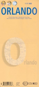
Orlando Borch Stanfords
£8.99
Vouchers
No voucher codes found.
Do you know a voucher code for this product or supplier? Add it to Insights for others to use.
Do you know a voucher code for this product or supplier? Add it to Insights for others to use.
 Denmark