
 United Kingdom
 France
 Germany
 Netherlands
 Sweden
 USA
USA
 Italy
Italy
 Spain
Spain
More From Contributor


Masbrough 1901
Masbrough in 1901 in a fascinating series of reproductions of old Ordnance Survey plans in the Alan Godfrey Editions, ideal for anyone interested in the history of their neighbourhood or family. The map covers the western part of Rotherham, stretching from Richmond Park eastward to King Street Rotherham, and from Bradgate southward to Holmes Farm. Features include the North Midland line with Masbrough station, MR Sheffield & Rotherham line with Holmes station, Phoenix Bessemer Steel Works, Sheffield & South Yorkshire Navigation New Cut, disused Holmes colliery, Rotherham Wagon Works, Holmes Rolling Mills, Holmes Steel Works, Brinsworth Iron Works, Midland Iron Works, St Paul`s church, Masbrough cemetery, Ferham Works, etc. The village of Kimberworth is in the north-western
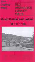
corner. On the reverse is a selection of street directory entries.About the Alan Godfrey Editions of the 25” OS Series:Selected towns in Great Britain and Ireland are covered by maps showing the extent of urban development in the last decades of the 19th and early 20th century. The plans have been taken from the Ordnance Survey mapping and reprinted at about 15 inches to one mile (1:4, 340). On the reverse most maps have historical notes and many also include extracts from contemporary directories. Most maps cover about one mile (1.6kms) north/south, one and a half miles (2.4kms) across; adjoining sheets can be combined to provide wider coverage.FOR MORE INFORMATION AND A COMPLETE LIST OF ALL AVAILABLE TITLES PLEASE CLICK ON THE SERIES LINK.
corner. On the reverse is a selection of street directory entries.About the Alan Godfrey Editions of the 25” OS Series:Selected towns in Great Britain and Ireland are covered by maps showing the extent of urban development in the last decades of the 19th and early 20th century. The plans have been taken from the Ordnance Survey mapping and reprinted at about 15 inches to one mile (1:4, 340). On the reverse most maps have historical notes and many also include extracts from contemporary directories. Most maps cover about one mile (1.6kms) north/south, one and a half miles (2.4kms) across; adjoining sheets can be combined to provide wider coverage.FOR MORE INFORMATION AND A COMPLETE LIST OF ALL AVAILABLE TITLES PLEASE CLICK ON THE SERIES LINK.

Product Description
Reviews/Comments
Add New
Intelligent Comparison
Archived Product

Greasborough 1901 Stanfords
£3.50
Archived Product

Mexborough 1901 Stanfords
£3.50
Archived Product
Conisbrough 1901 Stanfords
£3.50
Archived Product
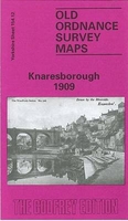
Knaresborough 1909 Stanfords
£3.50
Archived Product
Marlborough 1899 Stanfords
£3.50
Archived Product

Fraserburgh 1901 Stanfords
£3.50
Archived Product
Farnborough 1930 Stanfords
£2.95
Archived Product
Farnborough 1930 Stanfords
£3.50
Vouchers
No voucher codes found.
Do you know a voucher code for this product or supplier? Add it to Insights for others to use.
Do you know a voucher code for this product or supplier? Add it to Insights for others to use.
 Denmark