
 United Kingdom
 France
 Germany
 Netherlands
 Sweden
 USA
USA
 Italy
Italy
 Spain
Spain
More From Contributor
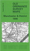


Manchester Clayton 1932
Manchester Clayton 1932 in a fascinating series of reproductions of old Ordnance Survey plans in the Alan Godfrey Editions, ideal for anyone interested in the history of their neighbourhood or family. Selected towns in Great Britain and Ireland are covered by maps showing the extent of urban development in the last decades of the 19th and early 20th century.In this title: the map covers an area on the east side of Manchester which includes Philips Park and Clayton. Coverage stretches from Forge Lane eastward to Edge Lane, and from Oldfield Street northward to Rose Bank Road. The LMS line runs across the northern part of the map, including Park station and Clayton Bridge station. Other features include the mineral line south to electricity generating station, Manchester & Ashton Canal,
River Medlock, Bradford Colliery, Bradford Iron Works, Clayton Finishing Works, Clayton Hall, St Cross church, Clayton Aniline Chemical Works, tramways, Culcheth, Victoria Rubber Works, Bank Bridge Works, Philips Park, Philips Park Cemetery, Avro Aeroplane Works, Park Engineering Works, etc. On the reverse are street directory entries for Bank Street, Berry Brow, Clayton Lane and Street, Forge Lane, Melbourne Street, Stuart Street. About the Alan Godfrey Editions of the 25
River Medlock, Bradford Colliery, Bradford Iron Works, Clayton Finishing Works, Clayton Hall, St Cross church, Clayton Aniline Chemical Works, tramways, Culcheth, Victoria Rubber Works, Bank Bridge Works, Philips Park, Philips Park Cemetery, Avro Aeroplane Works, Park Engineering Works, etc. On the reverse are street directory entries for Bank Street, Berry Brow, Clayton Lane and Street, Forge Lane, Melbourne Street, Stuart Street. About the Alan Godfrey Editions of the 25

Product Description
Reviews/Comments
Add New
Intelligent Comparison
Archived Product

Manchester Clayton 1932 Stanfords
£3.50
Archived Product
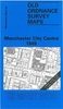
Manchester 1903 Stanfords
£7.99
Vouchers
No voucher codes found.
Do you know a voucher code for this product or supplier? Add it to Insights for others to use.
Do you know a voucher code for this product or supplier? Add it to Insights for others to use.
 Denmark