-
Home
-
Contributors
-
International
-
Account
-
Information
More From Contributor
Includes:: Philips Park & Clayton. Coverage stretches from Forge Lane eastward to Edge Lane, & from Oldfield Street northward to Rose Bank Road. The LMS line runs across the northern part of the map, including Park station & Clayton Bridge station. Other features include the mineral line south to electricity generating station, Manchester & Ashton Canal, River Medlock, Bradford Colliery, Bradford Iron Works, Clayton Finishing Works, Clayton Hall, St Cross church, Clayton Aniline Chemical Works, tramways, Culcheth, Victoria Rubber Works, Bank Bridge Works, Philips Park, Philips Park Cemetery, Avro Aeroplane Works, Park Engineering Works, etc. On the reverse are street directory entries for Bank Street, Berry Brow, Clayton Lane & Street, Forge Lane, Melbourne Street, Stuart Street. About the Alan Godfrey Editions of the 25 ...
Includes:: Philips Park & Clayton. Coverage stretches from Forge Lane eastward to Edge Lane, & from Oldfield Street northward to Rose Bank Road. The LMS line runs across the northern part of the map, including Park station & Clayton Bridge station. Other features include the mineral line south to electricity generating station, Manchester & Ashton Canal, River Medlock, Bradford Colliery, Bradford Iron Works, Clayton Finishing Works, Clayton Hall, St Cross church, Clayton Aniline Chemical Works, tramways, Culcheth, Victoria Rubber Works, Bank Bridge Works, Philips Park, Philips Park Cemetery, Avro Aeroplane Works, Park Engineering Works, etc. On the reverse are street directory entries for Bank Street, Berry Brow, Clayton Lane & Street, Forge Lane, Melbourne Street & Stuart Street. About the Alan Godfrey Editions of the 25” OS Series: Selected towns in Great Britain & Ireland are covered by maps showing the extent of urban development in the last decades of the 19th & early 20th century. The plans have been taken from the Ordnance Survey mapping & reprinted at about 15 inches to one mile (1:4, 340). On the reverse most maps have historical notes & many also include extracts from contemporary directories. Most maps cover about one mile (1.6kms) north/south, one & a half miles (2.4kms) across; adjoining sheets can be combined to provide wider coverage.FOR MORE INFORMATION & A COMPLETE LIST OF ALL AVAILABLE TITLES PLEASE CLICK ON THE SERIES LINK. ...
- Manchester, England is as witty, erudite & passionate as you would expect from a man who can say, again & again, ”I was there”. Like Jon Savage`s England`s Dreaming, this is the last word on the abiding centre of 40 years of UK pop culture. ...

Manchester Harpurhey And Collyhurst 1891
shed; Queen's Park, old quarries, brick works, Monsall Hospital, Moston Bottoms, Manchester General Cemetery, St Oswald's church, Moss Brook Works, Smedley Old Hall, Green Mount Dye Works, Hendham Vale Chemical Works, several other works on the River Irk, Junction Iron Works etc. On the reverse isa selection of street directory entries, including Alfred Street, Churnet Street, Grimshaw Lane, Hendham Vale, Monsall Street, St Oswald Street. About the Alan Godfrey Editions of the 25
This page now acts as a permanent archive for this product. Add more information using the comments box below to ensure it can still be found by future generations.
Use our search facility to see if it is available from an alternative contributor.
- Availability: Out Of Stock
- Supplier: Stanfords
- SKU: 9786000006631
Product Description
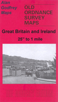
Manchester Harpurhey & Collyhurst in 1891 in a fascinating series of reproductions of old Ordnance Survey plans in the Alan Godfrey Editions, ideal for anyone interested in the history of their neighbourhood or family. Selected towns in Great Britain & Ireland are covered by maps showing the extent of urban development in the last decades of the 19th & early 20th century. In this title: the map covers the Collyhurst, Smedley & Harpurhey area on the north side of Manchester. Coverage stretches from Paley Street northward to Pickering Street & from St Luke's church Cheetham eastward to Monsall Hospital. Features include railways with Miles Platting station, Brewery Siding, Newton Heath Loop, west end of Newton Heath depot, wagon works, Cheetham Hill Junction with carriage shed; Queen's Park, old quarries, brick works, Monsall Hospital, Moston Bottoms, Manchester General Cemetery, St Oswald's church, Moss Brook Works, Smedley Old Hall, Green Mount Dye Works, Hendham Vale Chemical Works, several other works on the River Irk, Junction Iron Works etc. On the reverse isa selection of street directory entries, including Alfred Street, Churnet Street, Grimshaw Lane, Hendham Vale, Monsall Street, St Oswald Street. About the Alan Godfrey Editions of the 25
Reviews/Comments
Add New
Price History
Vouchers
Do you know a voucher code for this product or supplier? Add it to Insights for others to use.


 United Kingdom
 France
 Germany
 Netherlands
 Sweden
 USA
USA
 Italy
Italy
 Spain
Spain


 Denmark