
 United Kingdom
 France
 Germany
 Netherlands
 Sweden
 USA
USA
 Italy
Italy
 Spain
Spain
More From Contributor

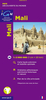

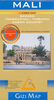


Mali ITMB
Mali at 1:1, 700, 000 on a double-sided indexed road map from ITMB, with large street plans of Bamako and Timbuktu (Tombouctou), a distance table, an inset indicating the extent of the Mali Empire and historical notes about European explorers of the region.The map divides the country east/west, with a good overlap between the sides. The country’s topography is shown by altitude colouring and spot heights (both in feet), with names of mountain ranges and other geographical features, plus graphics for cliffs or scarps, water wells(many with names) and oasis within the northern Saharan region. Also marked are salt flats, marshes, swamps and areas of seasonal inundation.Road network includes local roads and selected tracks. Distances are shown on primary routes and locations of fuel
supplies and border crossings are marked. Also shown are local airports and airfields and navigation stops on the Niger. The map highlights various places of interest, some annotated with brief descriptions. Also indicated are locations with tourist accommodation, medical facilities, fuel supplies, etc. Latitude and longitude lines are drawn at 2º30’ intervals. Each side has a separate index. Coverage includes most of Burkina Faso.A large street plan of Bamako shows main routes across the city and names districts outside the centre, with a separate enlargement providing a more detailed plan of the capital’s central area. Both plans are annotated with various facilities and places of interest, included selected hotels, restaurants, embassies, etc. Another inset shows a
similarly annotated street plan of Timbuktu (Tombouctou). Also provided is a distance table, a small rainfall chart for the whole of Africa, profiles of three early European explorers into Timbuktu: Gordon Laing, Henry Barth, and Réné Callié, and the extent of the Mali Empire in 1300 and 1500 AD superimposed on a map of present day countries of western Africa.

Product Description
Reviews/Comments
Add New
Intelligent Comparison
Archived Product
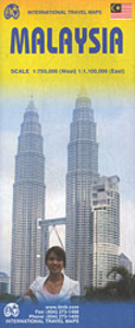
Malaysia ITMB Stanfords
£9.99
Archived Product

Manila ITMB Stanfords
£9.99
Archived Product

Nepal ITMB Stanfords
£9.99
Archived Product
Manitoba ITMB Stanfords
£9.99
Archived Product

Mongolia ITMB Stanfords
£9.99
Vouchers
No voucher codes found.
Do you know a voucher code for this product or supplier? Add it to Insights for others to use.
Do you know a voucher code for this product or supplier? Add it to Insights for others to use.
 Denmark