More From Contributor
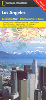
£14.99
Lorraine Guide Vert *FRENCH Edition* in Michelin’s Green Guide series covering France, with all the regions available either in English editions or in French versions. Drawing on Michelin’s long experience, the guides are renowned for their individual ‘star rating’ of sights & attractions. Listings in each guide are organized alphabetically, allowing readers to access information quickly. Towns are given overall star rating, with their sights & attractions also rated individually. Where appropriate, a street plan of the town centre is provided, indicating car parks & accompanied by an index of main streets & a list of sights highlighted on it. For many towns a recommended sightseeing tour is also marked on the plan. Entries for important churches are accompanied by detailed plans. Recommended car tours have overview maps showing road numbers & locations of the sights. Where necessary, the guides give opening hours & contact details. Many entries have an “ Address Book” section with Michelin’s recommendations for where to stay & where to eat. Each guide has a very extensive introductory section with practical information & pre-trip tips, chapters on history, art & culture (particularly strong on architectural styles, explained by excellent drawings), fauna & flora, etc. Fold-out flaps in the book covers provide an overview of the recommended sights and/or car tours.* * French language guides* have a larger number of individual entries than included in the corresponding English titles, as well as more exhaustive descriptions, with wider coverage of local history and/or famous people connected with a given location.* * English language guides* have more recommendations for car tours. The “ Address Book” sections often include shopping suggestions. ...
Archived Product
£11.50
Topographic survey of France at 1:25, 000 in IGN`s excellent TOP25 / Série Bleue series. All the maps are GPS compatible, with a 1km UTM grid plus latitude & longitude lines at 5’ intervals. Contours are at 5m intervals except for mountainous areas where the maps have contours at 10m intervals, vividly enhanced by hill shading & graphics for rocky terrain. Colouring with graphics indicates different types of vegetation or land use (deciduous or coniferous forests, moors, orchards, vineyards, etc). PLEASE NOTE: coverage of France at this scale is currently being revised – the format & the presentation of each title are indicated by the letters at the end of its Sheet Reference number (e.g. 0416ET, 3531ETR, 1923SB, etc.)MAPS WITH FULL TOURIST OVERPRINT & AN ENGLISH MAP LEGEND: all TOP25 maps & the SB editions of Série Bleue have an overprint highlighting waymarked walking trails including long-distance GR routes &, where appropriate, ski routes. Symbols indicate campsites, gîtes d’etape, refuges, equestrian centres & other recreational facilities or sites, tourist information centres, cultural heritage, etc. Towns & locations of particular interest are highlighted.- ET or OT = single-sided TOP25 map covering approx. 29x 21 km / 18x 13 miles.- ETR or OTR = waterproof & tear resistant TOP25 map covering the same area as the corresponding ET or OT number, but double-sided, printed on a smaller size sheet with a good overlap between the sides.- SB = Série Bleue map with full tourist overprint; these maps, first introduced in summer 2014, each cover approx. 29x 24km / 18x 15 miles.SÉRIE BLEUE maps with numbers ending in E (Est) or O (Ouest): most editions now indicate the GR routes, but do not show any other tourist information. Map legend is in French only. Each map covers approx. 14x 20km / 9x 12 miles. ...
Archived Product
£8.95
Clear street plan extending from the Downtown & Elysian Park region to Hollywood, with West Hollywood, Beverly Hills & the Santa Monica/ Venice Beach coastal strip shown in small insets. Railways & Metro Line routes are included in the detail & pastel colours distinguish parks, industrial areas, institutions, attractions & shopping areas. Symbols denote churches, museums, places of interest, police stations, schools, post offices, hospitals, tourist information offices, theatres & cinemas. A diagram shows the LA Metro Rail network & another inset map at 1:475, 000 shows the main roads of the whole Los Angeles region. The map is indexed only for Downtown & Hollywood streets. ...
Archived Product
£6.99
The National Geographic map of Los Angeles at 1:204, 000 is a durable waterproof road map of the greater Los Angeles area, with several enlargements for top areas, designed for tourism. The map clearly shows the city freeway & tollway network, main local roads, & metro connections, & each of the 80 smaller cities & districts that together make up the Los Angeles conurbation are shaded. The map also

Includes::
general tourist background info on the reverse, & transport advice on how to get around the city. The total area of coverage is from Laguna Hills, Irvine & Newport Beach in the south-east, to the Santa Monica Mountains in the north-west. Two small insets give slightly higher detail of Anaheim & Long Beach Two other enlargements provide higher-scale mapping of key areas: * Downtown Los Angeles* at 1:30, 000, showing Approx. 8.5x 8.5km (5x 5 miles) centred on Little Tokyo, & * Westside* at 1:78, 000, including Santa Monica, Beverly Hills, Hollywood, Universal City & part of the Santa Monica Mountains National Recreation Area (this overlaps with the Downtown LA map`s western half). These maps provide better
- but not comprehensive
- street detail, & have key points of tourist interest highlighted, including top attractions, notable buildings, hotels & information points. This map is printed on a surprisingly strong rip-proof, waterproof paper.


...
Archived Product
£4.99
Los Angeles at 1:81, 000 on a laminated, waterproof & tear-resistant street plan from the AA with on the reverse a mini guide to the city highlighting its top 25 sights, recommendations for eating out, shopping & entertainment, plus general tourist information. Coverage extends west beyond Hollywood & the UCLA campus to Topanga State Park, & eastwards beyond Pasadena & San Gabriel. Recommended sights are highlighted & other places of interest are prominently marked. Street index is next to the map. Separate insets show the city ...
Archived Product
£4.99
Los Angeles at 1:15, 000 on street plan from Marco Polo Travel Publishing printed on sturdy, waterproof & tear-resistant synthetic paper. The plan covers downtown LA with a separate panel extending coverage to include Hollywood. Metro stations are clearly marked & named, & a separate diagram shows the whole network. For drivers, entry/exits on freeways are clearly presented, principal traffic arteries are highlighted & one way streets & car parks are marked. Important buildings are highlighted & named. Street index is on the reverse side &

Includes::
lists of useful contact details for tourist information offices, transport information, car hire, museums, entertainment venues, emergency services, etc. Also provided is a road map of the LA conurbation.

...
Archived Product
£4.99
Los Angeles in the Luxe city guides series, which are slim & small enough to fit easily in a pocket or handbag. Information is distilled from elite suggestions by city residents, specially selected for their style, knowledge & expertise. Luxe guides aim at the upper end of the market & subjectively edit to choose the very best recommendations for shopping, restaurants, leisure options & nightlife. Half day shopping & activity itineraries are suggested for you to mix & match your visit to suit your timetable. When folded close the cardboard guide slots into its own protective plastic frame. Vanity Fair magazine calls them ...
Archived Product
£7.99
Los Angeles on a h&-drawn style street plan from Map Easy with publishers’ recommendations for accommodation, shopping, eating out & sightseeing. Printed on light, waterproof & tear-resistant synthetic paper the map has 10 separate panels showing different parts of the LA conurbation, including Disneyl&. All the plans, as listed below, are overprinted with the publishers’ recommendations for attractions (many highlighted by small drawings), accommodation, shopping, restaurants, etc. Hotels & restaurants are graded into inexpensive, moderate & expensive. The panels show:- Downtown Los Angeles- Rodeo Drive area of Beverly Hills- Hollywood Boulevard- Westwood UCLA area- Pasadena Colorado Avenue- Santa Monica beach front area- Santa Monica Main Street- Anaheim with Disneyland Also provided is an overview road map of the area from the downtown LA to the Pacific showing locations of the relevant panels & places of interest outside them. ...
Archived Product
£6.50
Los Angeles & Hollywood on an indexed street plan from Rand Mc Nally in their extensive range of maps covering cities in the United States. Insets provide a more detailed street plan of downtown Los Angeles, a map showing road access to the various terminals at the Los Angeles International Airport, plus a road map of LA & vicinity. Communities covered by this map include Bel Air Estates, Bell Gardens, Beverly Hills, Brentwood, Culver City, Huntington Park, Inglewood, Mar Vista, Pacific Palisades, Santa Monica, Venice & West Hollywood. Rand Mc Nally street plans provide coverage of cities with their outer suburbs, clearly indicating main traffic arteries: highways (distinguishing between free & toll access), plus primary & secondary routes. Road numbers and/or names are clearly displayed & exit numbers are indicated. Locations of service & rest areas are marked & one way streets are shown. Longer streets are annotated with block numbers for easier identification of addresses. The maps show railway, bus &, where appropriate, metro stations. A range of symbols indicate various places of interest including cultural & academic institutions, various municipal facilities, golf courses, etc. The plans have extensive street indexes, supplemented by lists of points of interest, parks & recreational areas, shopping malls, stations, schools, etc. ...
Archived Product
£5.99
Los Angeles & Orange County Beaches in the Moon Spotlight guide series; covering a range of specific local cities, districts, areas & regions in North, Central & South America & targeted at those seeking to travel to a specific area within a country. Each of the guides has been extracted in full from the relevant country Moon Handbook & individual titles focus on a particular city, region or notable area of the destination. Many of the guides in the series are unique in their coverage, although are limited in putting the destination into its wider geographical context that a more comprehensive guide would provide. Stylistically, Moon ...
Archived Product

Los Angeles

Los Angeles in a series of street plans from Rough Guides published on very light waterproof and tear-resistant plastic paper, indexed, with recommendations for shopping, eating, drinking, and venues. The plan is folded to only 9x19cm when removed from its protective cover and can be easily rolled or folded into smaller size without any damage or creases.On one side is a plan at 1:32, 300 of the city
RIP - This product is no longer available on our network. It was last seen on 25.09.2019

This page now acts as a permanent archive for this product. Add more information using the comments box below to ensure it can still be found by future generations.

Use our search facility to see if it is available from an alternative contributor.
  • External links may include paid for promotion
  • Availability: Out Of Stock
  • Supplier: Stanfords
  • SKU: 9781848361331
Availability: In Stock
£3.99

Product Description

Los Angeles in a series of street plans from Rough Guides published on very light waterproof & tear-resistant plastic paper, indexed, with recommendations for shopping, eating, drinking, & venues. The plan is folded to only 9x 19cm when removed from its protective cover & can be easily rolled or folded into smaller size without any damage or creases. On one side is a plan at 1:32, 300 of the city

Reviews/Comments

Add New

Price History

Vouchers

No voucher codes found.
Do you know a voucher code for this product or supplier? Add it to Insights for others to use.

Facebook

Jargon Buster

Paper - A thin sheet mainly used for writing. Available in a variety of colours. Made mainly from wood pulp.
Plastic - A generic term for a synthetic product used in the manufacture of products
Waterproof - Resistant to water, usualy specified by depth in metres
Size - is the measurement of how big an object is in space.
Resistant - Something that can repel against something.

Supplier Information

Stanfords
Stanfords was established in 1853 and opened their iconic Covent Garden flagship store in 1901. They have become the top retailer of maps, travel books and accessories in the UK and arguably offer the largest selection of maps and travel books worldwide. Famous names such as Captain Robert Falcon Scott, Ranulph Fiennes and Michael Palin have purchased from Stanfords. They now have a shop in Bristol and both stores together with other venues operate a calendar of events including talks, book signings and exhibitions. As a specialist map retailer, the map selection is comprehensive and includes road maps, street maps and walking maps from worldwide destinations, as well as a selection of world atlases and wall maps. Books include travel guides and travel literature. Stanfords also stock globes, from miniatures made of blue marble to magnificent floor-standing globes. The website features a selection of interesting articles on travel topics.
Page Updated: 2023-11-12 20:15:36

Community Generated Product Tags

Oh No! The productWIKI community hasn't generated any tags for this product yet!
Menu