
 United Kingdom
 France
 Germany
 Netherlands
 Sweden
 USA
USA
 Italy
Italy
 Spain
Spain
More From Contributor


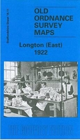
Longton East 1922
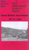
Longton East in 1922 in a fascinating series of reproductions of old Ordnance Survey plans in the Alan Godfrey Editions, ideal for anyone interested in the history of their neighbourhood or family. The map covers the eastern part of Longton, together with Normacot and part of Meir. Coverage stretches from Cromartie Street eastward to Meir station and from Anchor Road southward to Belgrave Road. Features include North Staffordshire Railway with Millfield Junction, Normacot station, Meir station, stretch of Adderley Green & Bucknall Branch, Park Hall Colliery, Weston Sprink, Meir Hay, St James church, tramways, Court House, Queen`s Pottery, other earthenware and pottery works, Church of the Resurrection, St Luke`s church, Institute & Free Library, cottage hospital, Church
of the Holy Evangelists, Normacot area, Christ Church, Holy Trinity church, Weston Coyney Brick Works, etc. On the reverse are directory extracts, including a Normacot, Lightwood & Meir Alphabetical List. About the Alan Godfrey Editions of the 25” OS Series:Selected towns in Great Britain and Ireland are covered by maps showing the extent of urban development in the last decades of the 19th and early 20th century. The plans have been taken from the Ordnance Survey mapping and reprinted at about 15 inches to one mile (1:4, 340). On the reverse most maps have historical notes and many also include extracts from contemporary directories. Most maps cover about one mile (1.6kms) north/south, one and a half miles (2.4kms) across; adjoining sheets can be combined to provide wider
coverage.FOR MORE INFORMATION AND A COMPLETE LIST OF ALL AVAILABLE TITLES PLEASE CLICK ON THE SERIES LINK.

Product Description
Reviews/Comments
Add New
Intelligent Comparison
Archived Product
London East 1920-1921 Stanfords
£9.99
Archived Product

Longton West 1898 Stanfords
£3.50
Archived Product
Poynton East 1907 Stanfords
£2.95
Archived Product

Poynton East 1907 Stanfords
£3.50
Archived Product
London East 1805-1822 Stanfords
£7.99
Archived Product
London East 1897-1902 Stanfords
£7.99
Archived Product
Weston East 1902 Stanfords
£3.50
Archived Product
London West 1920 Stanfords
£7.99
Vouchers
No voucher codes found.
Do you know a voucher code for this product or supplier? Add it to Insights for others to use.
Do you know a voucher code for this product or supplier? Add it to Insights for others to use.
 Denmark