More From Contributor
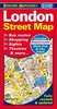
£9.98
This fine art print of Marion Billet`s red London Bus has been created on a traditional 4-colour proofing press, printing directly onto art-quality paper. Featuring a red bus filled with an assortment of London `characters`, it comes complete with a beautiful card mount & a certificate of authenticity. Capital stuff for all London fans- especially the little ones! Also available: London Characters print ...
Archived Product
£7.99
London in the Step by Step series by Insight Guides focuses on providing tailor made walks & tours around the city. The guide features twenty route recommendations that link up better known sights & take you off of the more beaten track; they are written by local experts who have personally selected places to eat & drink en-route & who offer insider tips on culture, shopping & nightlife. The guide has an array of colour photographs which help bring to life the background & descriptive information provided for destinations & attractions. An overview chapter opens the guide & reviews geography, customs & culture, history, food & drink, shopping, culture & entertainment. Next feature the selected itineraries for walks and/or tours, each of which have a good amount of accompanying information & come with a simple route plan. A user friendly alphabetical directory lists practical information to do with day to day basics & listings of h&-picked hotels & restaurants are provided to suit different budgets & tastes. The publisher ...
Archived Product
£4.99
Children will be amazed & enthralled as they seek out over 90 different sites & objects on this fabulous tour of Britain's historic capital city. Every landmark has a colour sticker that can be added to the matching picture as the site is spotted. All the key monuments & iconic items are included from St Paul's Cathedral to Buckingham Palace & red phone boxes to double-decker buses, with a few surprises along the way. This is a brilliant interactive guide for young sightseers in London or the city's inhabitants & a hugely enjoyable way to learn about this vibrant metropolis. It contains over 100 stickers plus a comprehensive map of London with extra stickers to accompany it. ...
Archived Product
£10.99
London has the greatest literary tradition of any city in the world. Its roll-call of story-tellers

Includes::


...
Archived Product
£12.99
Why don`t people take more notice of bollards? How often do they stop to look at a coal-hole cover? Why are pub signs largely ignored & Royal Warrants on shops scarcely noticed? Such a grievous situation is about to change with the publication of this, the first book dealing specifically with London Street Furniture. It examines the unconsidered trifles which can be found in bewildering diversity around the streets particularly of the older parts of central London but also elsewhere in the Metropolis. These items help us to understand the growth of London & provide pointers & fascinating insights into its economic & social development as well as the changes in science & technology it has witnessed. Knowing something about street furniture makes a walk around London far more interesting. ...
Archived Product
£3.50
London Street Map
- with the most detailed mapping, highly recommended for exploring London on foot
- from Bensons Map Guides

...
Archived Product
£12.99
An early street map of London published a century & a half ago so that passengers in Hansom cabs could check that they were being taken on the shortest route. It shows street names, prominent buildings, docks, factories, canals & the earliest railways in minute detail. Beyond the built up area can be seen the orchards & market gardens of Chelsea & Southwark, the marshes of the Isle of Dogs & the outlying villages of Earls Court, Kentish Town & Bow. Bound in a hardcover jacket. Each map is accompanied by an illustrated booklet which was produced to accompany the original edition & together they provide a fascinating glimpse into life in London a century ago. ...
Archived Product
£19.99
London Street Photography is published in association with The Museum of London to coincide with the major exhibition on show at the Museum until September 2011. Street photography thrives in London today. It documents the movement, diversity & seeming incoherence of the most multicultural city in the world. Its defining characteristic is the keen eye of the photographer catching the moment of a chance encounter, a fleeting expression or a momentary juxtaposition in a decisive click. However, photographing life on London`s streets is nothing new. The first `instantaneous` London street scenes were taken in the early 1860s, & by the 1890s candid street photographers were snapping Londoners unawares. The 20th century saw many photographers, famous & lesser-known, continue to capture the daily life of London. London Street Photography showcases the Museum of London`s unique historic collection of photographs. It contains the work of more than seventy photographers & is a fascinating view of London street life of the last 150 years. It

Includes::
the work of well-known photographers such as Paul Martin, John Thomson, Humphrey Spender, Bert Hardy, Laszlo Moholy-Nagy, Roger Mayne & Tony Ray-Jones as well as the work of many anonymous photographers whose contribution has been just as important in recording the story of the city. The book

Includes::
an introduction by Mike Seaborne, Senior Curator of Photographs at the Museum, in which he outlines the history of street photography in the Capital, exploring the shifts in approach as well as the impact of new cameras that could allow photographers to capture the wealth of detail to be found in London`s teeeming streets.


...
Archived Product
£6.95
London Streetwise in a series of handy concertina street plans from the Florida-based Streetwise Maps, one of a pair of titles covering London with the same map but with different additional information:- STREETWISE London: with a street index which also

Includes::
a list of parks, railway stations, points of interest & selected hotels- ARTWISE London: with no index but instead of it a list of museums with opening hours, telephone numbers, nearest underground station & a brief description of the collection Both titles have an identical map covering roughly the area of central London from Holland Park to the Tower & from Regents Park in the north to the Thames in the south-western part. Several important buildings are shown by small drawings, with colour-coding indicating their use. The maps also show main shopping streets. Underground stations are clearly marked. Also provided is a diagram of the underground network.

...
Archived Product
£16.99
Everyone is familiar with the iconic attractions of London but Saskia Graville`s London Style Guide
- now updated & fully revised
-

...
Archived Product

London Street Map

Highly recommended - this map is simply streets ahead of all its competitors, as anyone who has explored central London on foot will testify: great overall clarity of presentation, excellent placing of names, exceptional presentation of small passages and shortcuts between buildings, etc. In short, as near as one can ever come to a map user's dream come true!Using tube stations as markers to indicate the coverage, on one side is a street plan at approx. 1:9, 700 extending from Kilburn Park/Notting Hill Gate/Earl
RIP - This product is no longer available on our network. It was last seen on 25.09.2019

This page now acts as a permanent archive for this product. Add more information using the comments box below to ensure it can still be found by future generations.

Use our search facility to see if it is available from an alternative contributor.
  • External links may include paid for promotion
  • Availability: Out Of Stock
  • Supplier: Stanfords
  • SKU: 9781898929239
Availability: In Stock
£2.50

Product Description

Highly recommended
- this map is simply streets ahead of all its competitors, as anyone who has explored central London on foot will testify: great overall clarity of presentation, excellent placing of names, exceptional presentation of small passages & shortcuts between buildings, etc. In short, as near as one can ever come to a map user's dream come true! Using tube stations as markers to indicate the coverage, on one side is a street plan at approx. 1:9, 700 extending from Kilburn Park/ Notting Hill Gate/ Earl

Reviews/Comments

Add New

Price History

Vouchers

No voucher codes found.
Do you know a voucher code for this product or supplier? Add it to Insights for others to use.

Facebook

Jargon Buster

Foot - A part of the body at the bottom end of the leg
Foot - or Feet - a measurement equivilent to 30cm
Small - something that takes up less space than normal.
Exceptional - Something that is very good.

Supplier Information

Stanfords
Stanfords was established in 1853 and opened their iconic Covent Garden flagship store in 1901. They have become the top retailer of maps, travel books and accessories in the UK and arguably offer the largest selection of maps and travel books worldwide. Famous names such as Captain Robert Falcon Scott, Ranulph Fiennes and Michael Palin have purchased from Stanfords. They now have a shop in Bristol and both stores together with other venues operate a calendar of events including talks, book signings and exhibitions. As a specialist map retailer, the map selection is comprehensive and includes road maps, street maps and walking maps from worldwide destinations, as well as a selection of world atlases and wall maps. Books include travel guides and travel literature. Stanfords also stock globes, from miniatures made of blue marble to magnificent floor-standing globes. The website features a selection of interesting articles on travel topics.
Page Updated: 2023-11-12 20:15:36

Community Generated Product Tags

Oh No! The productWIKI community hasn't generated any tags for this product yet!
Menu