
 United Kingdom
 France
 Germany
 Netherlands
 Sweden
 USA
USA
 Italy
Italy
 Spain
Spain
More From Contributor


London Streetwise
London Streetwise in a series of handy concertina street plans from the Florida-based Streetwise Maps, one of a pair of titles covering London with the same map but with different additional information:- STREETWISE London: with a street index which also includes a list of parks, railway stations, points of interest and selected hotels- ARTWISE London: with no index but instead of it a list of museums with opening hours, telephone numbers, nearest underground station and a brief description of the collectionBoth titles have an identical map covering roughly the area of central London from Holland Park to the Tower and from Regents Park in the north to the Thames in the south-western part. Several important buildings are shown by small drawings, with colour-coding indicating their
use. The maps also show main shopping streets. Underground stations are clearly marked. Also provided is a diagram of the underground network.
use. The maps also show main shopping streets. Underground stations are clearly marked. Also provided is a diagram of the underground network.
Product Description
Reviews/Comments
Add New
Intelligent Comparison
Archived Product
London Artwise Stanfords
£7.95
Archived Product

London Stories Stanfords
£10.99
Archived Product
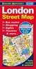
London Street Map Stanfords
£2.50
Archived Product

London Street Map Stanfords
£3.50
Archived Product
London Street Furniture Stanfords
£12.99
Archived Product
London Directions Stanfords
£5.59
Archived Product
Manhattan Streetwise Stanfords
£6.50
Vouchers
No voucher codes found.
Do you know a voucher code for this product or supplier? Add it to Insights for others to use.
Do you know a voucher code for this product or supplier? Add it to Insights for others to use.
 Denmark