More From Contributor
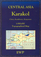
£13.99
Kaokol&, the north-western corner of Namibia, at 1:600, 000 on a road map from the South African publishers International Motoring Productions, annotated with numerous GPS waypoints for selected road junctions, settlements & recommended accommodation. Road classification indicates tarred roads, major & minor gravel roads & 4WD tracks, with driving distances marked on most routes & locations of fuel stations. Entry points to the Etosha National Park & the Skeleton Coast National Park are marked. Several campsites & selected other accommodation have their GPS coordinates marked directly on the map; 79 other location, mainly road junctions or small settlements are cross-referenced to the accompanying list of GPS waypoints. Latitude & longitude lines are drawn at intervals of 30’. Symbols indicate locations with access by air and/or tourist lodges & campsites, plus various points of interest. Rather simple cartography has basic elevation tinting & occasional spot heights; seasonal rivers are marked & main mountain ranges are named. Coverage further south along Namibia’s coast is provided by the publishers’ map of Damaraland which overlaps with this title. ...
Archived Product
£4.99
Kaposvar in a series of street plans of Hungary’s main towns from Cartographia in Budapest. The plans cover the whole town with its outer suburbs &, where appropriate, have an enlargement for the central area. All the plans have a street index. Map legend varies; in plans of larger towns or popular tourist destinations it usually

Includes::
English. Many plans also include additional

Features:
insets with plans of larger satellite developments or villages, lists of sights and/or various municipal offices & facilities, etc. Some titles include on the reverse a road map of the town’s environs or the administrative province.


...
Archived Product
£14.99
” Steve & I clutched hands – his right in my left – & then we simultaneously pushed down with our feet. Cogs clicked, wheels turned, & we were on our way. We left Nordkapp within minutes. Cape Town was only 18, 000 kilometres away.” Deciding to break away from his comfortable lifestyle in London, Reza & his friend Steven set off from the most northerly point on mainland Europe to cycle the 11, 000 miles to the other end of the planet, completely unsupported. Their expedition becomes a race against the clock, as they attempt to complete the trip in a world record of just 100 days. Battling punishing terrain & primitive roads, harsh & debilitating climates, malaria, food poisoning & heat stroke, their thrilling journey brings them face to face with some of the world’s most stunning, memorable & volatile regions. This is the intensely personal story of one man’s mission to create a more positive, purposeful life, & the compelling account of the epic journey he took to get there. ...
Archived Product
£7.99
The Karabiners by Lifeventure are great little travel accessories, ideal for securing light things to your pack. made from lightweight anodised aluminium alloy with a singlewire gate, these karabiners provide a fast & secure attachment. The pack contains 3 different size karabiners, 7.5 x 4.5cm 6x 3.5cm & 4x 3cm. Please note they are not suitable for heavy loads. ...
Archived Product
£17.95
Street plan of Karachi from the Pakistani national survey organization, showing names of principal streets within the city & numerous local neighbourhoods. The plan also indicates locations & names of main public buildings, institutions & various businesses/facilities such as markets/bazaars & shopping centres, post offices, schools, mosques, etc. Coverage extends well beyond the city centre: west to Paradise Point, north to the Hab Reservoir, & east to Dabeji. The plan has no index of streets or suburbs. Please note: the current edition available from the Pakistani Survey organization is based on the data obtained in the 1994-1995 survey. Deliveries from Pakistan are very irregular & we cannot guarantee a delivery date for any of their titles currently not in stock. ...
Archived Product
£14.99
Central part of the Karakoram Range on a waterproof & tear-resistant, double-sided map at 1:175, 000 from terra Quest, with coverage extending from Gilgit & the Karakoram Highway to the peaks of K2 & Gasherbrum. The map is presented in a special format, handy for conveniently viewing just small sections of it at one time. With Gilgit & the Karakoram Highway in the north-west & Karimabad (Baltit) on the northern edge of the map, coverage extends eastwards across the Karakoram National Park to include the peaks of Baintha Brakk (Ogre) & Latok, & southwards across K2, Broad Peak (Falchan Kangri) & the Gasherbrums to the road linking Skardu & Khapalu. Topography is vividly presented by contours at 100m intervals enhanced by relief shading, plus numerous spot heights/peak names & colouring for glaciers & different types of vegetation. An overprint highlights trekking & climbing routes & symbols show different types of tourist accommodation (hotels, tourist cottages, bivouac places), restaurants & grocery stores, banks, medical facilities, etc. Interesting locations, including the main peaks of the region, are prominently highlighted. Road network indicates unpaved routes & tracks, & gives distances on main routes. The map has a latitude & longitude grid at intervals of 2’. Map legend

Includes::
English. The map is laminated in a format similar to the old cloth-dissected maps so that sections of it can be easily folded back without damage, & can be annotated with write-on/wipe-off marker pens.

...
Archived Product
£12.95
Excellent road map, with altitude colouring indicating the topography of this mountainous area. The map extends from Peshawar & Islamabad/ Rawalpindi to Kashgar. On the Pakistani side, the map shows towns & villages with connecting roads, local airports, places of interest, administrative boundaries, etc., as well as numerous peaks. Information on the Chinese side is more limited. The map

Includes::
seventeen town plans, including Kashgar & Yarkand in China & Islamabad, Rawalpindi, Gilgit & Hunza in Pakistan.

...
Archived Product
£26.99
Karakoram on a set of two ridge-type maps at 1:250, 000 from the Swiss Foundation for Alpine Research providing an overview of the mountains from Gilgit & the Khunjerab Pass eastwards to the southern point of the Shyok River. The maps show mountain ridges, peaks & valleys in a schematic but fairly clear way. Trekking routes are shown, with settlements along the routes named. Sketch contours appear at intervals of 1220 metres (i.e. 4000 feet) & heights above sea level are given for peaks & passes. The main facilities in larger settlements are marked. The map has latitude & longitude lines at intervals of 30’ respectively. Map legend is in English. On the reverse is an index listing separately towns/villages/landmark features/camping grounds/forts, peaks, passes, glaciers, rivers & lakes. Also provided is a conversion chart between metres & feet. Current edition of this map was published in 1990. ...
Archived Product
£8.99
Johnny West has lived in this area for the past decade & speaks fluent Arabic, & so has the skills & ability to talk to everyone from security guards to revolutionaries, from families of protestors, some of whom have been killed, to oil workers, to cafe owners, lawyers, barbers & clerics. Travelling on public buses, visiting with families, hanging out in shops & cafes, he brings out for all of us what made ordinary people erupt, what happened to them during those days & now, what their hopes, fears & dreams are, how they see us in the West, how each country is different but how they see themselves as part of a joint Arab culture, before Islamists. Johnny West`s long experience in the area enables him to set all this in context, while never losing the vividness of a travel book or the characters of a novel. This is not a political treatise but a journey of discovery
- of people, of places, of life under extraordinary circumstances
- which this book allows us to share & makes one feels as if one had been there.

...
Archived Product
£6.95
Karancs, Medves & the Heves-Borsod Hillsin a series of contoured hiking & recreational maps from the Budapest based Cartographia, with hiking routes & other tourist information, including in many titles street plans, cycling trails, etc. The maps have contours at 10m intervals with relief shading & spot heights, plus colouring and/or graphics to indicate different types of vegetation. An overprint highlights local hiking paths, with cycling routes also included in some titles. Symbols mark various places of interest, sport & recreational facilities, including campsites & other tourist accommodation, locations of petrol stations, etc. The maps show 1km lines of the country ...
Archived Product

Karakol

Karakol region at 1:500, 000 in a series of detailed, contoured maps of the mountains of Central Asia derived from the Soviet era topographic survey but with transliterated place names and an English language map legend. Maps in this series provide coverage of the Tien Shan and Pamir Mountains, with the whole of Kyrgyzstan, northern Tajikistan, plus the adjoining regions of Uzbekistan (including Tashkent and Samarkand), southern Kazakhstan (with Almaty) and the Sinkiang Province of China. The maps have contours at 100m intervals, enhanced by altitude colouring and relief shading, with plenty of spot heights and names of various mountain chains, peaks, valleys, etc. Additional colouring and/or graphics indicate glaciers, cliffs, rock boulders, sands, ridges and dunes, mud and
salt flats, different types of vegetation, etc. The maps show all the information expected of topographic mapping at this scale, including detailed presentation of local roads and tracks, railways, aerodromes, isolated settlements, national and internal administrative borders, etc. Latitude and longitude grid is drawn at 20’ and 30’ respectively. Map legend is in English.The series was prepared in mid-2000s when all the place names have been transliterated from the original Russian mapping and given, where possible, modern local names for larger towns. Each map provides a guide to the transliteration, as well as English and German glossary for the abbreviations.To see the list of titles in this series please click on the series link.
RIP - This product is no longer available on our network. It was last seen on 25.09.2019

This page now acts as a permanent archive for this product. Add more information using the comments box below to ensure it can still be found by future generations.

Use our search facility to see if it is available from an alternative contributor.
  • External links may include paid for promotion
  • Availability: Out Of Stock
  • Supplier: Stanfords
  • SKU: 9780906227855
Availability: In Stock
£9.95

Product Description

Karakol region at 1:500, 000 in a series of detailed, contoured maps of the mountains of Central Asia derived from the Soviet era topographic survey but with transliterated place names & an English language map legend. Maps in this series provide coverage of the Tien Shan & Pamir Mountains, with the whole of Kyrgyzstan, northern Tajikistan, plus the adjoining regions of Uzbekistan (including Tashkent & Samarkand), southern Kazakhstan (with Almaty) & the Sinkiang Province of China. The maps have contours at 100m intervals, enhanced by altitude colouring & relief shading, with plenty of spot heights & names of various mountain chains, peaks, valleys, etc. Additional colouring and/or graphics indicate glaciers, cliffs, rock boulders, sands, ridges & dunes, mud & salt flats, different types of vegetation, etc. The maps show all the information expected of topographic mapping at this scale, including detailed presentation of local roads & tracks, railways, aerodromes, isolated settlements, national & internal administrative borders, etc. Latitude & longitude grid is drawn at 20’ & 30’ respectively. Map legend is in English. The series was prepared in mid-2000s when all the place names have been transliterated from the original Russian mapping & given, where possible, modern local names for larger towns. Each map provides a guide to the transliteration, as well as English & German glossary for the abbreviations. To see the list of titles in this series please click on the series link.

Reviews/Comments

Add New

Price History

Vouchers

No voucher codes found.
Do you know a voucher code for this product or supplier? Add it to Insights for others to use.

Facebook

Jargon Buster

Graphics - A general term for visual aspects of an item/display
Mud - A combination of water and soil/clay/silt. Oftern brown in colour
Railways - A set of tracks that have been laid for the purpose of trains to travel up and down them
Language - the method of communication used in different areas. Humans and computers have many different languages.
Altitude - Something that can be quite high in relation to sea or ground level.
Borders - A line that sometimes can be built up separating off an area, e.g. countries "the welsh boarder"
Language - The way humans communicate either written and spoken.

Supplier Information

Stanfords
Stanfords was established in 1853 and opened their iconic Covent Garden flagship store in 1901. They have become the top retailer of maps, travel books and accessories in the UK and arguably offer the largest selection of maps and travel books worldwide. Famous names such as Captain Robert Falcon Scott, Ranulph Fiennes and Michael Palin have purchased from Stanfords. They now have a shop in Bristol and both stores together with other venues operate a calendar of events including talks, book signings and exhibitions. As a specialist map retailer, the map selection is comprehensive and includes road maps, street maps and walking maps from worldwide destinations, as well as a selection of world atlases and wall maps. Books include travel guides and travel literature. Stanfords also stock globes, from miniatures made of blue marble to magnificent floor-standing globes. The website features a selection of interesting articles on travel topics.
Page Updated: 2023-11-12 20:15:36

Community Generated Product Tags

Oh No! The productWIKI community hasn't generated any tags for this product yet!
Menu