More From Contributor

£7.99
The Karabiners by Lifeventure are great little travel accessories, ideal for securing light things to your pack. made from lightweight anodised aluminium alloy with a singlewire gate, these karabiners provide a fast & secure attachment. The pack contains 3 different size karabiners, 7.5 x 4.5cm 6x 3.5cm & 4x 3cm. Please note they are not suitable for heavy loads. ...
Archived Product
£17.95
Street plan of Karachi from the Pakistani national survey organization, showing names of principal streets within the city & numerous local neighbourhoods. The plan also indicates locations & names of main public buildings, institutions & various businesses/facilities such as markets/bazaars & shopping centres, post offices, schools, mosques, etc. Coverage extends well beyond the city centre: west to Paradise Point, north to the Hab Reservoir, & east to Dabeji. The plan has no index of streets or suburbs. Please note: the current edition available from the Pakistani Survey organization is based on the data obtained in the 1994-1995 survey. Deliveries from Pakistan are very irregular & we cannot guarantee a delivery date for any of their titles currently not in stock. ...
Archived Product
£9.95
Karakol region at 1:500, 000 in a series of detailed, contoured maps of the mountains of Central Asia derived from the Soviet era topographic survey but with transliterated place names & an English language map legend. Maps in this series provide coverage of the Tien Shan & Pamir Mountains, with the whole of Kyrgyzstan, northern Tajikistan, plus the adjoining regions of Uzbekistan (including Tashkent & Samarkand), southern Kazakhstan (with Almaty) & the Sinkiang Province of China. The maps have contours at 100m intervals, enhanced by altitude colouring & relief shading, with plenty of spot heights & names of various mountain chains, peaks, valleys, etc. Additional colouring and/or graphics indicate glaciers, cliffs, rock boulders, sands, ridges & dunes, mud & salt flats, different types of vegetation, etc. The maps show all the information expected of topographic mapping at this scale, including detailed presentation of local roads & tracks, railways, aerodromes, isolated settlements, national & internal administrative borders, etc. Latitude & longitude grid is drawn at 20’ & 30’ respectively. Map legend is in English. The series was prepared in mid-2000s when all the place names have been transliterated from the original Russian mapping & given, where possible, modern local names for larger towns. Each map provides a guide to the transliteration, as well as English & German glossary for the abbreviations. To see the list of titles in this series please click on the series link. ...
Archived Product
£14.99
Central part of the Karakoram Range on a waterproof & tear-resistant, double-sided map at 1:175, 000 from terra Quest, with coverage extending from Gilgit & the Karakoram Highway to the peaks of K2 & Gasherbrum. The map is presented in a special format, handy for conveniently viewing just small sections of it at one time. With Gilgit & the Karakoram Highway in the north-west & Karimabad (Baltit) on the northern edge of the map, coverage extends eastwards across the Karakoram National Park to include the peaks of Baintha Brakk (Ogre) & Latok, & southwards across K2, Broad Peak (Falchan Kangri) & the Gasherbrums to the road linking Skardu & Khapalu. Topography is vividly presented by contours at 100m intervals enhanced by relief shading, plus numerous spot heights/peak names & colouring for glaciers & different types of vegetation. An overprint highlights trekking & climbing routes & symbols show different types of tourist accommodation (hotels, tourist cottages, bivouac places), restaurants & grocery stores, banks, medical facilities, etc. Interesting locations, including the main peaks of the region, are prominently highlighted. Road network indicates unpaved routes & tracks, & gives distances on main routes. The map has a latitude & longitude grid at intervals of 2’. Map legend

Includes::
English. The map is laminated in a format similar to the old cloth-dissected maps so that sections of it can be easily folded back without damage, & can be annotated with write-on/wipe-off marker pens.

...
Archived Product
£12.95
Excellent road map, with altitude colouring indicating the topography of this mountainous area. The map extends from Peshawar & Islamabad/ Rawalpindi to Kashgar. On the Pakistani side, the map shows towns & villages with connecting roads, local airports, places of interest, administrative boundaries, etc., as well as numerous peaks. Information on the Chinese side is more limited. The map

Includes::
seventeen town plans, including Kashgar & Yarkand in China & Islamabad, Rawalpindi, Gilgit & Hunza in Pakistan.

...
Archived Product
£8.99
Johnny West has lived in this area for the past decade & speaks fluent Arabic, & so has the skills & ability to talk to everyone from security guards to revolutionaries, from families of protestors, some of whom have been killed, to oil workers, to cafe owners, lawyers, barbers & clerics. Travelling on public buses, visiting with families, hanging out in shops & cafes, he brings out for all of us what made ordinary people erupt, what happened to them during those days & now, what their hopes, fears & dreams are, how they see us in the West, how each country is different but how they see themselves as part of a joint Arab culture, before Islamists. Johnny West`s long experience in the area enables him to set all this in context, while never losing the vividness of a travel book or the characters of a novel. This is not a political treatise but a journey of discovery
- of people, of places, of life under extraordinary circumstances
- which this book allows us to share & makes one feels as if one had been there.

...
Archived Product
£6.95
Karancs, Medves & the Heves-Borsod Hillsin a series of contoured hiking & recreational maps from the Budapest based Cartographia, with hiking routes & other tourist information, including in many titles street plans, cycling trails, etc. The maps have contours at 10m intervals with relief shading & spot heights, plus colouring and/or graphics to indicate different types of vegetation. An overprint highlights local hiking paths, with cycling routes also included in some titles. Symbols mark various places of interest, sport & recreational facilities, including campsites & other tourist accommodation, locations of petrol stations, etc. The maps show 1km lines of the country ...
Archived Product
£23.99
Map No. 10171, Karasjohka, in the new topographic survey of Norway at 1:50, 000 covering the country on 195 double-sided sheets & first published by Nordeca in 2011
- 2012; fully GPS compatible, indicating waymarked footpaths, campsites, tourist huts, illuminated ski runs, etc. The maps, now published by Nordeca, the successors to Statens Kartverk & its subsequent owners the Ugland Group, are printed on light, waterproof & tear-resistant synthetic paper. Each map covers an area of 62x 45 kilometres (39 x 28 miles approx.), with a 2-km overlap between the sheets. The maps have contours at 20m intervals (10m glacier contours), plus colouring & graphics to show cultivated areas, bogs, forests, etc. In addition to all the information expected of topographic mapping at this scale the maps distinguish between waymarked & unmarked footpaths & show campsites, tourist huts (serviced/self service/no supplies), country hotels & restaurants, & illuminated ski trails. The series uses EUREF89 (WGS84) datum & the maps have a 1-km UTM grid. Map legend is in Norwegian & English. Each title comes in a sturdy protective card envelope.
...
Archived Product
£8.99
Two daringly original works from the acclaimed Danish author Dorthe Nors, published back to back in a uniquely designed edition. ` Beautiful, faceted, haunting stories... Dorthe Nors is fantastic` Junot Diaz Karate Chop In these glittering, funny miniature tales, the acclaimed Danish writer Dorthe Nors sketches ordinary lives taking unexpected turns: a son`s love for his father is tested when he suddenly discovers its fragility; a woman in an abusive relationship seeks to better understand the choices she has made; a man with dreams of self-improvement is haunted by deceit; & a daughter watches on silently as her mother`s search for meaning ends in madness. Blending compassion with dark delight, Nors conjures up a flawed, unsettlingly familiar world with each cautionary glance
- as fresh moments of wonder, romance & frail beauty are unexpectedly infiltrated by depravity, isolation & despair. Minna Needs Rehearsal Space Minna is feeling desperate. Lars has just dumped her by text message. Her friends are constantly flaunting their lovers, children & dogs (with Facebook as their cruel accomplice). & her neurotic sister is everywhere she turns. Minna needs security, & a place in Copenhagen to practise her music. Minna wants a child. Minna needs to stop being answerable to everyone. So, with only Ingmar Bergman for comfort & company, she decides to take a trip away from it all. In this highly original, playful, poignant yet funny novella, Dorthe Nors explores our struggles to find love, relate to others & simply be heard above the relentless noise of the modern age. Praise for Karate Chop ` Unsettling & poetic... Some pieces, like one about a four-pound tomato, are oddly beautiful; others are brilliantly disturbing` New York Times Book Review ` Dorthe Nors is a writer of moments
- quiet, raw portraits of existential meditation, at times dyspeptic, but never unsympathetic` Paris Review ` In the span of two pages, she is able to both build & unmake a character, achieving the same complexity that other writers require entire novels to establish... Karate Chop is the first of Nors` books to be translated to English but certainly won`t be the last. Lovers of the art of literary fiction, students of psychology, & everyone looking for a quick, thought-provoking read should all indulge themselves in the subversive delight of this short story collection` Booklist ` The short-short stories in Danish sensation Nors`s slim, potent collection, Karate Chop...evoke the weirdness & wonder of relating in the digital age` Vogue ` Nors illuminates an ominous world of disconnected people trying to make sense of their dislocation... Nors` affectless, matter-of-fact storytelling...is the perfect complement to the low-wattage desperation & inertia her characters feel... Karate Chop is just like that: It loves you & wants to teach you, but it also wants to harm you` Los Angeles Times ` In this collection of stories, Danish fiction comes off a little like Danish furniture, spare & sublime. Author Dorthe Nors knows how to capture the smallest moments & sculpt them into the unforgettable` Oprah ` Theintricately crafted stories in Karate Chop, from popular Danish writer Dorthe Nors, focus on ordinary occurrences.. .and then twist them into brilliantly slanted cautionary tales about desire, romance, deception, & dread` Elle Praise for Minna Needs Rehearsal Space ` The funniest Danish novel I have read in a long time` Information ` Satirically sharp & satirically funny` Weekendavisen ` This is music to a language lover`s ears` Dagbladenes Bureau, 5-star review ` Tremendously insightful` Jyllands-Posten `A poetic pearl` Berlingske Tidende ` One of the best books I have read` Litteratur Nu ` Short, precise, & hugely entertaining` Litteratursiden

...
Archived Product
£11.99
Karavanke Mountains between the peaks of Kepe & Košutenikov Turn at 1:50, 000 on a waterproof & tear-resistant, contoured & GPS compatible walking & cycling map from Kartografija in Ljubljana, with on the reverse information about local mountain huts. Coverage, including the overprint for hiking trails, cycle routes & other tourist information, spans both sides of the Slovenia / Austria border. On the reverse are map extracts centred on 20 huts specially highlighted on the main map, each with GPS coordinates, seasonal opening dates & contact details, plus a photo. Maps in this series have contours at 20m intervals, enhanced by relief shading, with plenty of spot heights & names of peaks, mountain chains, etc. Local hiking routes are highlighted, indicating difficult passages. Also marked are recommended cycling routes. Symbols indicate various types of accommodation including mountain huts, campsites, inns with lodgings, tourist farms or apartments, hotels & motels, as well as recreational facilities (golf, horse riding, swimming pools, etc), vineries, cultural & historical sites, etc. Road network indicates locations of petrol stations. Railway lines are shown with stations & various types of mountain transport (gondolas, chair lifts, etc) are marked. The maps have a latitude & longitude grid at intervals of 2’’. Map legend & all the text include English. To see the list of titles in this series please click on the series. ...
Archived Product

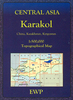
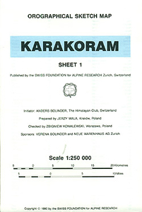
Karakoram SFAR 2-Map Set

Karakoram on a set of two ridge-type maps at 1:250, 000 from the Swiss Foundation for Alpine Research providing an overview of the mountains from Gilgit and the Khunjerab Pass eastwards to the southern point of the Shyok River.The maps show mountain ridges, peaks and valleys in a schematic but fairly clear way. Trekking routes are shown, with settlements along the routes named. Sketch contours appear at intervals of 1220 metres (i.e. 4000 feet) and heights above sea level are given for peaks and passes. The main facilities in larger settlements are marked.The map has latitude and longitude lines at intervals of 30’ respectively. Map legend is in English. On the reverse is an index listing separately towns/villages/landmark features/camping grounds/forts, peaks, passes, glaciers,
rivers and lakes. Also provided is a conversion chart between metres and feet.Current edition of this map was published in 1990.
RIP - This product is no longer available on our network. It was last seen on 25.09.2019

This page now acts as a permanent archive for this product. Add more information using the comments box below to ensure it can still be found by future generations.

Use our search facility to see if it is available from an alternative contributor.
  • External links may include paid for promotion
  • Availability: Out Of Stock
  • Supplier: Stanfords
  • SKU: XL00000009886
Availability: In Stock
£26.99

Product Description

Karakoram on a set of two ridge-type maps at 1:250, 000 from the Swiss Foundation for Alpine Research providing an overview of the mountains from Gilgit & the Khunjerab Pass eastwards to the southern point of the Shyok River. The maps show mountain ridges, peaks & valleys in a schematic but fairly clear way. Trekking routes are shown, with settlements along the routes named. Sketch contours appear at intervals of 1220 metres (i.e. 4000 feet) & heights above sea level are given for peaks & passes. The main facilities in larger settlements are marked. The map has latitude & longitude lines at intervals of 30’ respectively. Map legend is in English. On the reverse is an index listing separately towns/villages/landmark features/camping grounds/forts, peaks, passes, glaciers, rivers & lakes. Also provided is a conversion chart between metres & feet. Current edition of this map was published in 1990.

Reviews/Comments

Add New

Intelligent Comparison

Oooops!
We couldn't find anything!
Perhaps this product's unique.... Or perhaps we are still looking for comparisons!
Click to bump this page and we'll hurry up.

Price History

Vouchers

No voucher codes found.
Do you know a voucher code for this product or supplier? Add it to Insights for others to use.

Facebook

Jargon Buster

Metres - A unit of measure, one metre equals 100 centimetres
foundation - A flesh toned cosmetic applied to the face to create an even complexion.
swiss - Short for Switzerland, one of the richest countries in the world
Set - a group of items usually related to one another. Some objects cannot function without the complete set of items.

Supplier Information

Stanfords
Stanfords was established in 1853 and opened their iconic Covent Garden flagship store in 1901. They have become the top retailer of maps, travel books and accessories in the UK and arguably offer the largest selection of maps and travel books worldwide. Famous names such as Captain Robert Falcon Scott, Ranulph Fiennes and Michael Palin have purchased from Stanfords. They now have a shop in Bristol and both stores together with other venues operate a calendar of events including talks, book signings and exhibitions. As a specialist map retailer, the map selection is comprehensive and includes road maps, street maps and walking maps from worldwide destinations, as well as a selection of world atlases and wall maps. Books include travel guides and travel literature. Stanfords also stock globes, from miniatures made of blue marble to magnificent floor-standing globes. The website features a selection of interesting articles on travel topics.
Page Updated: 2023-11-12 20:15:36

Community Generated Product Tags

Oh No! The productWIKI community hasn't generated any tags for this product yet!
Menu